Level-2 News
Contract signed for new Arctic Ocean Surveillance Precursor mission [link]
"On Friday 1st November, 2024 ESA’s General Support Technology Programme (GSTP) and Kongsberg Defence & Aerospace (KDA), Norway, have signed a contract to develop the Arctic Ocean Surveillance precursor (AOS-p) mission.
With launch planned in 2027, AOS-P will conduct surveillance of vessels, particularly in the Arctic Regions of Norway (NAVAREA XIX), and provide this data to end users, allowing them to track unauthorized fishing activities, assist in Search and Rescue (SAR) operations and perform routine surveillance of difficult to monitor areas in Norwegian waters.
This improvement to maritime surveillance and ship tracking in the Arctic Ocean will focus its efforts on the area under Norwegian responsibility, a critical hub for economic activities and national sovereignty."
NASA Begins Hand-off To Commercial Satellites [link]
"The first Tracking and Data Relay System (TDRS) satellites were launched in the 1980s to support NASA’s growing fleet of spacecraft, including Shuttle missions, the ISS, and a variety of EO satellites. The system of communications satellites in geosynchronous orbit make sure NASA missions can stay in touch with operators on Earth.
As the spacecraft reach the end of their life, NASA decided to turn to private companies instead of building, launching, and operating a new comms system. TDRS will come to an end in the 2030s, replaced by a fleet of commercial sats purchased through the Commercial Services Project (CSP).
NASA is providing $278.5M to six companies (Inmarsat , Kuiper, SES, SpaceX, Telesat, Viasat) and partnering with a seventh (Kepler) through an unfunded Space Act agreement, to work through integration into NASA’s Near Space Network."
Maxar Intelligence divests sensor technology business to ARKA Group [link]
"ARKA acquired Maxar’s business unit known as the Radar and Sensor Technology (RST) group, based in Ypsilanti, Michigan"
BlackSky buys Thales Alenia’s stake in LeoStella joint venture [link]
"BlackSky has taken full ownership of smallsat manufacturer LeoStella, giving the remote sensing company greater control over the production of its next generation of imaging satellites."
NASA Acquires Advanced Radar and WorldDEM Data from Airbus for Enhanced Earth Observation Missions [link]
"NASA has secured access to radar SAR tasking and WorldDEM products from Airbus through the Commercial SmallSat Data Acquisition (CSDA) Program to help identify and evaluate science and research application initiatives to support the NASA Indian Space Research Organisation (ISRO)."
Developer's Orbit
Using Foundation Models for Earth Observation [link]
"Geospatial Foundation Models (GeoFMs) have the potential to dramatically reduce barriers to working with satellite imagery.
Instead of spending months collecting training data, you can now get reliable results across geographic and temporal features. You can process continental-scale datasets in hours and extract precise insights from multiple data sources (satellite, drone, and ground-level imagery).
GeoFMs create specialized embeddings for every location on Earth, providing a unified foundation for diverse applications—from ecosystem monitoring to urban development tracking."
Read this blog post, by Development Seed, on the lessons learned after spending a year delving into the details of creating and applying foundation models.
New Notebooks Showcase openEO's Load_stac Functionality [link]
"OpenEO has introduced the Load_stac process in the openEO API. It loads data from a static STAC catalogue or an STAC API Collection and returns it as a processable data cube."
Notebooks on GitHub [link]
Data
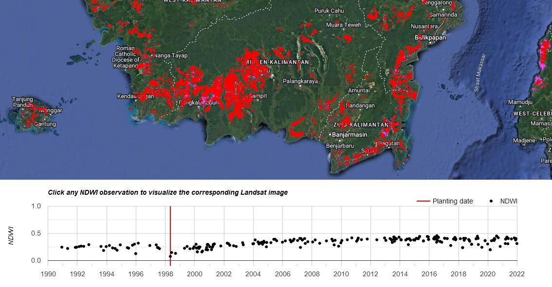
Global oil palm extent and planting year from 1990 to 2021 [link]
"Remote sensing of oil palm: a global 10 m resolution global map of industrial and smallholder oil palm plus estimation of the planting year from 1990 to 2021 at a 30 m spatial resolution."
Visualization [link]
Dataset [link]
Paper [link]

Snapshots

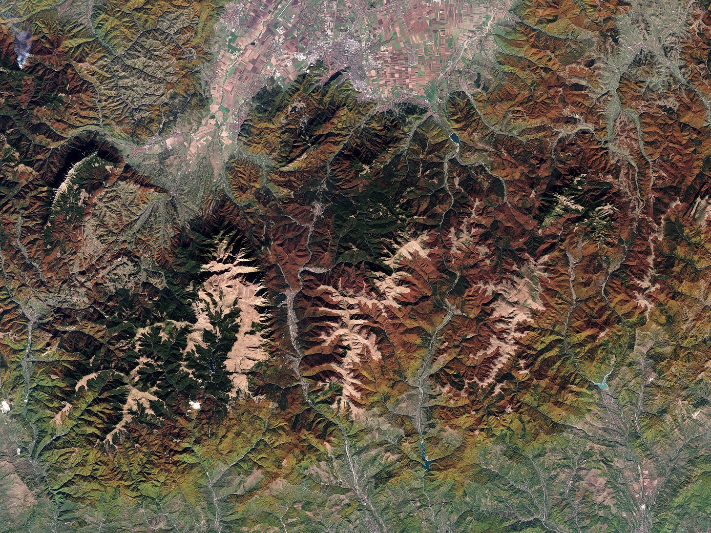
Earth from Space: Autumn foliage across Europe [link]
"Autumn foliage is one of nature's most stunning displays, turning deciduous forests into landscapes painted with vibrant colours. As temperatures cool and daylight shortens, deciduous trees cease producing chlorophyll so that leaves turn yellow, orange and red – the colours of autumn.
The images in this post, from October 2024, capture these colours across the Tuscan-Emilian Apennines in Italy, the western border of Greece and North Macedonia and the southeastern Carpathian Mountains in Romania."

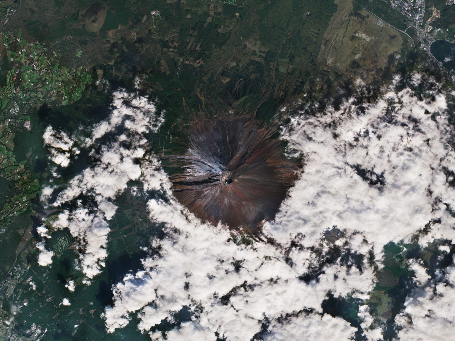
Snow returns to Mount Fuji [link]
"Mount Fuji, Japan’s highest peak, has seen its first snowfall after one of the longest periods without snow since records began 130 years ago."
Interesting reads
Surprised Russian school kids discover Arctic island has vanished after comparing satellite images [link]
"A student-led project comparing satellite images of the Arctic has discovered that a small Russian island has recently vanished after "completely melting" away."
GeoAI Unpacked #2: AI for weather forecasting [link]
Follow this article by Ali Ahmadalipour, where he explores AI applications for weather forecasting.
EO Data enhances vulnerability assessment of Georgia’s Black Sea coast [link]
"The European Space Agency (ESA) Global Development Assistance (GDA) Climate Resilience Consortium has partnered with the Asian Development Bank’s (ADB) Improved Coastal Management and Coastal Protection team to support Georgia’s National Ministry for Regional Development and Infrastructure.
In collaboration with the ADB, the consortium adapted CoastSat—an open-source coastal mapping tool—by integrating data from satellites (Landsat and Sentinel) to monitor shoreline changes over the past 40 years. This approach is invaluable as manual field surveys are often insufficient to understand the baseline conditions of coastal zones. Access to open data, including EO data, can significantly contribute to developing effective coastal zone management strategies."
Hurricane Helene’s Gravity Waves Revealed by NASA’s AWE [link]
"On Sept. 26, 2024, Hurricane Helene slammed into the Gulf Coast of Florida, inducing storm surges and widespread impacts on communities in its path. At the same time, NASA’s Atmospheric Waves Experiment, or AWE, recorded enormous swells in the atmosphere that the hurricane produced roughly 55 miles above the ground. Such information helps us better understand how terrestrial weather can affect space weather, part of the research NASA does to understand how our space environment can disrupt satellites, communication signals, and other technology."
Powerful New US-Indian Satellite Will Track Earth’s Changing Surface [link]
"We don’t always notice it, but much of Earth’s surface is in constant motion. Scientists have used satellites and ground-based instruments to track land movement associated with volcanoes, earthquakes, landslides, and other phenomena. But a new satellite from NASA and the Indian Space Research Organisation (ISRO) aims to improve what we know and, potentially, help us prepare for and recover from natural and human-caused disasters.
The NISAR (NASA-ISRO Synthetic Aperture Radar) mission will measure the motion of nearly all of the planet’s land and ice-covered surfaces twice every 12 days. The pace of NISAR’s data collection will give researchers a fuller picture of how Earth’s surface changes over time."
Space AI is Having a Moment [link]
"After years of AI changing the way people work on Earth, the tech is finally having its moment in the space industry’s spotlight.
Recently, a flurry of new companies have come on the scene or announced new products focused on using AI to increase the efficiency of space operations."
Architecture Firm Looks to Satellite Data for More Resilient Urban Planning [link]
"Hungarian architectural firm Paulinyi & Partners is using satellite technology to improve its work in urban planning and says this collaboration can lead to more climate-resistant designs.
In late 2023, the firm signed a contract with the European Space Agency (ESA) to participate in the ‘Space for Green Construction’ program. As part of the program, Hungarian experts will use EO data from satellites to study the phenomenon of urban microclimate and develop solutions to reduce the urban heat island (UHI) effect."
Upcoming Events
ECMWF Online Computing Training Week [link]
"Every two years, we host a series of Computing webinars designed to bring existing and new users the latest updates in our software and computing services. This year’s sessions will introduce new tools, platforms, and enhancements to help you maximise the value of ECMWF resources."
18 - 22 November 2024


