Level-2 News
Sentinel-2C: ready for liftoff
"The Copernicus Sentinel-2C satellite is ready for liftoff! Tune in to ESA WebTV on 4 September from 03:30 CEST to watch the satellite soar into space on the last Vega rocket to be launched from Europe’s Spaceport in Kourou, French Guiana. Sentinel-2C is scheduled to liftoff at 03:50 CEST." [link]
First test images from Phisat-2 [link]
"Φsat-2 will push the boundaries of Earth observation, demonstrating how AI technologies can be used to advance how we observe Earth from space. The miniature satellite is equipped with a state-of-the-art multispectral camera and powerful AI computer that analyses and processes imagery while in orbit. This will prove critical for disaster response efforts, maritime monitoring, environmental protection and more."
Cutting-edge German tech for better weather forecasts worldwide [link]
"Germany delivered a state-of-the-art measuring instrument – the METimage multispectral radiometer – to the European Organisation for the Exploitation of Meteorological Satellites (EUMETSAT) and the European Space Agency (ESA).
The instrument measures clouds, ice cover, land and ocean surface temperatures, vegetation and fires with an unprecedented level of accuracy, paving the way for more precise weather and climate forecasting. The first flight model, worth approximately €300 million, is the German contribution to an international EUMETSAT programme scheduled to launch in 2025."
UP42 & Planet Expand High-Res Satellite Access [link]
"UP42 announced a partnership with Planet Labs.
This collaboration significantly expands UP42’s optical data portfolio with the integration of Planet SkySat, the world’s largest constellation of high-resolution Earth observation satellites.
The partnership also highlights UP42’s unique tasking solution, which offers advanced order tracking, automated delivery, and support for complex Areas of Interest (AOIs)."

Developer's Orbit
Introduction to STAC GeoParquet [link]
"This post introduces STAC GeoParquet, a specification and library for storing and serving SpatioTemporal Asset Catalogs (STAC) metadata as GeoParquet. By building on GeoParquet, STAC GeoParquet makes it easy to store, transmit, and analyze large collections of STAC items. It makes for a nice complement to a STAC API."
Data
Additions to the Awesome gee-community-catalog [link]
Urban Heat Island Intensity (UHII)
High-Res Extended Spring Indices database
Global Groundwater-Dependent Ecosystems (GDEs)
Canada 2023 Wildfires
National Structures Inventory (Insiders Program)
Find more information in the change log.
Snapshots
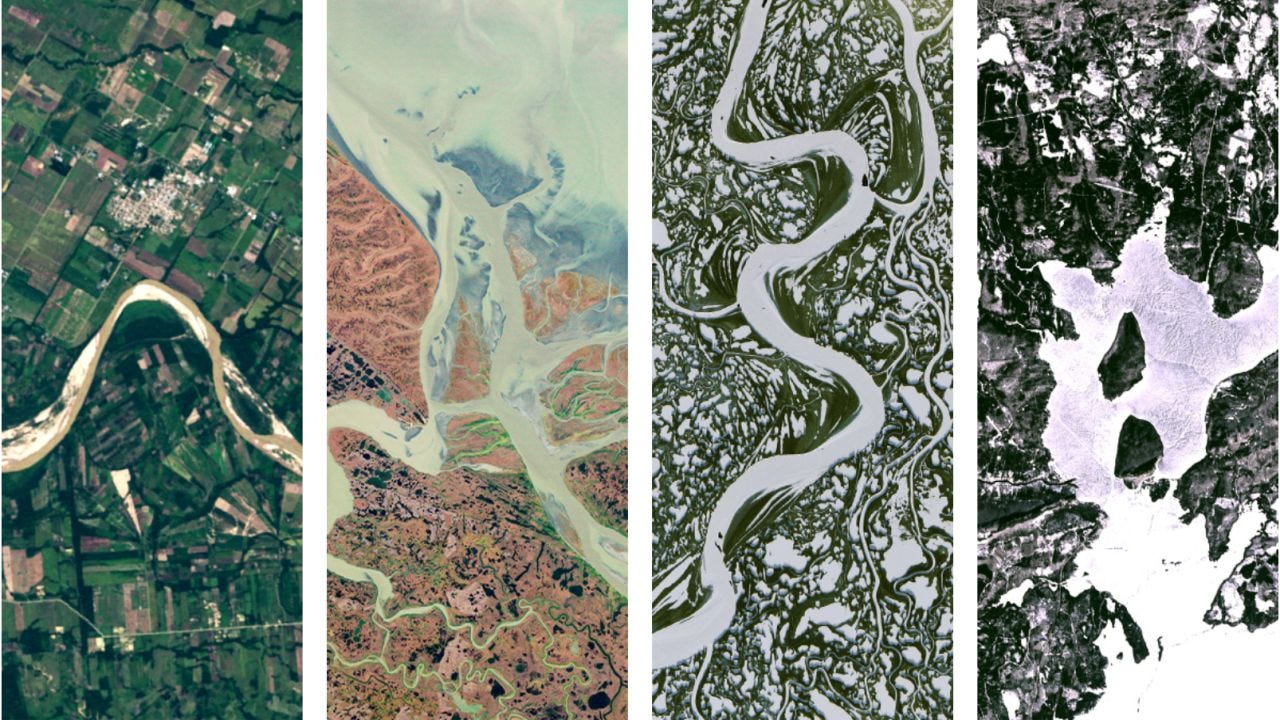
Can you see our name in these satellite photos of Earth? [link]
"Spell yours in images from the NASA & USGS Landsat program, which has observed our home planet for over 50 years."
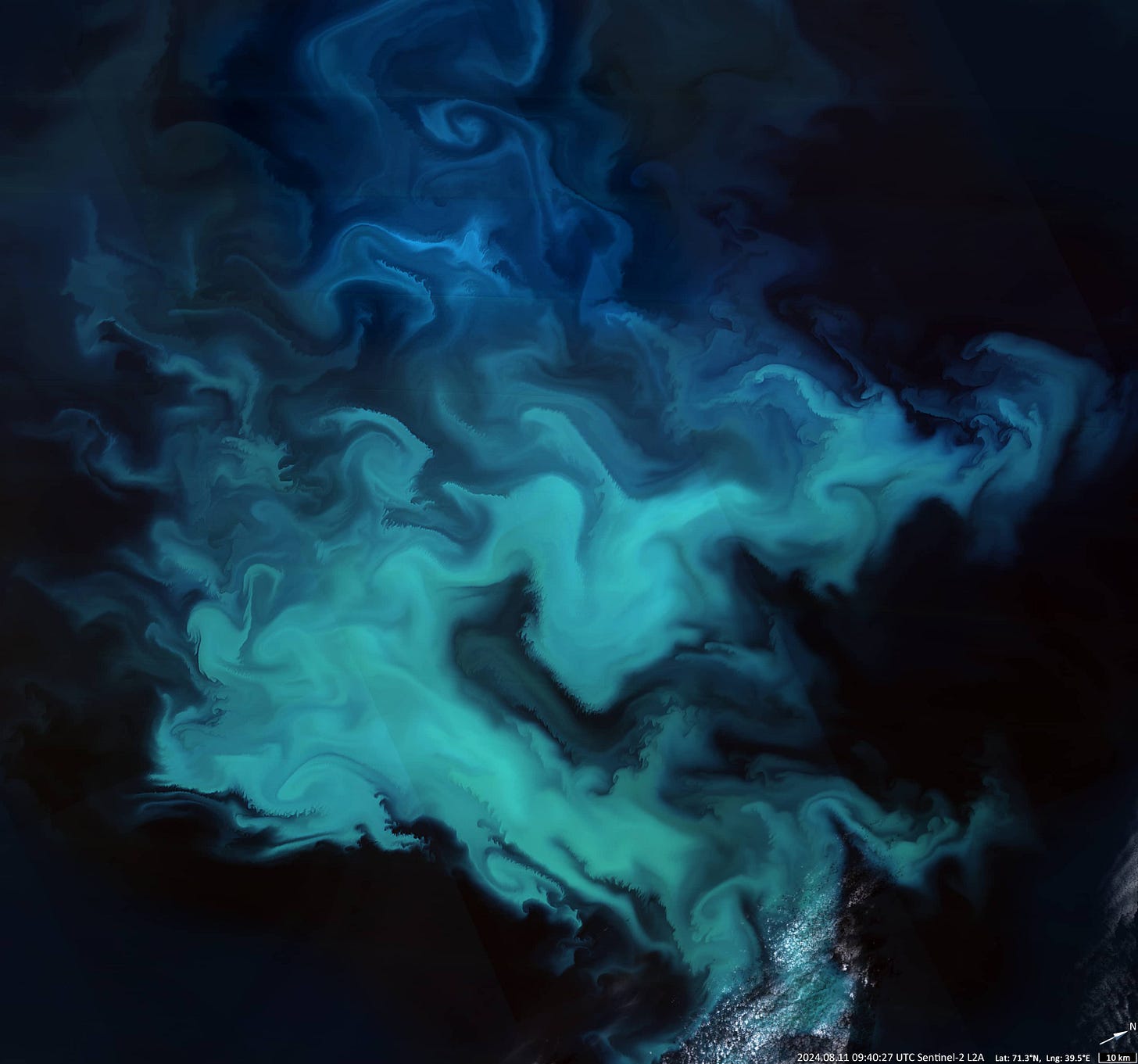
Algae Bloom in Barents Sea [link]
"The Barents Sea is a marginal sea of the Arctic Ocean and lies on the continental shelf. The sea typically experiences two main phytoplankton blooms per year, with diatoms peaking in May and June and coccolithophores in August.
This period is characterised by high light intensity during the 24-hour daylight of the Arctic summer and an abundance of nutrition. At this time, phytoplankton bloom in the Barents Sea can extend for hundreds of kilometres and show particularly intense colours. The algal bloom in this image covers an area of about 45,000 km2, slightly larger than the Netherlands."
Seven beautiful beaches from space [link]
"This week's Observer is taking you on a visual journey to seven stunning beaches, captured through the lens of the Copernicus Sentinel-2 satellites."

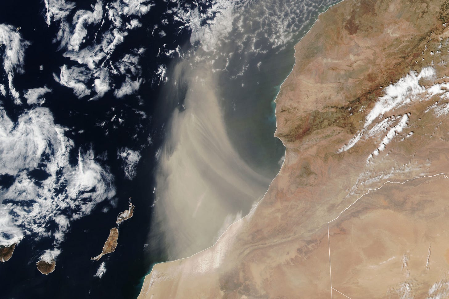
Dust Pours Off the Moroccan Coast [link]
"The Sahara Desert is Earth’s largest source of airborne dust, and the particles can travel for thousands of miles. From late spring to early fall, it is common for the dry, dusty Saharan Air Layer to carry the particles westward across the Atlantic Ocean high in the atmosphere. With different wind patterns in the winter and spring, dust emerging from North Africa can drift over the United Kingdom and western Europe at relatively low altitudes."
Interesting reads

On Slicks and Satellites: An Open Source Guide to Marine Oil Spill Detection [link]
Check out this Open Source Guide on Marine Oil Spill Detection, developed by Bellingcat. [Linkedin Post]
Related:
Guide to Remote Sensing for OSINT [link]
Bellingcat is an independent investigative collective of researchers, investigators and citizen journalists brought together by a passion for open source research.
The collective makes extensive use of satellite imagery for investigative reporting.
Satellite Data for disaster response and humanitarian applications
Robert Simmon highlights two insightful articles about the use of satellite data for disaster response and humanitarian applications [link]:
Should Humanitarians Operate Satellites for Their Missions? [link]
Explore the debate from SatSummit 2024, where experts discussed whether the humanitarian sector should have dedicated satellites for disaster response and aid missions. With strong arguments on both sides, the question remains open—could dedicated satellites enhance humanitarian efforts, or should resources be allocated elsewhere?Rethinking Crisis Data [link]
Read how Development Seed is reimagining the use of Earth Observation data in humanitarian crises. Moving beyond outdated desktop GIS tools, this blog post discusses the need for a decentralized, interactive geospatial system that fosters cross-institutional collaboration, improves data accessibility, and standardizes methodologies.
How to make ML4EO datasets [link]
This guide, written by Julia Wąsala, explores the key components needed to create a ML dataset.
A New Era of Thermal Intelligence: What do thermal sensors capture? [link]
Follow this post by Constellr to learn more about how thermal imagery can be used for urban heat monitoring and help cities like Toulouse tackle extreme heat.
New NASA Study Tallies Carbon Emissions From Massive Canadian Fires [link]
"Stoked by Canada’s warmest and driest conditions in decades, extreme forest fires in 2023 released about 640 million metric tons of carbon, NASA scientists have found. That’s comparable in magnitude to the annual fossil fuel emissions of a large industrialized nation. NASA funded the study as part of its ongoing mission to understand our changing planet.
The research team used satellite observations and advanced computing to quantify the carbon emissions of the fires, which burned an area roughly the size of North Dakota from May to September 2023. The new study, published on Aug. 28 in the journal Nature, was led by scientists at NASA’s Jet Propulsion Laboratory in Southern California."
Satellites for Oceanic Resilience [link]
"Follow this conversation, where Dr. Rick Spinrad, NOAA Administrator and Under Secretary of Commerce for Oceans and Atmosphere, discusses the vital role of partnerships, space systems, and geospatial technologies in tackling pollution, climate change, and biodiversity loss."
Podcasts
The MapScaping Podcast - Natural Language Geocoding [link]
"In this episode, I Daniel O'Donohue welcomes Jason Gilman, a Principal Software Engineer at Element 84, to explore the exciting world of natural language geocoding."
Learning
2024 July ESIP Meeting Recordings [link]


The case for why ESA shoulc keep Sentinel2-A active after S2-C is commissioned, and a petition https://labo.obs-mip.fr/multitemp/lets-ask-copernicus-to-keep-s2a-operational-after-s2c-launch/