

Level-2 News
Strong European support for space to combat climate crisis [link]
In a recent survey almost nine out of ten people questioned said that collecting insights on climate change and understanding what is happening on Earth should be the most important use of space. More than 21,000 people from 22 countries participated in the survey.
The poll was conducted ahead of the ESA Council at Ministerial level which will be held in Paris on 22nd and 23rd November.
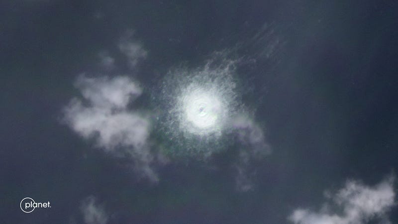
“Dark ships” emerge from the shadow of the Nord Stream pipeline mystery [link]
The satellite data monitoring firm SpaceKnow analyzed images from multiple satellites and detected two ships that did not have their automatic identification system (AIS) transponders turned on while they were passing through the area of interest.
C-SCALE Call for Use Cases [link]
The C-SCALE project has opened a call to onboard new use cases into the project. Eligible candidates will get (free) access to cloud, htc/hpc, storage resources until 30th June 2023.
Next cut-off date for applications: 30 November 2022
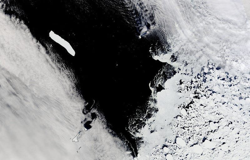
Iceberg A-76A in the Drake Passage [link]
The Antarctic iceberg A-76A is the biggest remaining piece of what was once the largest iceberg floating in the world’s oceans. It measures 135 kilometers long and 26 kilometers wide — a total area equal to about twice the size of London.
It is destined to drift north and… melt.
Interesting reads
Democratizing Open Machine Learning Technologies for Earth Observation [link]
Read this article, written by Jed Sundwall, the Executive Director at Radiant Earth Foundation; an article based on his recent presentation at Pecora.
It’s an absolutely insightful story; he starts from listing the requirements for the democratization (of data), to the origin story of COG and how the combination of the need to provide easy data access and several pre-existing inventions lead to it. And he goes on to argue that what we need for earth observation to inform better decision making at all levels of society are: 1. New data products, 2. New scientists and leaders, and 3. New kinds of institutions.

Modelling emissions from soil using EO data [link]
The article is a paper review (paper written by researchers at the Department of Climate and Space Sciences and Engineering, University of Michigan) where researchers used TROPOMI, SMAP and ERA4 data to estimate daily Cropland Soil NOx Emissions.
Fuel Crisis in Haiti — A Satellite View of the Two Month Blockade at the Varreux Fuel Terminal [StoryMap link]
Check this storymap about the fuel crisis in Haiti and the analysis of the night-time images over Port-au-Princ that BlackSky collected.
Data Products
The first batch of the Global Land Cover Mapping and Estimation Yearly 30m (GLanCE30) is out [Twitter link]
“NASA’s GLanCE annual 30 meter Version 1 data product provides global land cover and land cover change data derived from Landsat 5 Thematic Mapper (TM), Landsat 7 Enhanced Thematic Mapper Plus (ETM+), and Landsat 8 Operational Land Imager (OLI).” [link]
SICE — Snow and Ice Products on Demand [link]
Read about the Operational Sentinel-3 Snow and Ice Products Within EuroDataCube (EDC)
Omdena Local Project (call for applications)
Flood Extent Mapping Using Computer Vision and Satellite Imagery [link]
The goal of this project is to train a segmentation model to produce flood extent maps along with a dashboard to display these maps and view time series of maps for past data.
Floods are the most common disaster and affect more people than all other natural disasters combined. In 2021 alone, 223 of 432 catastrophic events were floods, with an $80 billion estimated economic loss.
Systems, even at the scope of this Omdena project, that provide timely information and are used to evaluate methods for flood control and management are extremely valuable.
Learning
Let’s Talk About the Value of SAR [link]
ICEYE Talk — Join the SAR Journey [YouTube link]
Why should I use polarimetric data? [link]
Elise Colin explains what polarimetric data is and the advantages of having all the polarizations.
Latest stories from Spectral Reflectance
How to download an image from the EnMAP data archive [link]
Career Opportunities
Internal Research Fellow (PostDoc) in Earth Observation (EO) and Computer Science for Climate [LinkedIn link]