Level-2 News
NASA Launches PACE Satellite in New Climate Mission to Study the Ocean and Atmosphere [link]
"SpaceX launched NASA’s satellite mission to study ocean health, air quality, and the effects of climate change into orbit early Thursday morning.
After being rescheduled twice due to weather conditions, PACE — the Plankton, Aerosol, Climate, ocean Ecosystem satellite — launched aboard a SpaceX Falcon 9 rocket from Space Launch Complex 40 at Cape Canaveral Space Force Station in Florida at 1:33 a.m. EST on Thursday."
BlackSky wins approximately $50 million in multi-year contracts for gen-3 capabilities and services to accelerate sovereign space capabilities for Indonesian Ministry of Defence [link]
"BlackSky Technology Inc. (NYSE: BKSY) won a first-of-its-kind contract with Thales Alenia Space supporting the Ministry of Defense (MoD) of the Republic of Indonesia to deliver Gen-3 Earth observation satellites, ground station capabilities and flight operations support. BlackSky has also provided Assured subscription-based real-time imagery and analytics services to support the Indonesian MoD. These multi-year contracts have a combined value of approximately $50 million dollars."
Google and EDF Partner to Tackle Methane Leaks with Space Tech [link]
"Google and the Environmental Defence Fund (EDF) on February 14, 2024 announced a new partnership to tackle methane emissions from oil and gas operations. This collaboration leverages space technology to detect and expose leaks, holding companies accountable and ultimately aiding in climate change mitigation efforts.
The centrepiece is the launch of MethaneSAT, a new satellite specifically designed to detect methane emissions with high precision. Scheduled for launch in March 2024, this satellite will provide unprecedented global coverage and sensitivity for identifying leaks."
TCarta and Capella Space Partner to Leverage All-weather SAR Imagery for Coastline Management [link]
"Capella Space announced a partnership with TCarta, a global provider of hydrospatial products and services, to add high-resolution SAR satellite imagery to TCarta’s coastal monitoring and shoreline feature extraction solutions. This partnership will enable more consistent and reliable identification of coastline changes so coastal managers have the accurate and up-to-date information for mitigating the impacts of climate change."
Saudi Arabia to monitor sustainability strategy from space [link]
"Saudi Arabia is looking to tap into the Earth observation market for enhanced environmental monitoring across the kingdom, a Saudi space official has said.
The efforts would help the country track the impact of its Green Initiative, a plan to plant 10 billion trees in the coming years, is having on the kingdom's weather and if it is helping to fight climate change."
USGS and Partners Declare February 12 as World Lidar Day [link]
"World Lidar Day was founded by a group of public agencies and private industry representatives working collaboratively to raise awareness about the value of lidar."
Synspective to Contribute to Natural Disaster Preparedness in Vietnam [link]
"Synspective is teaming up with the National Remote Sensing Department of the Ministry of Natural Resources and Environment of Vietnam and Fujitsu Vietnam to help with natural disaster preparedness, natural resource management, and economic and social development.
The MoU between the three parties was announced on Feb. 8."
Maxar Intelligence names new chief technology officer [link]
"Maxar Intelligence has named Arvind Srinivasan as its new chief technology officer. The appointment marks the latest leadership change at the company following its acquisition by the private equity firm Advent International."
Developer’s Orbit
Leafmap now supports visualizing Xarray DataArray [link]
Jupyter Notebook: Visualizing in-memory raster datasets and image arrays [link]
Using Machine Learning to Forecast the Weather and Climate [link]
"An Overview of Three CCAI Tutorials on Forecasting.
Machine Learning (ML) methodologies and accelerated computing harnessing GPU technology offer an unprecedented potential to provide faster, accurate, long-term predictions as an alternative or a complement to traditional, model-based methods.
This series of forecasting tutorials by CCAI illustrate how to produce such fast and accurate predictions for three different types of phenomena spanning different temporal and spatial scales: (1) El Niño, (2) synoptic scale weather, and (3) extreme events at the edge of synoptic scale."
Snapshots

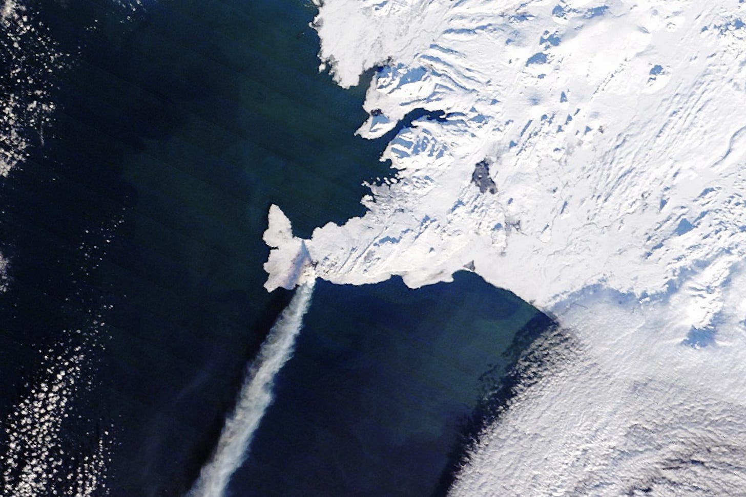
Another Eruption in Iceland [link]
"After a lull in activity, fresh lava has once again poured from the Reykjanes peninsula in southwestern Iceland.
The latest eruption—the third in the region since December 2023—began early on February 8, 2024, with lava spraying up to heights of 80 meters (260 feet) along a 3-kilometer (1.8-mile) long fissure near Mount Sýlingarfell."

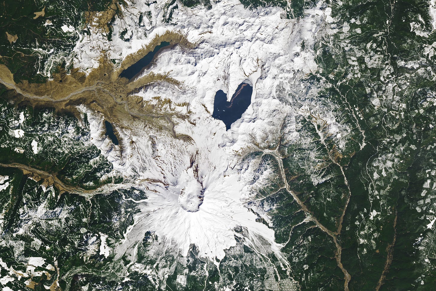
The Lovely Shape of Spirit Lake [link]
"Spirit Lake is resilient. The lake and once-popular tourist site in south-central Washington was nearly obliterated in May 1980 during the events that unfolded around the cataclysmic eruption of Mount St. Helens. The lake survived, and it took on a lovely new shape."

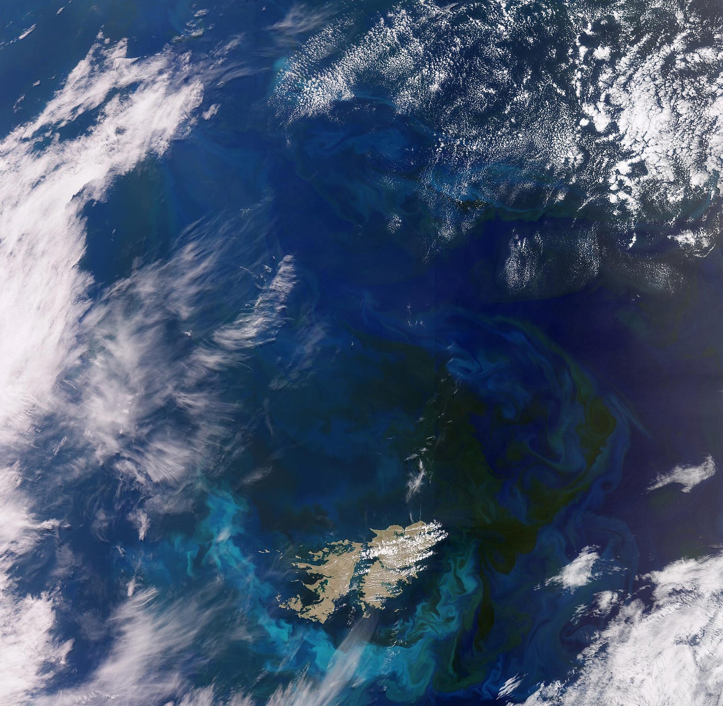
Oceanic Masterpiece: Satellite Captures Vast Algae Bloom the Size of Germany in the South Atlantic [link]
"In November 2023, the Copernicus Sentinel-3 mission documented a vast algae bloom around the Falkland Islands, highlighting the interplay between oceanic currents that fuel these essential marine phenomena."
Kennecott's Bingham Canyon Mine [link]
Check out this image share on LinkedIn by Joe Morrison, VP of Commercial Experience at Umbra.
The image is available through Umbra’s Open Data Program.
Interesting reads
A century of reforestation helped keep the eastern US cool, study finds [link]
"Widespread 20th-century reforestation in the eastern United States helped counter rising temperatures due to climate change, according to new research. The authors highlight the potential of forests as regional climate adaptation tools, which are needed along with a decrease in carbon emissions.
The team used a combination of data from satellites and 58 meteorological towers to compare forests to nearby grasslands and croplands, allowing an examination of how changes in forest cover can influence ground surface temperatures and in the few meters of air right above the surface.
The researchers found that forests in the eastern U.S. today cool the land's surface by 1 to 2 degrees Celsius (1.8 to 3.6 degrees Fahrenheit) annually.
The study is published in the journal Earth's Future."

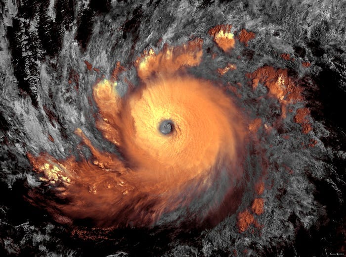
An Artistic Approach to Satellite Imagery [link]
Read this article by Kosmi, who creates artistic satellite images using Sentinel Hub EO Browser and custom scripts.
Trustworthy Satellite Earth Observations for Science and Society [link]
"Enhancing confidence in satellite observations of terrestrial properties like land surface temperature and soil moisture requires advances in validation and data quality assessment practices."
Meet NASA’s Twin Spacecraft Headed to the Ends of the Earth [link]
"Launching in spring 2024, the two small satellites of the agency’s PREFIRE mission will fill in missing data from Earth’s polar regions.
Two new miniature NASA satellites will start crisscrossing Earth’s atmosphere in a few months, detecting heat lost to space. Their observations from the planet’s most bone-chilling regions will help predict how our ice, seas, and weather will change in the face of global warming."
Upcoming Events
NASA EMIT Mapping Methane Plumes: Data Tutorial Workshop [link]
"Join NASA's JPL EMIT Science team for a 2-hour virtual workshop on March 14. This free workshop will demonstrate how to use methane data products from NASA's Earth Surface Mineral Dust Source Investigation (EMIT) mission."
Jobs in my feed
Opportunity to join the European Space Agency - ESA as a Research Fellow (PostDoc) in the ESRIN Science Hub [link]
"5 new positions open for researchers in the following areas:
- Advanced SAR methods and techniques
- Hydrology and water cycle
- Terrestrial carbon cycle
- Polar science and cryosphere
- Atmosphere"
Remote Sensing Specialist (Biomass) Internship at Space4Good [link]
Internship goal: Use remote sensing data and techniques to perform biomass estimation, including AI-based algorithm development and insight-driven analysis on vegetation dynamics.


