Level-2 News
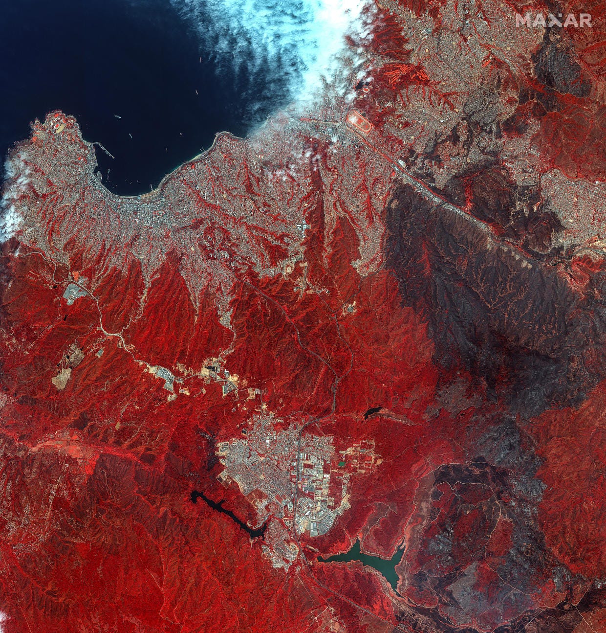
Satellite Images Reveal Wildfire Devastation in Chile [link]
"New Satellite Images from Maxar paint a stark picture of the widespread damage inflicted by wildfires in Chile’s picturesque Valparaíso region. This tragedy has claimed the lives of at least 122 people with the death toll expected to rise.
The images captured on Monday show expose the extensive burn scars left behind by the destructive blaze."
Related:
Fires Rage in Central Chile [link]
BlackSky Wins $50M Project To Give Indonesia Eyes in the Sky [link]
"BlackSky inked ~$50M-worth of contracts with the Indonesian Ministry of Defense to provide the agency access to the company’s commercial space-based intelligence, with plans to build a sovereign capability for the country down the road.
Under the contracts, the ministry will immediately be able to task BlackSky’s commercial sats, and have access to its trove of commercial data. "
AI Startup Synthetaic Closes $15M Series B [link]
"Synthetaic closed a $15M Series B round on Tuesday that will help bring its AI-driven image search tech to market.
The startup’s use of AI to quickly analyze huge numbers of images made headlines last year for nailing down the path of the Chinese spy balloon in just two minutes after sifting through 18T pixels of EO imagery, according to a press release."
Cerulean empowers ocean pollution watchdogs with orbital observation [link]
"The vastness of the ocean allows polluters to evade detection in all but the most egregious violations. SkyTruth aims to change that with Cerulean, an orbital monitoring platform for coastal waters that spots not just oil slicks but also the ships that produce them faster and with more certainty than ever before."
Related:
LinkedIn post by Development Seed about Cerulean [link]
Farewell to ICEYE-X1 [link]
After 6 years in orbit, ICEYE-X1 re-entered Earth's atmosphere.
Since 2018, ICEYE has launched more than 30 satellites, with over 15 more planned for 2024 and beyond.
"Launched in January 2018, ICEYE-X1 was the proof-of-concept satellite mission of the Finnish startup ICEYE, in preparation for their Synthetic Aperture Radar (SAR) equipped commercial constellation, set to have 48 satellites operational by the end of 2024. The ICEYE-X1 mission aimed to test and validate the performance of the satellite and its components, as well as begin operations with ICEYE customers." [link]
MGISS Raises £600K for Mapping Critical Infrastructure Using ESA’s Satellite Imagery [link]
"Mobile GIS Services (MGISS), a Liverpool, UK-based provider of geospatial software for utility companies, raised £600K in funding.
The company intends to use the funds for the development of a new system that MGISS is working on with the European Space Agency (ESA).
Mobile GIS Services (MGISS) uses satellite data and mapping technologies to help operators identify potential risks, such as construction work taking place close to underground cables or power lines, or when planning new projects to ensure the work does not affect existing infrastructure."
Omani startups harness satellite imagery for palm trees census [link]
"Two Omani startups, in cooperation with the Ministry of Transport, Communications and Information Technology, have embarked on an innovative initiative using satellite image analysis technology and drones for a palm trees census."
Snapshots

Indonesia’s Mahakam Delta [link]
"The Mahakam River originates in Borneo’s central mountain range and weaves more than 900 kilometers through dense jungles before flowing into the Makassar Strait. As it nears the strait, the river branches out across a large, fan-shaped delta that was once covered in palms and mangrove forests. By 2020, about half of the delta’s forested areas had been converted into shrimp farms.
The delta, which spans about 1,100 square kilometers, was once among the largest mangrove forests in Southeast Asia. But development for aquaculture has changed the landscape.
Using 30 years of data from Landsat satellites, researchers in Indonesia found that since 1989, about 55 percent of the delta’s area has been impounded and converted into aquaculture ponds, mostly for shrimp production."
Interesting reads
Understanding AI’s Impact on Space Data with Planet’s Head of Product [link]
Follow this interview on Payload with Planet's Head of Product Nate Gonzalez discussing the impact of AI on remote sensing data and how they leverage AI at Planet to derive insights from the vast archive.
Highlights:
- "Deloitte, the global consulting firm, argues that generative AI will be transformative for firms that collect unique data sets with satellites, which include Maxar, Planet Labs, Spire, Capella, ICEye and many others"
- Planet’s ML infrastructure is focused on transformer-based methodologies
- Planet’s archive consist of more than 50 petabytes of storage
- recent demonstrations; Planet partnered with Synthetic.AI to find the origins of 2023’s Chinese spy balloon
- interesting points around licencing ML models, Planet’s approach on working with partners to get the most out of the data and considerations about providing valuable ML-derived insights and staying relevant
Interview with Simonetta Cheli at the 16th EU Space Conference [link]
"At the 16th European Space Conference, SpaceWatch.Global’s Editor-in-Chief Dr Emma Gatti spoke with Simonetta Cheli, ESA’s Director of Earth Observation Program. The conversation focuses on ESA’s projects related to sustainable development goals, such as food security and water management. It also discusses ESA’s role in facilitating government decisions based on data, specifically in the context of climate change. The interview concludes with a mention of upcoming projects and the integration of digital technologies in Earth observation."
55 years of Commercial Geospatial Technology [link]
Follow these two articles by Joe Francica covering the first 50 years of Commercial GIS in a historical retrospective and his LinkedIn post for the highlights during the latest 5 years.
Fifty Years of Commercial GIS – Part 1: 1969-1994 [link]
Fifty Years of Commercial GIS – Part 2: 1994-2019 [link]

OpenET Study Helps Water Managers and Farmers Put NASA Data to Work [link]
"As the world looks for sustainable solutions, a system tapping into NASA satellite data for water management has passed a critical test.
Called OpenET, the system uses an ensemble of six satellite-driven models that harness publicly available data from the Landsat program to calculate evapotranspiration (ET)—the movement of water vapor from soil and plant leaves into the atmosphere. OpenET does this on a field-level scale that is greatly improving the way farmers, ranchers, and water resource managers steward one of Earth’s most precious resources."
First consistent forest structure survey for Germany from 2017 to 2022 [link]
"The German forest is in bad shape. A new method from the EOC now shows for the first time in high spatial and temporal resolution how its horizontal and vertical structure has changed in recent years.
Drought and heat waves have taken a toll on German forests since 2018. Pests such as the bark beetle and storms did the rest. As a result, foresters had to cut down numerous diseased and damaged trees early in order to prevent pests from spreading. Due to the loss of trees, the forest canopy becomes thinner and lower. The forest becomes more vulnerable and loses above-ground biomass."
USGS scientists help lead development of crucial climate report [link]
"Meet the five USGS scientists who served as coordinating lead authors for the Fifth National Climate Assessment.
The Fifth National Climate Assessment is the most comprehensive analysis of the state of climate change in the United States. The report, released November 14, 2023 by the U.S. Global Change Research Program, provides critical information for decision-makers and highlights key advancements in understanding current and future climate change impacts in the U.S.
The report marked the culmination of a four-year process in which more than 30 scientists from the U.S. Geological Survey worked alongside academic, private sector and federal scientists."
Greenland’s Biggest Losers [link]
"The Greenland Ice Sheet has shed about one-fifth more ice mass in the past four decades than previously estimated, researchers at NASA’s Jet Propulsion Laboratory in Southern California reported in a new paper. The majority of glaciers on the landmass have retreated significantly, and icebergs are falling into the ocean at an accelerating rate. This additional ice loss has had only an indirect impact on sea levels, but it could hold implications for ocean circulation in the future."
Upcoming Events
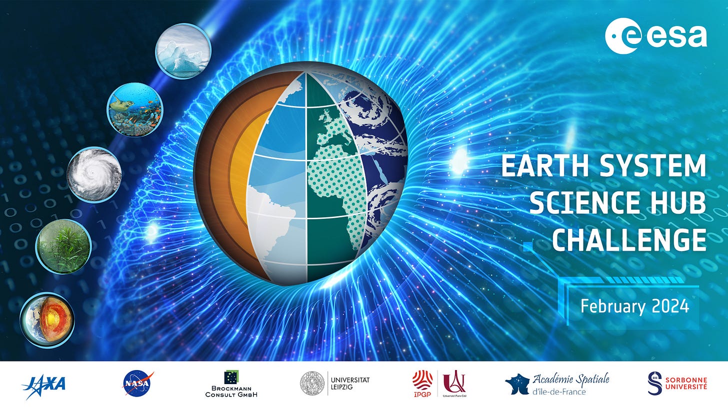
Earth System Science Hub Challenge February 2024 [link]
"The Challenge Unveiled: Exploring Earth Dynamics with DeepESDL
The scientific investigations will take place on the DeepESDL platform (Deep Earth System Data Lab) – an AI-ready, collaborative environment enabling researchers to understand the complex dynamics of the Earth System using multi-variate empirical approaches with numerous global observations and environmental and climate datasets."
Registration deadline is February 15th
The event will take place between 26th of February – 1st of March 2024
February 21, 2024: Quantus x Climate - Applying Explainable AI Evaluation in Climate Science [link]
ARSET - Overview of SeaDAS 8.4.1 for the Processing, Analysis, and Visualization of Optical Remote Sensing Data for Water Quality Monitoring [link]
"SeaDAS software, developed by the NASA Ocean Biology Processing Group (OBPG), is used in the processing, analysis, and visualization of satellite images. SeaDAS uses OBPG algorithms to produce water quality data and can be used to obtain water quality parameters from current optical sensors such as OLI (Operational Land Imager), MSI (MultiSpectral Instrument), OLCI (Ocean and Land Colour Instrument), VIIRS (Visible Infrared Imaging Radiometer Suite), and MODIS (MODerate resolution Imaging Spectroradiometer). SeaDAS can also be used to apply atmospheric correction and obtain remote sensing reflectance at the water surface level from these sensors.
This two-hour training will provide an overview and demonstration of the latest version of SeaDAS 8.4.1, which is useful for remote sensing of water quality monitoring."
Tuesday, February 13, 2024
An identical session will be offered once at 10:00am-12:15pm and again at 2:00-4:15pm ET
EO For Africa Symposium 2024 - Call for Abstracts [link]
"ESA is pleased to announce the organization of the 2024 EO for Africa Symposium in partnership with the African Union Commission (AUC), African Association of Remote Sensing of the Environment (AARSE), the European Commission (EC), the European Organization for the Exploitation of Meteorological Satellites (EUMETSAT), and the National Aeronautics and Space Administration (NASA). The symposium is scheduled to take place from 23 to 26 September 2024 at ESA-ESRIN in Frascati, Italy."
Abstract submission closure: 31 March 2024
Jobs in my feed
Lead InSAR Engineer at SkyGeo [link]
Learning
A Collection of NASA ARSET Courses for Flood Mapping and Synthetic Aperture Radar (SAR) [link]
Check out this collection of NASA ARSET courses focused on Flood Mapping and Synthetic Aperture Radar (SAR), compiled by Mark Bauer.


