Level-2 News
SpaceX Launches Transporter-9 [link]
On Saturday, Transporter-9 took off, sending 113 payloads across 90 different spacecraft and 89 deployments to orbit from a Falcon 9.
More than 40 of the payload slots were for EO satellites!
Planet launched 36 SuperDoves and a tech demonstrator; Pelican-1.
GHGSat got its first CO2-monitoring satellite, Vanguard, in orbit, along with two methane-sensing satellites.
Open Cosmos, a Barcelona startup, sent two satellites, MANTIS and PLATERO, to space.
And one slot was for Poland’s KP Labs Intuition-1 satellite; a tech demonstrator that will show how AI can deliver in-orbit processing of hyperspectral data for soil analysis.
Related:
Open Cosmos Satellites Successfully Launched & Integrated with EO Constellation [link]
Two ESA Φ-lab-enabled satellites launched [link]
Object Computing, Planet Labs Partner up for Better Data Insights [link]
"By combining Object Computing’s deep geospatial expertise with Planet’s data, the partnership will deliver significant benefits to businesses, including improved visibility and insights, decision-making, and operational efficiency."
The European Commission decides to refer GREECE to the Court of Justice of the European Union for failing to provide updated flood risk and flood hazard maps [link]
"Flood hazard maps and flood risk maps are key instruments for flood risk management. They help raise awareness about areas at risk of flooding and help communities develop strategies for reducing these risks. Civil protection and first responders can use the maps to plan emergency responses and they can also support insurance decisions. The maps also support land-use planning and urban development, particularly to avoid creating new risks."
Developer’s Orbit
How to Visualize Changes in a Radar Timeline [link]
Elise Colin walks us through REACTIC: Rapid and EAsy Change detection In radar TIme-series by Variation coefficient for visualizing all changes between two dates at a glance for a time series of radar images.
Snapshots

Italy's Mount Etna spews lava [link]
"One of the world’s most active volcanoes, Mount Etna, erupted on Sunday – spewing lava and clouds of ash high over the Mediterranean island of Sicily."
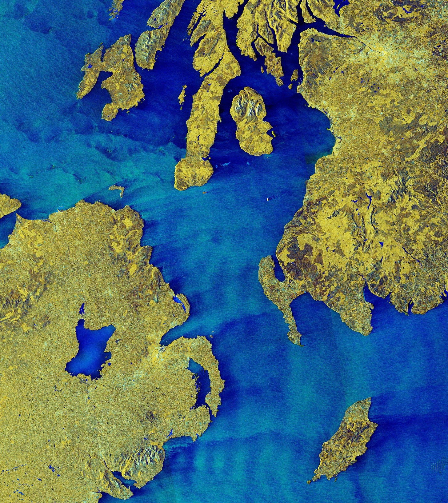
Earth from Space: North Channel [link]
"The North Channel is a strait linking the Irish Sea and the North Atlantic Ocean and spans a width of about 22 km at its narrowest point.
This dual-polarisation image combines information from horizontal and vertical radar pulses. This processing technique helps to distinguish different types of surface, thereby providing detailed information."
A volcanic eruption gave birth to a new island, and a NASA satellite saw it from space [link]
"Landsat-9 saw the island that formed off the coast in a volcanic eruption at the end of Oct. 30."
Interesting reads
Investment Frenzy for Small Satellites [link]
"It’s been a whirlwind of a year for small satellite startups – but will the excitement, and funds, last?"
Follow this interview with Kuva Space‘s CEO, Jarkko Antila, on what the market challenges are for startups involved in the development of small-satellite-related technologies.
The U.S. has special rules for satellites over one country: Israel [link]
"The war between Israel and Hamas is being fought, in part, through disinformation and competing claims — and satellite imagery has emerged as an important fact-checking tool. It's also putting new scrutiny on how commercial satellite companies operate in a conflict area."


