Level-2 News
EU and UK reach deal on Copernicus [link]
”The European Union and the United Kingdom have reached a deal that will allow the UK to resume participation in the EU elements of the Copernicus Earth observation program.”
Open Cosmos raises $50 million to expand Earth observation satellite business [link]
”Smallsat developer Open Cosmos has raised $50 million to expand the company and develop larger satellites and constellations focused on Earth observation.
The company has launched several smallsats to date to support Earth observation, communications and navigation applications and has five more satellites scheduled to launch through next March, all 6U or 12U cubesats with a range of Earth observation applications, from agriculture to disaster management.”
Microsoft and Esri to speed up access to Earth-observation data [link]
”To speed up access to Earth observation data for millions of customers, Esri is closely integrating its ArcGIS geographic mapping platform with Microsoft Azure Space.”
Descartes Labs lays off about 10-15 employees
Although there is no linked news headline at this point, several Descartes Labs employees have reported on LinkedIn that their roles have been affected by the company’s most recent layoffs. The exact number is unknown but it’s estimated to about 10-15 employees (Descartes Labs employs approximately 100-120 people).
Bayanat partners with HySpecIQ and AzurX to enable hyperspectral imaging and analysis for the UAE [link]
”The relationship between HySpecIQ and Bayanat will support the creation of hyperspectral data applications as well as the development of systems that can combine hyperspectral with other geospatial data to produce high value insights.”
Space firms to develop Gulf-UK “Space Channel” [link]
”International space companies have won the opportunity to develop an ambitious project that will see Bahrain and the United Arab Emirates (UAE) collaborate with the UK’s pioneering space sector to boost knowledge sharing, technology transfer, trade and investment on both sides. The ambitious venture will lay the foundations for a new “Space Channel” that has the wider potential to inspire further UK international space collaboration across the region.”
Satellogic and SkyWatch Partner to Increase Access to Timely Earth Observation Data [link]
”Satellogic's EO data is now available via SkyWatch's EarthCache platform. EarthCache provides an intuitive interface and robust API that enables customers to browse archive data, as well as task new satellite imagery by using a variety of criteria.”
Snapshots
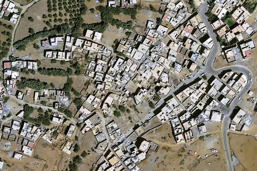
Earthquake in Morocco [link]

”Pléiades Neo and SPOT have been mobilised over the city of Marrakech, Amizmiz, Tizguine and Mouzda. Tasking was used to obtain coverage of the entire disaster area on 10th September, 2023.”
Floods in Greece
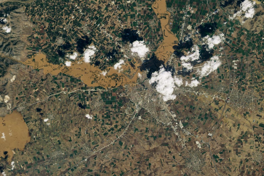
Greece’s Agricultural Heartland Underwater [link]
”In early September 2023, Greece endured a four-day storm that dropped 910 millimeters (3 feet) of rain on central parts of the country. The record rainfall triggered deadly flooding and inundated towns and farm fields in Thessaly, a region that includes Greece’s agricultural heartland.”
IMERG Captures Flooding Rainfall in Greece [link]
”On Sept. 4, 2023, a low-pressure system developed over southeastern Europe that would lead to devastating floods over Greece and other parts of the region. The system was given the name “Daniel” by local meteorological agencies.
The above animation shows precipitation rates (in blue/yellow shading) and accumulations (in green/purple shading) from NASA’s IMERG multi-satellite product from Sept. 3 - 7, 2023. Cloudiness is shown in shades of white/gray using infrared geosynchronous satellite data.”

Interesting reads

NASA Scientists Test New Tool for Tracking Algal Blooms [link]
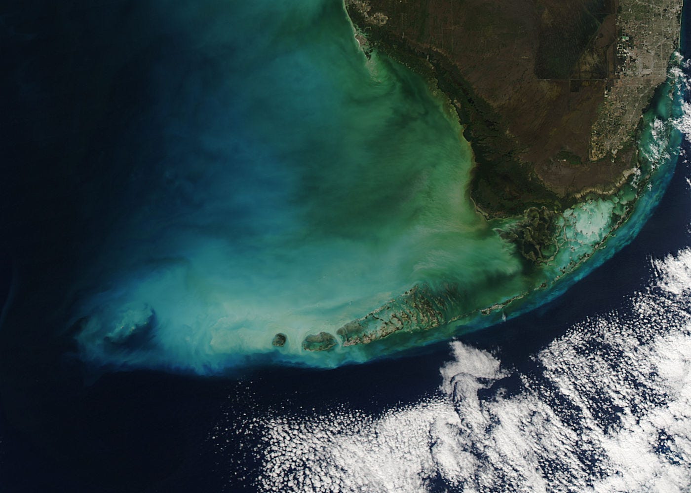
”A recent study, led by scientists at NASA’s Jet Propulsion Laboratory in Southern California, has shown how one space-based instrument called TROPOMI, or TROPOspheric Monitoring Instrument, was able to peer through thin clouds to uncover powerful clues about Karenia brevis (or K. brevis), the microscopic algae responsible for the 2020 blooms.”
Upcoming Events
ARSET - Transforming Earth Observation (EO) Data into Building Infrastructure Data Sets for Disaster Risk Modeling [link]
”This short course, covers the basics of natural hazard risk modeling and exposure development with a focus on fusing data from multiple datasets expressly for the purposes of risk assessment. It also presents examples applying the techniques to applications related to flood risk assessment, climate adaptation, and earthquake modeling.”
October 3, 2023 - October 10, 2023
Competitions
GOES-R DataJam Competition [link]
The GOES-R DataJam is a virtual competition for undergraduate and graduate students to showcase their best use of GOES-R Series data.
Registration closes on September 15
Cross-city multimodal Semantic Segmentation Challenge [link]
”The task is to build novel cross-city semantic segmentation models based on modern artificial intelligence (AI) technologies and emerging multimodal remote sensing data.
This contest is organized in conjunction with the 13th Workshop on Hyperspectral Image and Signal Processing: Evolution in Remote Sensing (WHISPERS).”
Athens, Greece, Oct. 31 – Nov. 2, 2023
Showcase your climate data visualisation talent [link]
”Enter ESA’s latest competition to showcase your talent by transforming decades of satellite climate data into impactful visuals to help bridge the gap between climate science, policy makers and the wider public. The winner will have the unique opportunity to display their data visualisation at the 2023 United Nations Climate Change Conference (COP28) taking place later this year.
The deadline for entry is 15 November 2023.”


