Level-2 News
Apply for the ESA NoR Sponsorship and Receive up to €5,000 to spend on Earth Observation Services and Data [link]
“The ESA sponsorships for Network of Resources initiative (NoR) are meant for use in research, pre-commercial development, and demonstration projects that exploit satellite-based EO data. You can apply if you’re working on a geospatial-related project that doesn’t generate revenue and only requires downloading of the processed results (not the original data).”
UK suffers marine heatwave [link]
“Some of the most severe marine heat increases on Earth are occurring in the seas surrounding the UK and Ireland. Satellite measurements show that water temperatures in certain areas are above average for this time of year.”
New Space companies join Copernicus [link]
“With commercial companies playing an increasingly important role in creating a dynamic and innovative space industry, nine New Space satellite data suppliers have joined the Copernicus programme as ‘Contributing Missions’.”
Kuva Space wins 5 million euro award for hyperspectral data [link]
“Finland’s Kuva Space won a 5 million euro ($5.47 million) European Commission contract to supply hyperspectral data to the Copernicus Contributing Mission program.”
Developer’s Orbit

Visualising turbidity using Sentinel-2 satellite data [link]
A new Jupyter Notebook for visualising turbidity using Sentinel-2 satellite data by Joram Downes.
NDVI Time-Series from Sentinel-2 Imagery Using STAC [link]
Follow this tutorial to generate an NDVI time series for a single point located in the Kolstad Lake Waterfowl Production Area.
Data
A quarter million game-crowd generated data labels to understand Europe’s climate threat [link]
BlackHorse’s crow-sourced labeling campaign managed to generate 236,006 data labels in an effort to help understand how climate change is impacting the Mediterranean region of Europe.
“To do so, BlackShore developed an online gaming platform using very high resolution satellite images (currently down to 30-cm resolution data) to zoom in the surface of the Earth as a key resource.
The game teaches players how to identify and map pre-defined features such as obstructed roads, flooded zones, or clear-cut areas. Working with satellite images to make useful operational maps for organisations such as governments, urban planners or emergency services gives players a sense of purpose, in addition to being fun.
All generated labels are delivered as open data with Jupyter Notebooks and can be accessed at Zenodo [link].”
Related:
Using EO and crowdsourcing to respond to today’s global challenges [link]
Crowd Generated Maps with Cerberus [link]
Snapshots

Ethereal ice swirls dance around Arctic peninsula in stunning new satellite image [link]
“NASA’s Aqua satellite spotted giant ice swirls stretching for hundreds of miles in the Sea of Okhotsk off Russia’s P’yagina Peninsula.”
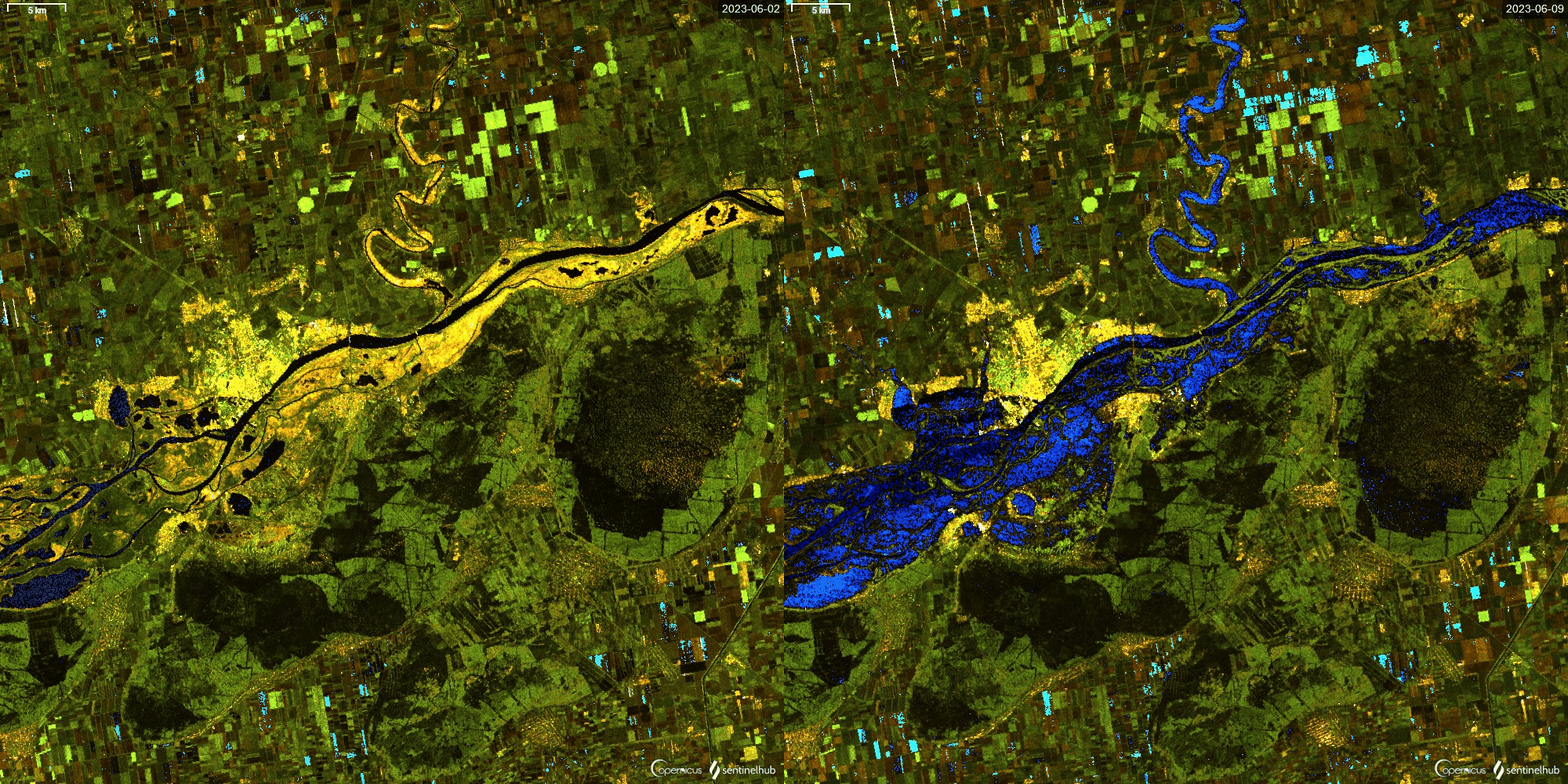
Flooded aread in theKherson region due to Kakhovka dam destruction, using Sentinel 1 SAR [link]
“Sentinel 1 SAR images shows flood huge impacted areas of Kherson region due to Kakhovka dam destruction, image before destruction on June 2 and after June 9.”

Earth from Space: Eastern Mediterranean [link]
“This wide view includes Egypt to the south, and Israel, Jordan, Lebanon and Syria to the east. Part of Saudi Arabia can be seen to the east of the Red Sea and Sudan to the west. To the north are the island of Cyprus and the south coast of Türkiye.”
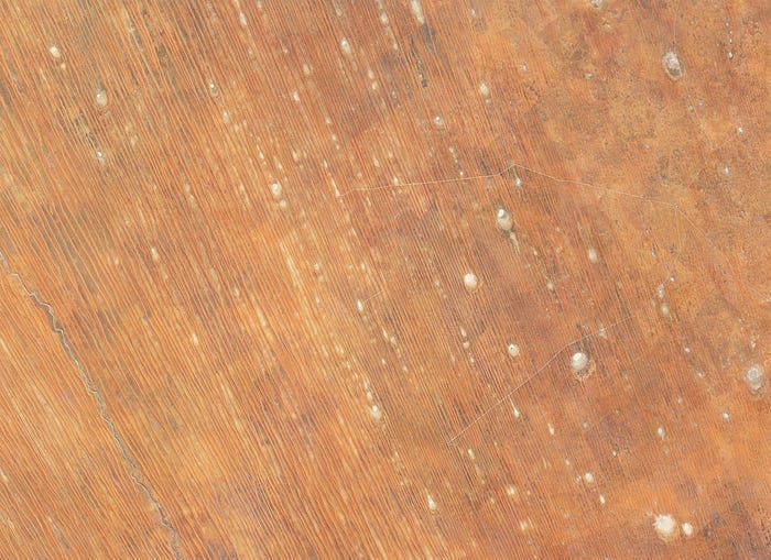
Planet Snapshots Issue 80: Deserts [link]
In this week’s issue:
Earth’s growing deserts
Villages on stilts
Crystalline ice
Interesting reads

El Niño is officially here, scientists say [link]
“El Niño could lead to new records for temperatures, particularly in areas that already experience above-average temperatures during El Niño.”
Upcoming Events
Mapping forest biomass with EO [link]
“Join this upcoming webinar to discover how Earth Observation (EO) and ground information are being used to map forest biomass. The webinar covers two use cases in the Amazon Basin and the Republic of the Congo, highlighting the value of biomass maps for informed forest management decision-making.”
06/07/2023–11:00–12:00 am (CEST) — English session with French subtitle
06/07/2023–04:00–05:00 pm (CEST) — Spanish session
Learning
Earth Observation Learning Resources [link]
“This page compiles several learning resources about Earth Observation! From books to webinars, tutorials, Python Notebooks, podcasts and online courses, this collection features a variety of sources to help you learn more about Earth Observation and Remote Sensing.”


