Level-2 News
Earth’s climate is changing. IBM’s new geospatial foundation model could help track and adapt to a new landscape [link]
“Built from IBM’s collaboration with NASA, the watsonx.ai model is designed to convert satellite data into high-resolution maps of floods, fires, and other landscape changes to reveal our planet’s past and hint at its future.”

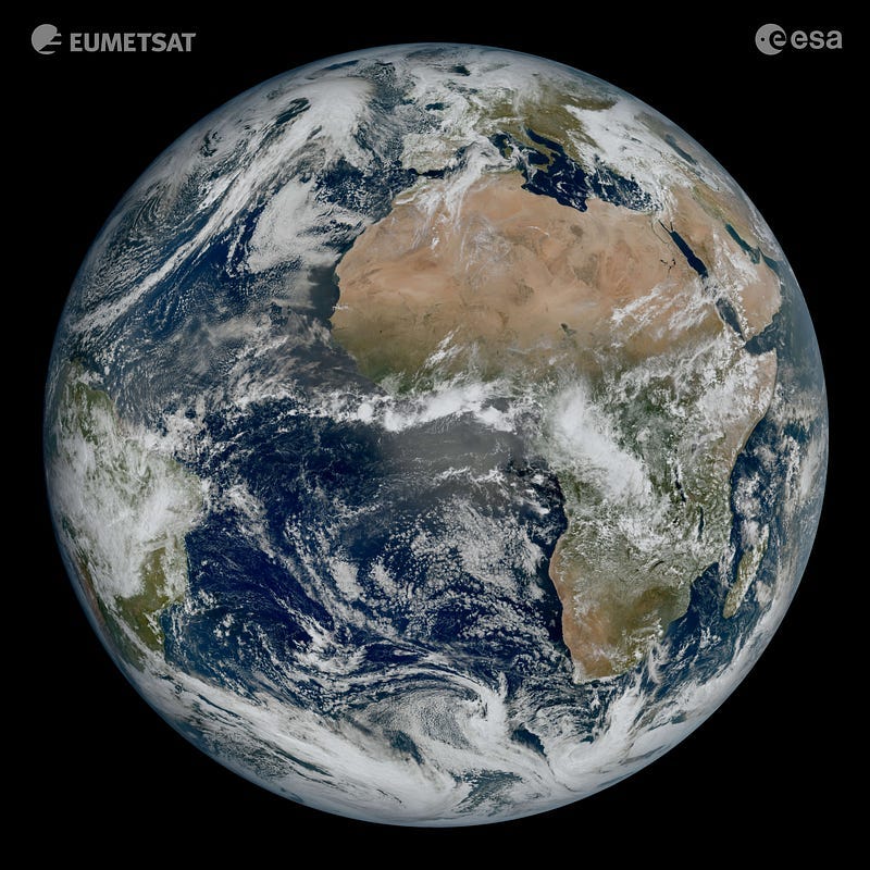
New weather satellite reveals spectacular images of Earth [link]
“Europe’s latest weather satellite, the Meteosat Third Generation Imager, has just delivered its first view of Earth — revealing conditions over Europe, Africa and the Atlantic in remarkable detail.”
NUVIEW to Map the Entire Globe in 3D with LiDAR [link]
“NUVIEW announced that it is building the world’s first commercial LiDAR satellite constellation which will map the entire land surface of the Earth in 3D for the first time ever.”
Canadian Space Agency Awards Spire and OroraTech Wildfire Detection Contract [link]
“Spire Global and OroraTech are working together on a Canadian Space Agency contract to monitor wildfires from space via satellite.”
Ordnance Survey, CGI Develop Water Pollution Predictive Tool [link]
“CGI in partnership with Ordnance Survey, has developed an initiative designed to remotely detect sewage overspill events from space.
The project will utilise a newly created artificial intelligence (AI) model that can predict with high levels of accuracy the conditions most often associated with pollution events.”
Snapshots

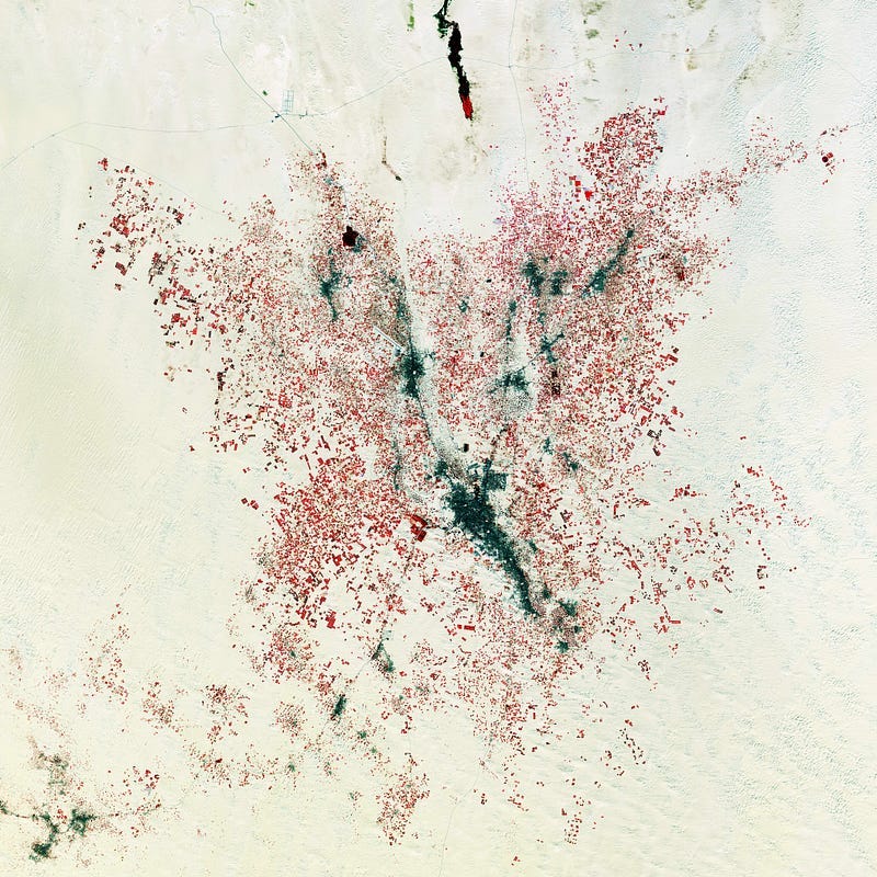
Earth from Space: Farming the desert [link]
“The Copernicus Sentinel-2 mission takes us over El Oued, in northeast Algeria, about 80 km west of the border with Tunisia.
Shown as a dark elongated area in the centre of the image, the town of El Oued lies around an oasis in the northern Sahara, in a region that is otherwise an endless sea of sand.”
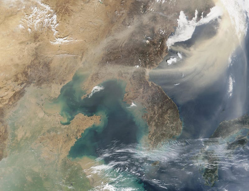
Planet Snapshots Issue 74: Water Quality [link]
In this week’s issue:
Satellites monitor water pollution
A new blue hole is discovered
Shiveluch erupts

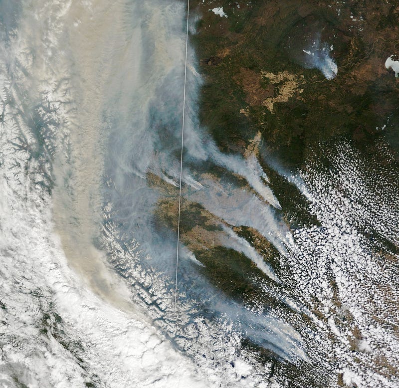
Fires Scorch Western Canada [link]
“More than 100 wildland fires raged across Western Canada in early May 2023, forcing tens of thousands of people in Alberta and British Columbia to evacuate. The fires destroyed homes and produced chimneys of smoke that reached into the upper troposphere.”
Interesting reads
The satellite boom is far from over [link]
Follow this article by David Ziegler about the expanding space economy and how the EO drives this growth.

Scientists begin to unravel global role of atmospheric dust in nourishing oceans [link]
“New research led by an Oregon State University scientist begins to unravel the role dust plays in nourishing global ocean ecosystems while helping regulate atmospheric carbon dioxide levels.”
Can Earth Observation Technology Help to Restore Trust in Carbon Offsetting? [link]
Follow this article for how EO data could bring transparency and restore trust in carbon offsetting.
Monitoring Forests More Closely [link]
“Increasing heat and drought are changing forests faster than expected. Researchers at the University of Würzburg want to keep a better eye on these dynamics. They have raised 1.2 million euros for their project.”
Upcoming Events
Remote sensing — more than meets the eye webinar series 2023 [link]
“A mini-series of five webinars during 15–19 May to showcase some of the recent developments in remote sensing technologies and how these are applied to answer questions for policy-makers, councils and landowners.”
Competitions
Google Research — Identify Contrails to Reduce Global Warming [link]
“Train ML models to identify contrails in satellite images and help prevent their formation.”


