Level-2 News
SpaceX launches seventh Transporter rideshare mission [link]
“SpaceX launched more than 50 satellites early April 15 on the latest in a series of dedicated Falcon 9 smallsat rideshare missions.”
As it was the case to the previous Transporter mission, this batch also included several Earth Observation satellites:
Satellogic had four imaging satellites onboard while GHGSat had three satellites for greenhouse gas monitoring. Umbra launched another synthetic aperture radar imaging satellite.
Saudi Arabia’s King Abdullah University of Science and Technology equipped with a hyperspectral camera and a sensor for measuring soil moisture.
Orbital Sidekick launched the first two satellites of its six-satellite Global Hyperspectral Observation Satellite, or GHOSt, constellation to provide hyperspectral imagery.
Planet Partner Upstream Tech To Offer Global Basemaps Subscription Within Lens [link]
“Through a new integration with Upstream Tech’s Lens platform, PlanetScope Basemaps is now available through a Planet Basemaps in Lens, allowing users to access both global, monthly visual Basemaps with historical imagery back to the start of 2020, as well as new up-to-date Basemaps that will appear directly in Lens moving forward.”
Picterra announced the integration of the Segment Anything Model (SAM) by Meta AI into its platform [link]
The integration enables faster annotation of objects in Earth Observation imagery in the Picterra platform.
In Navy experiment, commercial satellites serve as key weapons against drug traffickers [link]
“Royce Geospatial Consultants used floating acoustic sensors to tip and cue commercial imaging satellites. For the Navy experiment, it tasked Planet’s electro-optical and Iceye synthetic aperture radar (SAR) satellites to capture images of the moving vessels.
The total time from acoustic detection to vessel report was about 30 minutes.”
L3Harris to Build Geostationary Weather Satellite Sensors for Japan [link]
“L3Harris will build and deliver an advanced imager and sounder for JMA’s Himawari-10 satellite. The imager will use a similar technical platform as L3Harris’ Advanced Baseline Imager (ABI) on NOAA’s Geostationary Operational Environmental Satellite-R (GOES-R). The imager will also carry enhancements beyond its predecessor, Himawari-8/-9, including tailored Japanese spectral bands to supply the most advanced geostationary weather information for the international community.”
Queryable Earth: combining satellite imagery and next-generation AI [YouTube link]
“Back in 2018, Planet co-founder and CEO Will Marshall asked the audience during his TED talk: what if you could search the surface of the Earth the same way you search the internet?
The tech is now here to actually try that.
In collaboration with the Microsoft AI for Good Lab, Planet built this proof-of-concept project affectionately known as ‘Queryable California.’”
Data
USDA-ARS Now Stewarding the Rangeland Analysis Platform [link]
“United States Department of Agriculture’s (USDA) Agricultural Research Service (ARS) will now manage the scientific and technological advancements of the Rangeland Analysis Platform (RAP), a dataset with an interactive online mapping tool that allows users to access more than three decades of vegetation and production trends across the United States.”
RAP data on GEE:
Rangeland Analysis Platform data products are available as GEE assets and are made publicly available for analysis through the web application at rangelands.app [link]
Snapshots
Planet Snapshots Issue 71: Blue Carbon [link]
In this week’s issue:
Coastal carbon-storing ecosystems
Solar panels float atop reservoirs
Using AI to search satellite data

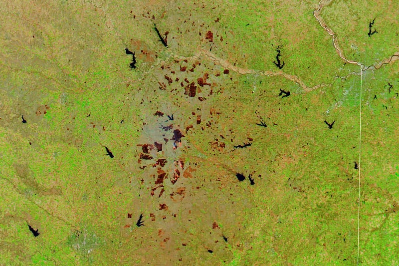
Burn Scars in Kansas [link]
“In spring 2023, numerous fires burned across the grassy Flint Hills region of eastern Kansas. Satellite images show fire activity starting to ramp up in late March and early April, which produced a patchwork of burn scars across the region.”

Heavy Rains Hit Drought-Stricken Horn of Africa [link]
Flash flooding from heavy rains killed dozens and affected 300,000 people in Ethiopia and Somalia in March 2023. The damaging flooding came after the region has experienced almost three years of extreme drought.”
Shiveluch volcano erupts on the Kamchatka Peninsula [link]
“This year’s largest volcanic eruption to date took place on April 10 when Shiveluch volcano on Kamchatka Peninsula erupted at 13:49 UTC. The UV spectrometer TROPOMI on board Europe’s Sentinel-5 Precursor (S5P) satellite recorded for the first time the massive volcanic cloud of sulphur dioxide (SO2) one day after the first eruption. S5P measurements are processed around the clock at EOC, so a record of the trend of volcanic emissions can be continuously provided.”
Interesting reads
First release of the Global Channel Belt (GCB) map [link]
“This map was created using machine learning to identify landform patterns that define the extent of river channel belts based on 30 meter resolution Landsat imagery.
The potential applications of the GCB map are numerous and far-reaching, such as understanding river evolution, assessing flood risks, analyzing freshwater budgets, constraining terrestrial biogeochemical cycles and much more.”
An interactive map to further explore the GCB dataset is also available here. And here for a 3D perspective in Google Earth.
The EU’s Regulation on Deforestation-free Products and the Role of Earth Observation [link]
Follow this article to learn more about the recent Regulation on Deforestation and the role of EO data.

Detecting oil pollution with a multi-sensor approach [link]
“DLR’s Earth Obsevation Center (EOC) is developing various methods to map oil slicks in both SAR and optical satellite images. The sinking on February 28 of MT Princess Empress, a tanker loaded with 800,000 litres of industrial oil, near the Philippine island of Mindoro is now providing up-to-date research data. Within a month about half of the oil had leaked from the wreck and was dispersed over hundreds of kilometres by the currents.

How much water do we use for irrigation? [link]
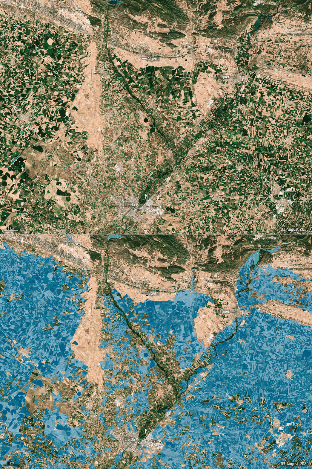
“While we know that we use more water for irrigation than for any other single purpose, watering practices are not monitored worldwide. Water needed for agriculture is expected to further increase as time goes on, so managing this precious resource as effectively as possible is imperative. Scientists have now shown that a nifty way of using information from satellites could pave the way to measuring how much water we use to irrigate, which could subsequently lead to better management.”

Those Seaweed Blobs Headed for Florida? See How Big They Are. [link]
Scientists say they spotted more than 13 million tons of Sargassum, a yellowish-brown seaweed, drifting in the Atlantic Ocean last month — a record for the month of March.
Learning
The recording of the Arctic Wildfires webinar by SentinelHub is now available! [link]
“Satellite data are extremely useful in monitoring wildfire activity, including in the Arctic. Predictions over a decade ago suggested a ‘fire invasion’ at higher latitudes. In this webinar held on April 6th 2023 we explored, whether and how this can actually be seen through the EO data.”
Watch the webinar on YouTube!
Earth Observation Learning Resources [link]
This page compiles several learning resources about Earth Observation! From books to webinars, tutorials, Python Notebooks, podcasts and online courses, this collection features a variety of sources to help you learn more about Earth Observation and Remote Sensing.


