

Level-2 News
Dubai’s Earth observation nanosatellite to be launched April 14 [link]
“Dubai Electricity and Water Authority (DEWA) on said its nanosatellite DEWA-SAT2 would be launched on Friday (April 14). DEWA-SAT2 features a high-resolution camera (4.7 meters) that will be used for Earth observation missions.”
The ESA Φ-lab March Newsletter is out! [link]

Earth-observing satellite captures rare photos of Jupiter and its moons [link]
“A new beautiful image of Jupiter and its largest moon Ganymede demonstrates the imaging power of one of Europe’s flagship satellites. This photo wasn’t taken by an astronomical satellite or an Earth-based telescope, however, but by a European spacecraft built to observe planet Earth in detail.”
“Hard to believe, but these pictures were taken by a Pléiades Neo satellite” [link]
Developer’s Orbit
Can you use MetaAI’s tool ‘Segment Anything’ for drone imagery? [link]
Follow this post to learn more about how MetaAI’s tool “Segment Anything” can be used for segmentation tasks on drone imagery.
Snapshots
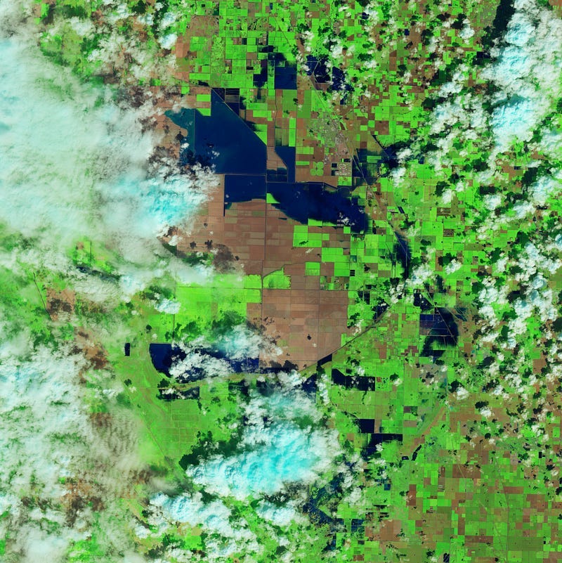
Return of Tulare Lake [link]
Three months of heavy rain and snow flooded the diverted rivers and brought water back to Tulare Lake.
13 volcanoes seen from space [link]
Watch this video of 13 volcanoes as they are seen by the Copernicus Sentinels.
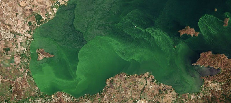
Planet Snapshots Issue 70: Spring Blooms [link]
In this week’s issue:
Blooms announce Spring
Oases sprout from the desert
Renewables surpass coal in the US
Year-to-year snowpack comparison
Interesting reads
The Nature Conservancy and Planet collaborate to Map Blue Carbon [link]
“Planet and The Nature Conservancy announced collaborative efforts on the Blue Carbon Explorer, a digital tool developed by TNC that aims to map mangrove and seagrass blue carbon around the world.”
Forecasting pollen to alleviate allergy suffering [link]
Follow this article for how CAMS data is used to track and forecast pollen concentrations across Europe.
Scientists Use NASA Satellite Data to Determine Belize Coral Reef Risk [link]
“Researchers at JPL, alongside colleagues in Belize, used 20 years of data from MODIS, an instrument on NASA’s Aqua satellite, to assess risk to Belize’s coral reefs due to human activity and climate change.”
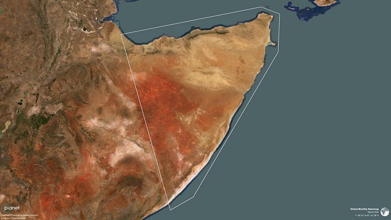
Using Planetary Forensics To Visualize Historic Drought In The Horn Of Africa [link]
Read this article by Steve Levay and Ryder Kimball at Planet about the disastrous drought and humanitarian crisis at the Horn of Africa led by record low rainfall.
NASA Space Mission Takes Stock of Carbon Dioxide Emissions by Countries [link]
“A NASA Earth-observing satellite has helped researchers track carbon dioxide emissions for more than 100 countries around the world. The pilot project offers a powerful new look at the carbon dioxide being emitted in these countries and how much of it is removed from the atmosphere by forests and other carbon-absorbing “sinks” within their borders. The findings demonstrate how space-based tools can support insights on Earth as nations work to achieve climate goals.”
How satellites assist wildfire management [link]
Follow this article to learn how satellite data can be used to support early detection, monitor wildfires and predict their course and about the operational platforms that provide near-real-time monitoring.
Upcoming Events
USGS Bulk Download Web Application Webinar [link]
“On April 18, 2023, at 12:00 p.m. CDT (UTC/GMT-6), USGS EROS User Services staff will host a webinar to review the components of the BDWA and will demonstrate how to use the BDWA to download Landsat data.”
SAR Revolution: Unleashing the power of satellite radar data across use cases [link]
“This digital meetup brings together the expertise of industry experts to explore the latest advancements in Synthetic Aperture Radar (SAR) satellite data and its increasingly significant role in business applications.”
Tuesday, May 9th 2023 @ 11:00AM EEST
AEMON-J “Hacking Limnology” Virtual Workshop and the 2023 Virtual Summit: Incorporating Data Science and Open Science in Aquatic Research (#DSOS23)! [link]
The “Hacking Limnology” Workshop will take place on July 24–26, 2023 15:00–19:00 UTC (11:00–15:00 EDT).
The 2023 Virtual Summit will take place on July 27–28, 2023 17:00–21:00 UTC (13:00–17:00 EDT).
There is no cost for either event.
Call to join Omdena Local Chapter Project
Developing a Forest Fire Detection and Monitoring System for Algeria using Satellite Imagery and Machine Learning [link]