Weekly newsletter on Earth Observation
Level-2 News

Bidding Farewell to Virginia T. Norwood, the Mother of Landsat [link]
“Virginia T. Norwood, a founding figure in the field of satellite land imaging, died on Sunday, March 26 at age 96. Known as the “Mother of Landsat,” Norwood designed the first space-based multispectral scanner that flew on Landsat 1 — an instrument that went on to define many aspects of modern remote sensing.”
Related:
The woman who brought us the world [link]
GEDI Gets New Lease of Life for Another Decade [link]
“NASA has decided to extend the Global Ecosystem Dynamics Investigation (GEDI)’s life for another decade for the second time. Meanwhile it has been paused and moved into International Space Station (ISS)’s storage.
The GEDI instrument with climate and biodiversity sensor, scans the globe’s forest cover and provides data that can answer some very imperative questions related to the planet’s ecosystem. GEDI will get back to its original location in late 2024 and will start collecting Earth’s vital data through till 2030.”
ICEYE US Awarded a Multi-Year Blanket Purchase Agreement by NASA to Provide Radar Satellite Imagery for Evaluation in Support of Earth Science and Research [link]
“ICEYE announced a Blanket Purchase Agreement (BPA) with NASA. The contract is a five-year agreement for the purchase of synthetic-aperture radar (SAR) data for evaluation to determine their suitability for advancing NASA’s science and application goals.”
Planet Joins Ursa Space’s Virtual Constellation And Partner Network [link]
Ursa Space Systems, announced this week that Planet Labs will join its Virtual Constellation and Partner Network.

Highest wildfire emissions for March in Spain since at least 2003, according to CAMS data [link]
“Areas of Spain were hit by wildfires of unusual intensity for the season during March, according to data from the Copernicus Atmosphere Monitoring Service (CAMS). CAMS Global Fire Assimilation System (GFAS) shows the highest wildfire carbon emissions for the whole Spain, by a short margin of 0.01 megatonnes, since at least the beginning of the dataset in 2003.”
The Copernicus Climate Change new dashboard has just been published! [link]
“Check the Climate Indicators that show the long-term evolution of several key variables and help assessing the global and regional trends of a changing climate”
China’s Hyperspectral Multifunctional Observation Satellite release first public images [link]
“The China National Space Administration published the first images taken by an advanced Chinese Earth-observation satellite.
The 14 images were taken by the world-class apparatus on the Hyperspectral Multifunctional Observation Satellite, including a wide thermal infrared imager and an advanced hyper-spectral imager.”
NASA Earth science hosted payload set for launch on Intelsat satellite [link]
“The upcoming launch of a NASA Earth science instrument on a commercial communications satellite illustrates the promise of, but also the problems with, hosted payloads.
Intelsat 40e, built by Maxar, carries a NASA hosted payload called Tropospheric Emissions Monitoring of Pollution (TEMPO). The instrument, produced by Ball Aerospace, is designed to measure concentrations of atmospheric pollutants such as nitrogen dioxide, ozone and formaldehyde across the continental United States as well as portions of Canada, Mexico and the Caribbean. TEMPO, from GEO, will for the first time provide hourly data on air pollution”
Snapshots
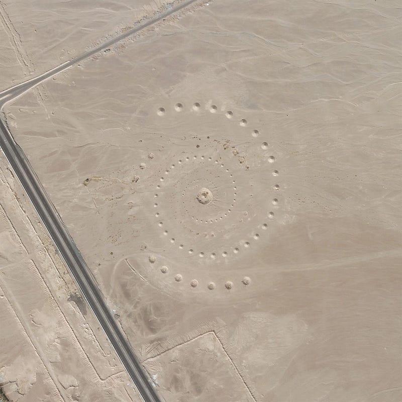
Planet Snapshots Issue 69: Geoglyphs [link]
In this week’s issue:
Markings etched into Earth
Tornadoes in the Midwest
Inflation migration
Storm in Mississippi, USA [link]
“Mississippi State in the USA was hit by sudden storms on Sunday, 26th March. The aftermath of the storms in the city of Rolling Fork can be monitored in the two before-and-after Pléiades Neo images attached to the article.”
Interesting reads
STAC: A Retrospective, Part 1 [link]
In this 1st part of a 2-part retrospective, Matthew Hanson dives into the history of STAC.
Top trends driving the adoption of Earth Observation data through 2023 and beyond [link]
Satellite data has made headlines due to its crucial role in the global political landscap but have yet to receive wide adoption in other industries. However, it seems that there is a shift coming.
Follow this article to learn more about the key factors that drive thadoption of EO data.
Is Europe already drying up? [link]
“Europe has just endured its second warmest winter on record. Much of southern and western Europe has been affected by substantial anomalies of soil moisture owing to this exceptionally dry and warm winter. Data from ESA’s Soil Moisture and Ocean Salinity mission have been used to monitor the low levels of soil moisture across Europe.”
Upcoming Webinars
CAMS user workshop Denmark [link]
Join Copernicus ECMWF on 19 April, 2023, at the online CAMS User Workshop, where experts and stakeholders will gather to discuss the latest advancements in air quality monitoring and forecasting in Denmark.
Registration deadline; 18:00 CET on the 12th of April 2023.
Learning
Explore (VV, VH) or (HH, HV) SAR time series [link]
Elise Colin keeps sharing her amazing tutorials about SAR!
This week; How to calculate the degree of polarization.


