Level-2 News
Planet to Acquire Sinergise to Expand its Data Analysis Platform [link]
“Planet Labs announced it has signed an agreement to acquire the business of Holding Sinergise.”
The First 30 cm HD Global Imagery Basemap [link]
Maxar announced the first global, satellite imagery basemap at 30 cm high-definition (HD) resolution.
Satellogic Announces Integration with SkyFi [link]
“Satellogic announced its partnership and integration with SkyFi. This partnership will allow SkyFi’s customers to task Satellogic satellites directly through the platform.”
The German forest under climate stress — ForstEO project launched [link]
“ForstEO, a project with the goal to detect climate-related forest disturbances in Germany using EO data, was launched on March 21, 2023, the International Day of Forests.
The project is funded by the German Federal Ministry of Food and Agriculture (BMEL) and the German Federal Ministry for the Environment, Nature Conservation, Nuclear Safety and Consumer Protection (BMUV) through the Forest Climate Fund.”
Thales to Build 6 Satellites for Italy’s IRIDE Constellation [link]
“Thales Alenia Space has won a contract to build six satellites for the Italian Earth observation (EO) constellation IRIDE. The contract, awarded by the European Space Agency (ESA), is for a batch of six small satellites with synthetic aperture radars (SAR) and one satellite based on optical technology.”
New ECCOE tool helps compare satellite data and products [link]
“The USGS Earth Resources Observation and Science (EROS) Cal/Val Center of Excellence (ECCOE) aims to help the world produce and access the best quality Earth observation remote sensing data possible.
ECCOE has developed a new tool that helps users visually compare data from satellite sensors and analyze their strengths and weaknesses over different terrain.”
Three research projects to improve ECMWF’s Copernicus services [link]
“January 2023 marked the start of three EU-funded research projects to further develop the EU’s Copernicus Climate Change Service (C3S) and Copernicus Atmosphere Monitoring Service (CAMS) implemented by ECMWF; CERISE, CAMEO and CORSO”
Remote sensing companies try to capture bigger piece of satellite imaging market [link]
Maxar, Planet and BlackSky are working to expand their offerings beyond optical imagery
Developer’s Orbit
Leafmap new feature: Timelapse animations [link]
Create timelapse animations from satellite images with only one line of code. It supports both locally stored raster datasets and Cloud Optimized GeoTIFFs.
Download, preprocess and visualize land surface temperature (LST) using acquired by NASA’s ECOSTRESS sensor [GitHub repo]
In this tutorial, Aleksandra Radecka walks us through the process of accessing ECOSTRESS (and Sentinel-2 data) through NASA’s AppEEARS (and CloudFerro’s Creodias APIs), pre-processing and visualizing.
The top 3 winning solutions from the HarvestProgram Field Boundary Detection Challenge, now available on RadiantMLHub [link]
Follow the link and check out the top 3 solutions from the challenge.
The code for them is available on GitHub.
All three solutions were built using PyTorch and are based on the U-Net architecture.
Snapshots
Planet Snapshots Issue 68: 10-Year Timelapses [link]
In this week’s issue:
Timelapses hint at trends in global changes
A curious lake in Kazakhstan
Celebrating a milestone with potash pools
Related (to the displayed timelapse):
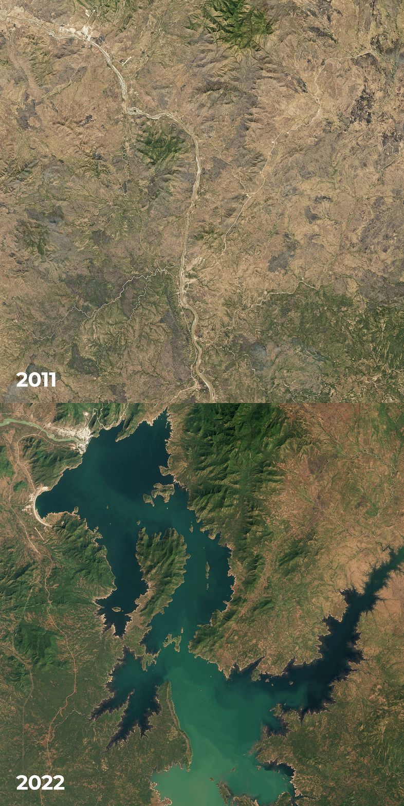
A Grand New Dam on the Nile: The Grand Ethiopian Renaissance Dam [link]
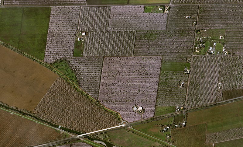
Food: California Almond Trees and Bees [link]
“Almond trees in the Central California region are in bloom as early as February. For the trees to be productive, at least two different varieties of almond trees among the thirty cultivated in California are planted in alternating rows. The multiple varieties can be distinguished on the Pléiades Neo image by variations in hue.”

Putting the Red in “Red Tide” [link]
“Blooms of the harmful algae Karenia brevis occur regularly along the west coast of Florida, where they can add a green, brown, red, or black hue to the water. But scientists have had difficulty using satellites to observe these blooms — commonly called “red tide” events — in areas close to beaches and inside small bays. Researchers at the University of South Florida (USF) found one way to overcome that challenge.”
Interesting reads
How The State Of Wyoming Is Using Planet Data To Preserve Western Rangelands [link]
“The sagebrush biome of the Western U.S. covers approximately 150 million acres, touches 13 states, and is home to 350 rare, threatened, and endangered species. But, this rich ecosystem has seen dramatic degradation and loss of sagebrush grasslands. A main culprit? Invasive species. “
Follow this article to learn how Planet data is used by the Extension Center and the Institute for Managing Annual Grasses Invading Natural Ecosystems (IMAGINE) to detect these invasive grasses.
Learning
A list of free books on InSAR [link]
Check out this post on LinkedIn for a list of 8 books on SAR Interferometry.
How to perform orthorectification: A practical guide [link]
Learn more about orthorectification in this second post of a series from UP42.
Related:
An introduction to orthorectification [link]


