Level-2 News
IBM, NASA Collaborate for Climate Change Research [link]
“IBM and NASA are collaborating for initiating improved climate change research. It was announced on February 1, that IBM is going to work together with NASA’s Marshall Space Flight Center to use artificial intelligence for climate change research in an effort to greatly improve research analysis of these large datasets. The aim is to make the research process simpler and overall save time by enhancing project efficiency.”

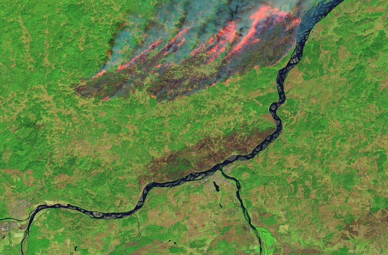
Fires Blaze Through South-Central Chile [link]
“Stoked by a summer heat wave and strong winds, widespread fires have been raging through south-central Chile since February 2, 2023. Over the course of several days, the deadly fires have destroyed more than 1,000 homes and have spread across more than 294,000 hectares (1,100 square miles).”
Related:
Chile battles raging wildfires [link]
Developer’s Orbit
Using Google Earth Engine to examine the Haines landslides of 2020; three-part blog series [link]
In this three-part blog series, Erin Dawn Trochim examined the Beach Road Landslide and surrounding landslides of 2020 in Haines, Alaska.
As part of her analysis, she combined several datasets in order to examine different aspects of the event and the impact it had.
In Part 1, she examined precipitation patterns surrounding this event using ERA5-Land and Daymet climate data available in the Earth Engine Data Catalog. In Part 2, she used the Dynamic World dataset — a 10m near-real-time (NRT) Land Use/Land Cover (LULC) dataset — to detect change and FABDEM (Forest And Buildings removed Copernicus 30m DEM) to create a slope histogram over the area of interest.
The first two parts of this blog series are out.
Part 1 [link]
Part 2 [link]
Release 1.0.4 of the awesome-gee-community-catalog [link]
The release includes the addition of the Canada Landsat Derived Forest harvest disturbance 1985–2020 [link] and Canada Landsat Derived Wildfire disturbance 1985–2020 [link], both under the Open Canada dataset series.
Sinergise added the Sentinel-1 GRD and Sentinel-2 L1C and L2A STAC collections to the AWS Open Data Registry [link]

Snapshots
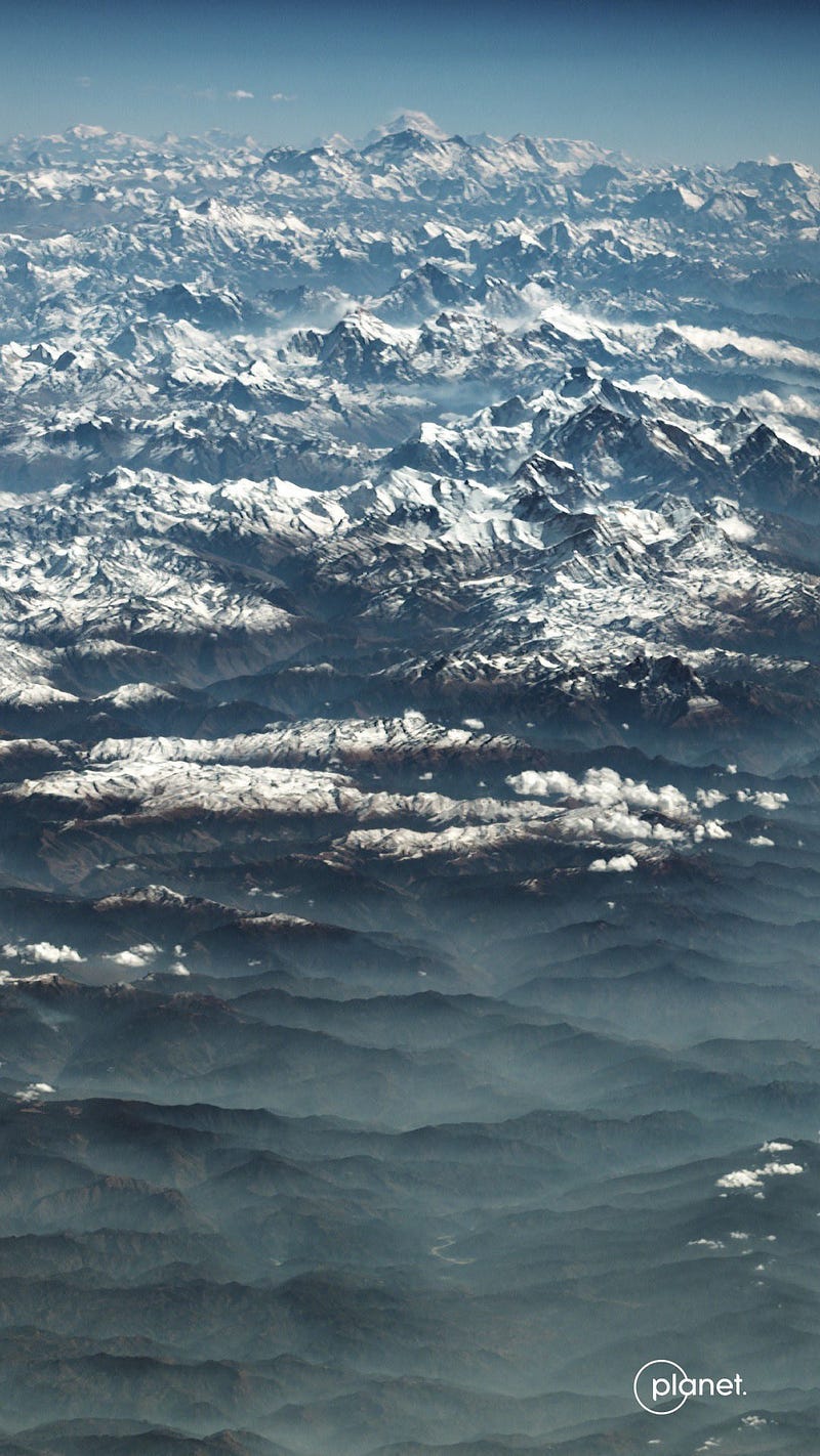
All 9 Himalayan 8,000-meter peaks in one view [link]
Planet Snapshots Issue 61: Megaprojects [link]
“This issue explores infrastructure that costs upwards of $1 billion; cerulean lakes are spotted at high elevation; and satellites capture icy scenes at Earth’s geographical fringes.”
Interesting reads

A Dry Lake Hamun Means More Dust Storms [link]
“Persistent drought and upstream water withdrawals have put Lake Hamun in a precarious position in recent decades. Amidst great year-to-year variability, the seasonal lake and wetlands in the Sistan Basin of eastern Iran and southern Afghanistan have been shrinking over time. The change has reduced vegetation cover and exposed silt and dust that has turned the area into a major source of dust storms.”
Podcast
Vision Transformers for Satellite Image Time Series with Michail Tarasiou [link]
Upcoming competition
MAFAT Satellite Vision Challenge [link]
“In this challenge, MAFAT’s DDR&D (Directorate of Defense Research & Development) would like to tackle the challenge of object detection from satellite imagery.
The participants’ goal is to detect objects of certain classes from diversified satellite images. Images available in the competition dataset differ by resolution, downward angle (pitch), direction (azimuth) and the date and time they were taken (time of day and seasonality).”
Learning
Guide: Fundamentals of Synthetic Aperture Radar (SAR) [link]
Follow this interactive guide made by Esri to learn more about SAR, the theory and applications.


