Level-2 News
Planet Completes Acquisition of Salo Sciences [link]
“With the purchase of Salo Sciences (Salo), Planet plans to further develop its offerings to enable customers to quantify carbon stocks globally, monitor forest change, and mitigate climate risks.”
Related:
Planet Accelerates Deployment Of Forest Carbon Monitoring System [link]

Planet and NASA Harvest Partner to Enable and Advance Food Security Offering [link]
“Planet Labs and NASA Harvest, the federal space agency’s Global Food Security and Agriculture Program, today announced a partnership to further support the joint Food Security and Agricultural Monitoring Solution. The offering aims to deliver policy-grade agricultural monitoring and assessments of potential threats to global food security.”
Maxar’s High-Resolution Imagery and GeoHIVE Crowdsourcing Platform Support Walrus Counting for British Antarctic Survey and World Wildlife Fund UK [link]
“The World Wildlife Fund (WWF) and British Antarctic Survey (BAS) have teamed up with Maxar to recruit citizen scientists to assist in conservation efforts of Atlantic and Laptev walrus populations. Walrus from Space, as the project is called, has two phases: identify Maxar satellite images that contain walruses (Phase I) and then count the walruses (Phase II).”
Landsat Newsletter — January 2023 [link]
“This year was huge for the Landsat Program. Landsat led the year by releasing Landsat 9 data, celebrating 50 years of Earth observation, and extending Landsat 7’s mission.”
Copernicus Sentinels 2023 calendar [link]
“Download the 2023 Copernicus Sentinels calendar. Each month offers a spectacular view of our home planet captured by one of the Sentinel satellites.”
Developer’s Orbit
Leafmap new feature: Searching and visualizing STAC catalogs interactively without coding. It will support AWS Open Data, EarthEngine, PlanetaryComputer, NASA CMR, and STAC Index [link]
FLOODPY — FLOOD PYthon toolbox [link]
The FLOod Mapping PYthon toolbox is a free and open-source python library that uses Sentinel-1 GRD intensity time series data to estimate the extent of a flood.
Datasets
Descartes Labs’ Data Ingest team has released the ASTER L1T product through Amazon Web Services (AWS) and the AWS Open Data program [link]
“The team has successfully processed the entire archive of VNIR, SWIR, and TIR data to cloud-optimized geotiff (COG) format, complete with STAC metadata. This marks the first dataset released by Descartes Labs via the AWS Open Data program”
Snapshots
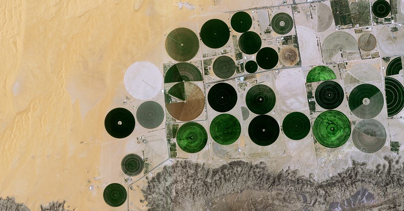
Food: Farming in Saudi Arabia [link]
Take a look at agricultural farms in the desert in Saudi Arabia.
Planet Snapshots Issue 59: Atmospheric Rivers [link]
“In this week’s issue: Clouds clear after a torrent of atmospheric rivers bombard California; two rias glow in Spain; and grasses invade marshes in China.”
Interesting reads
Looking back at the eruption that shook the world [link]
“One year ago, the Hunga Tonga-Hunga Ha’apai volcano erupted, causing widespread destruction to the Pacific Island Nation of Tonga, spewing volcanic material up to 58 km into the atmosphere. It brought a nearly 15 m tsunami that crashed ashore, destroying villages, and creating a sonic boom that rippled around the world — twice.
Satellites orbiting Earth scrambled to capture images and data of the aftermath of the disaster. Almost a year later, you can now listen to a sonification of the largest eruption of the 21st Century, created using wind data from ESA’s Aeolus mission.”
Learning
Webinar: Jump-Start SAR Data Analysis in the Cloud with ASF’s OpenSARLab [link]
Join this webinar to learn how to use the Alaska Satellite Facility’s OpenSARLab to work with synthetic aperture radar (SAR) data in the cloud.
Date: Jan 25


