

Level-2 News
Capella Space Raises $60M to Expand Satellite Imaging Capacity [link]
“Capella Space announced it has closed $60 million in growth equity financing from the U.S. Innovative Technology Fund. Capella will leverage this growth capital to expand its imaging capacity and develop new data products as customer demand grows for its frequent, timely and high-quality SAR imagery and analytics capabilities.”
The Global Climate Highlights 2022 is out! [link]
“A summary of the past year’s temperatures, greenhouse gas concentrations and significant climate and weather events. The summary shows that several high temperature records were broken both in Europe and across the world, while other extreme events such as drought and flooding affected large regions. Europe saw its hottest summer ever recorded and several prolonged and intense heatwaves affected parts of western and northern Europe.”

Earth from Orbit: NOAA’s GOES-18 is now GOES West [link]
“After the launch of GOES-18 on March 1, 2022 and post-launch testing of its instruments, systems, and data, GOES-18 replaces GOES-17 as GOES West, located 22,236 miles above the equator over the Pacific Ocean. GOES-17 will become an on-orbit standby.”
Observing lightning with a cubesat constellation [link]
“NASA Marshall Space Flight Center is working with the Los Alamos National Laboratory and the University of Alabama, Huntsville, on Cubespark, a proposed constellation of six cubesats to map lightning.. Cubespark is designed to measure the global distribution of lightning, help explain the relationship between lightning and severe weather, and monitor lightning-produced nitrogen oxides, which have an impact on air quality.”
Dataset
Planet-CR: A Multi-Modal and Multi-Resolution Dataset for Cloud Removal in High Resolution Optical Remote Sensing Imagery [link]
“Planet-CR is the first public dataset for cloud removal to feature globally sampled high resolution optical observations, in combination with paired radar measurements as well as pixel-level land cover annotations. With this dataset, we consider the problem of cloud removal in high resolution optical remote sensing imagery by integrating multi-modal and multi-resolution information.”
Interesting reads
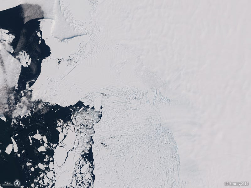
Sentinel-1 and AI uncover glacier crevasses [link]
“Scientists have developed a new Artificial Intelligence, or AI, technique using radar images from Europe’s Copernicus Sentinel-1 satellite mission, to reveal how the Thwaites Glacier Ice Tongue in West Antarctica is being damaged by squeezing and stretching as it flows from the middle of the continent to the coast. Being able to track fractures and crevasses in the ice beneath the overlying snow is key to better predicting the fate of floating ice tongues under climate change. Thwaites is a particularly important part of the Antarctic Ice Sheet because it holds enough ice to raise global sea levels by around 60 cm and is considered by many to be at risk of rapid retreat, threatening coastal communities around the world.”
Understanding The Earth Observation Value Chain [link]
Follow this article on GeoAwesomeness for how the EO value chain is structured, from data capture to analysis and developing applications. You will also read about how new startups enter the market and existing companies expand horizontally or verticaly in the value chain as part of a rapidly growing market.
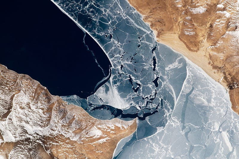
Winter from the International Space Station [link]
A collection of photographs taken aboard the ISS of Earth’s snow and ice in both hemispheres.
Learning
Jean-Martin Bauer: How Data Enables the World Food Program to Effectively Feed a Country — Minds Behind Maps #26 [link]
“Jean Martin Bauer is the Country Director for the World Food Programme in Haiti, where his job is in simple terms to ensure the population does not run out of food. This conversation focuses on the use of data — specifically satellite imagery & maps — and how it helps feed the country.”