
Level-2 News
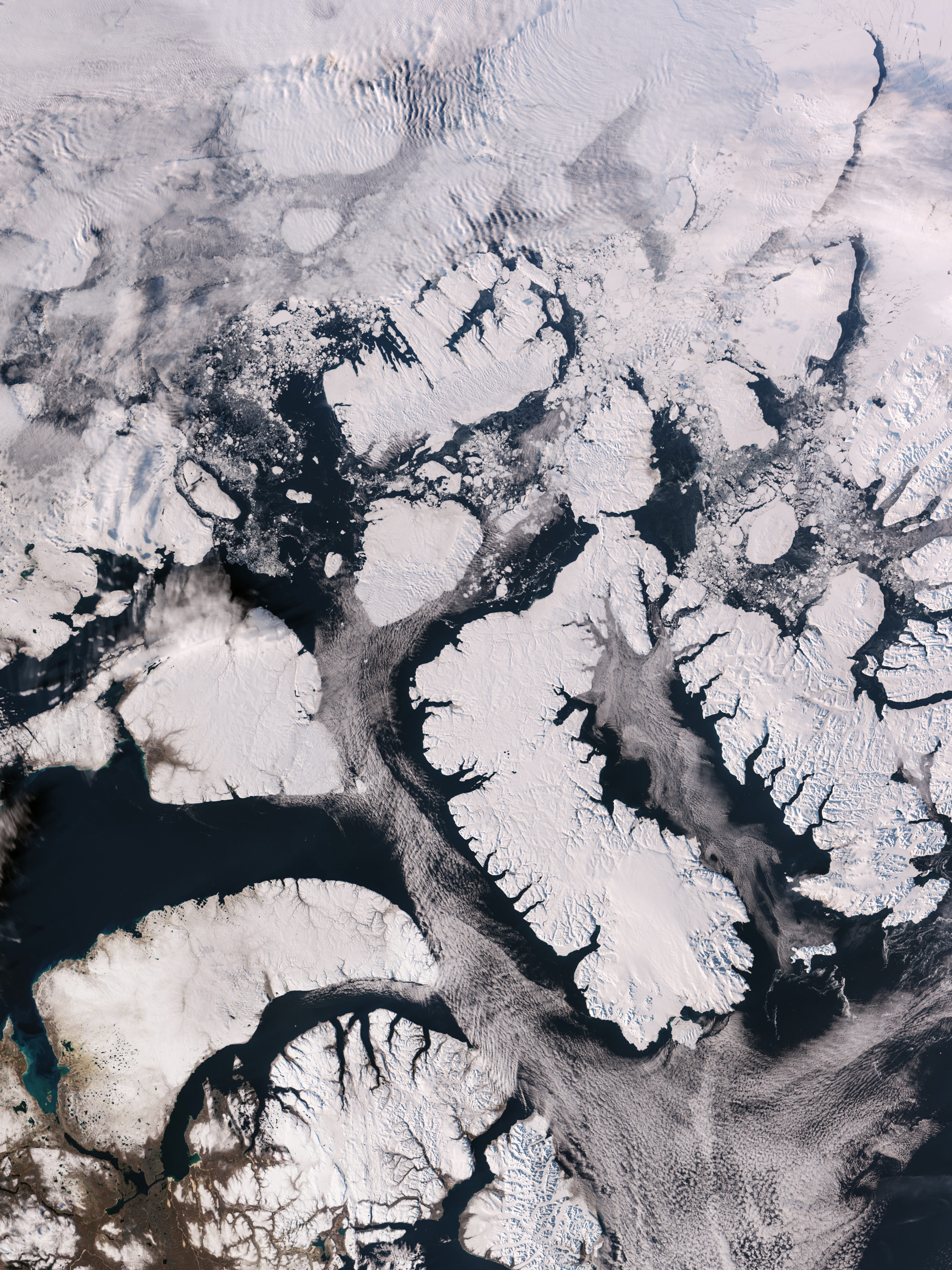
Sentinel-3C returns its first views of Earth [link]
Sentinel-3C has returned its first OLCI images and measurements from its SRAL radar altimeter. Both instruments remain in a five-month commissioning phase before the satellite enters routine service.
Sentinel-2A will keep collecting data through 2027 [link]
ESA has extended the satellite’s tailored acquisition campaign to 31 December 2027, one year beyond the previous end date.
Planet Selected by European Space Agency to Build Slovenia’s Space Resilience Node [link]
ESA selected Planet for a 12-month prototype linking wide-area Copernicus/PlanetScope change detection to higher-resolution tasking for Slovenia disaster response, initially wildfires.
Hungary’s HULEO constellation adds two radar payloads [link]
MetaSensing signed a contract for two StarSAR-X payloads for HULEO, planned as six optical and two radar satellites; the supplier cites a potential resolution up to 20 cm.
BlackSky signs pilot deal for Gen-3 imagery [link]
An unnamed international intelligence customer has ordered on-demand tasking of 35 cm imagery and access to BlackSky’s Spectra workflows under a six-figure agreement.
Developer's Orbit
Portolan Registry plugin v0.2 for QGIS [link]
The plugin brings Portolan registry search and dataset loading into QGIS. Its v0.2 release includes a demonstration with JRC flood-depth rasters.
New openEO Community Example: Detect Harvest Timing with Sentinel-1 SAR Coherence [link]
The notebook computes Sentinel-1 VH coherence on the Copernicus Data Space openEO backend. It then uses Python and xarray to flag dates when fields may have been harvested.
Agentic AI in EO
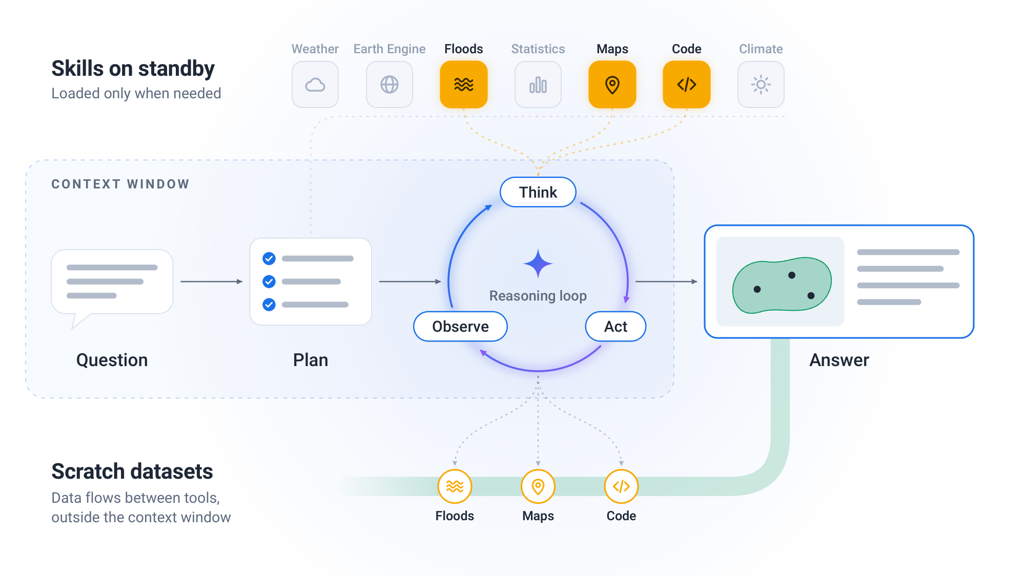
Google Earth AI Geospatial Reasoning Agent [link]
Google has published technical details and development benchmarks for its Geospatial Reasoning agent while expanding limited early access through Google Earth and an A2A API.
Paper: Google Earth AI Geospatial Reasoning Agent: Capabilities and a Systematic Evaluation [link]
ESA introduces Earth Virtual Expert [link]
ESA Φ-lab has introduced EVE as a way to ask questions across Earth-observation documents and repositories.
Data
MTG-S1 infrared sounder data now operational [link]
EUMETSAT declared the instrument’s Level-1 data operational on 13 October. Principal-component data are available through EUMETCast and the Data Store, while full spectral radiances are available through the Data Store.
Sentinel-5P processing update planned for November [link]
Copernicus Data Space plans to update Sentinel-5P’s Level-1B and several Level-2 processors on 10 November. The changes include a revised internal cloud mask for methane retrievals, and sample files are available for users to check their workflows.

Snapshots
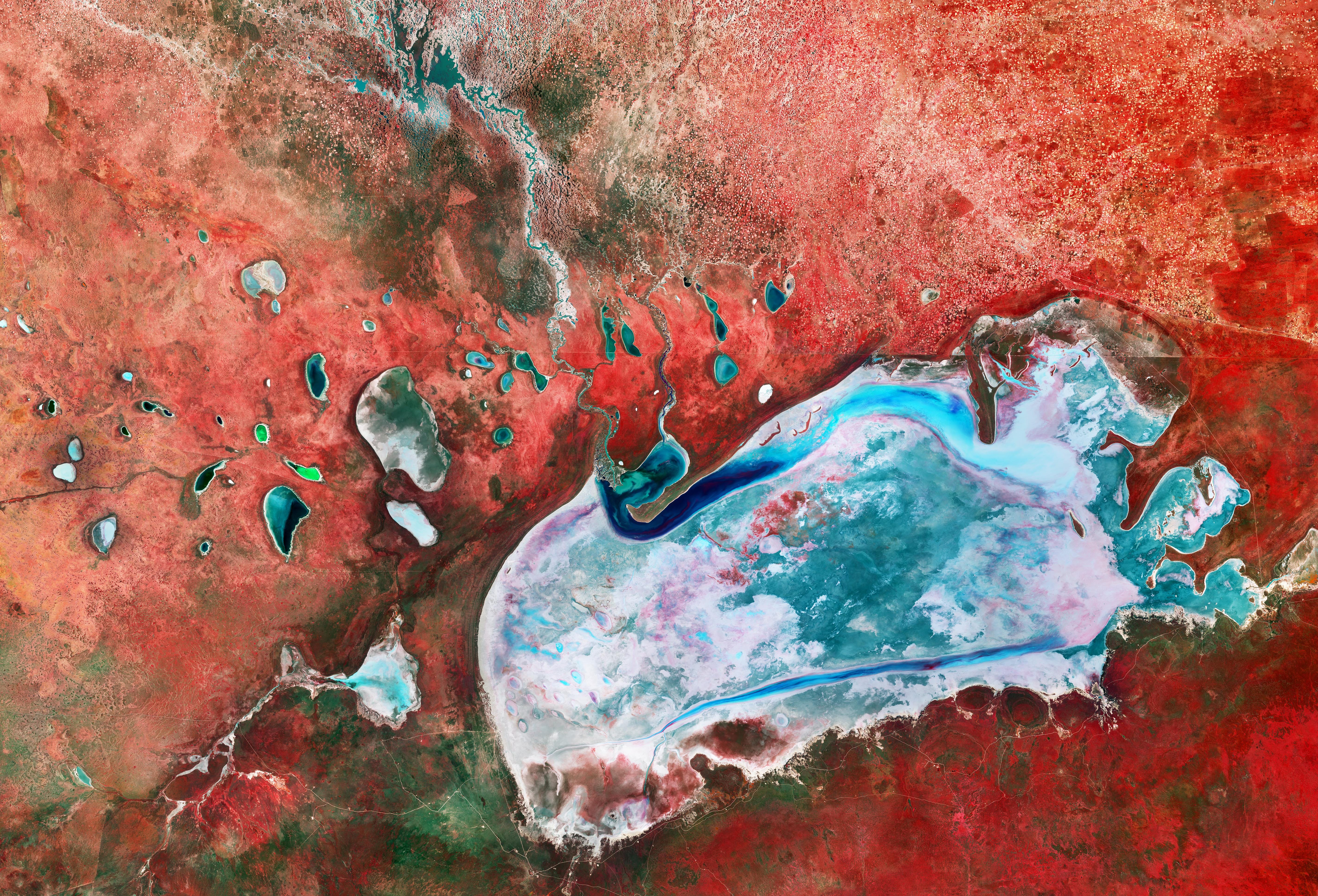
Earth from Space: Namibia’s biggest salt pan [link]
A Sentinel-2 image acquired on 5 April shows Namibia’s Etosha Pan in false colour. Vegetation appears red, contrasting with the pale salt flat and wet areas around it.
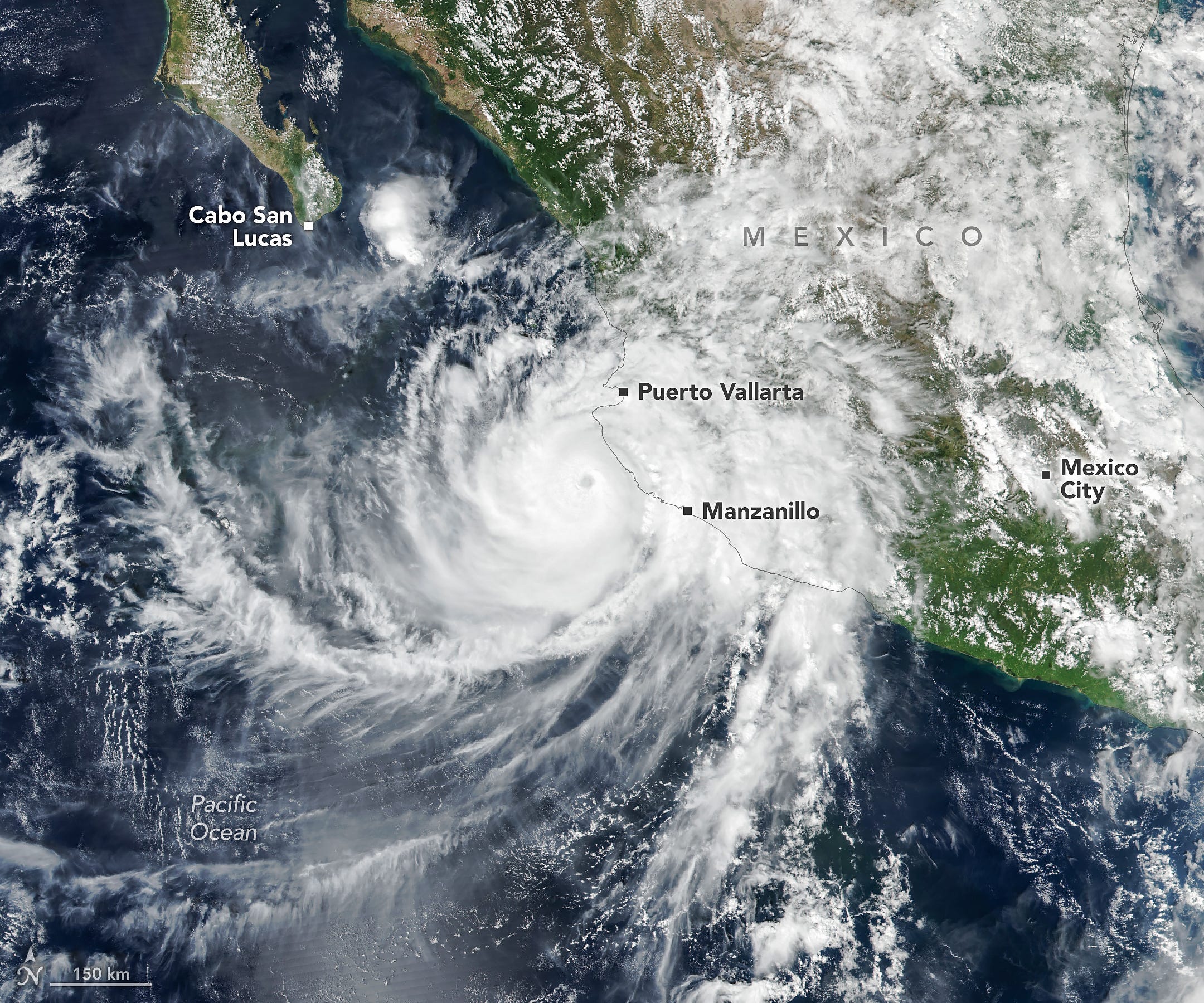
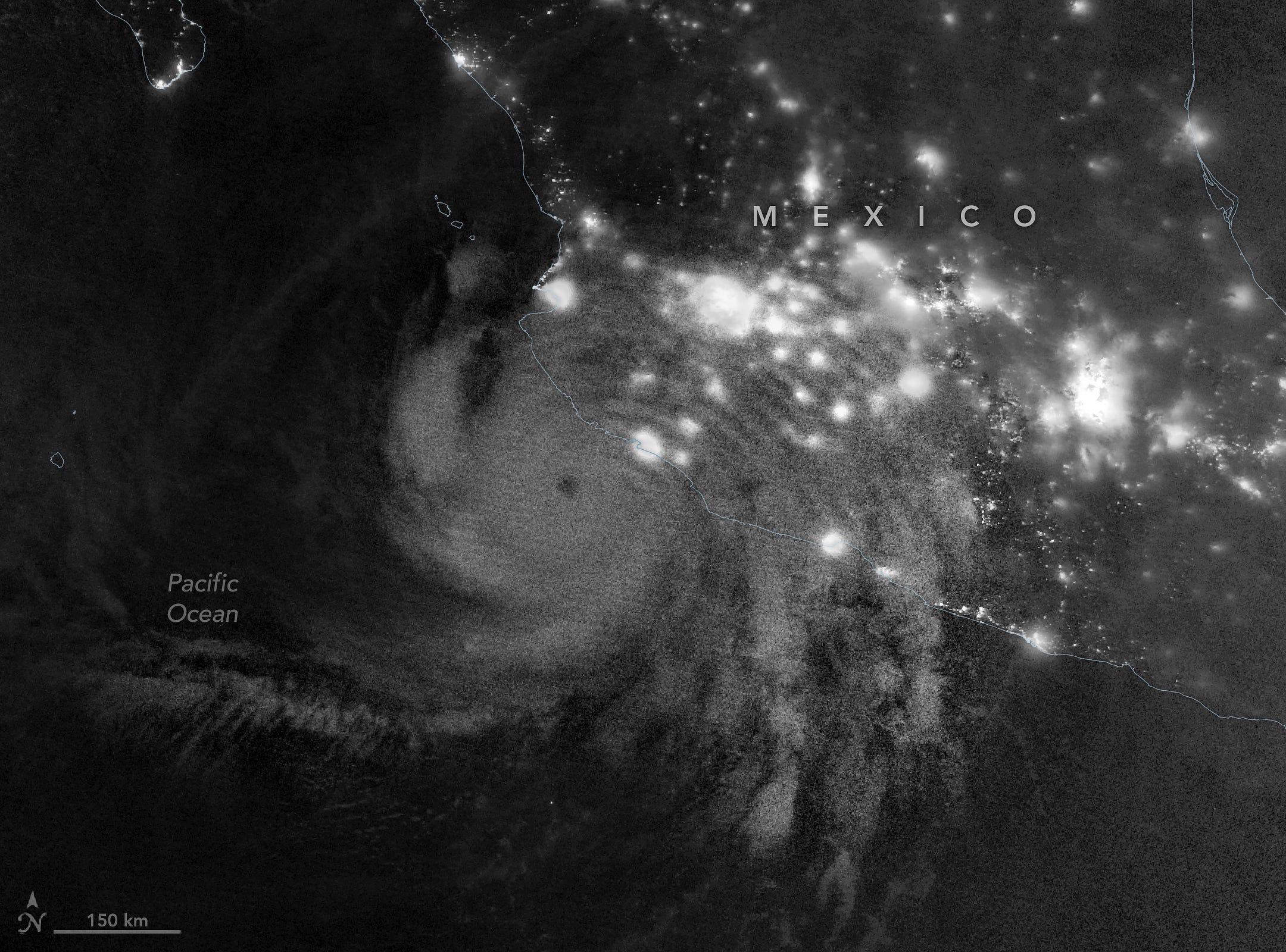
Hurricane Simon Lurks Off the Mexican Coast [link]
Suomi NPP’s VIIRS recorded Hurricane Simon off the Mexican coast on 11 October. NOAA-21 also captured ripples in airglow higher in the atmosphere. Together the images show the storm at cloud level and the atmospheric gravity waves it generated, visible as ripples in nighttime airglow.
Interesting reads
Correcting bias in weeks-ahead weather forecasts [link]
A new Nature paper describes a lightweight correction for systematic bias in probabilistic weather forecasts two to six weeks ahead. The study reports better results for the pressure, temperature and precipitation targets it tested, with code released by Microsoft Research.
Ai2 adds wind and pressure to its 3 km climate emulator [link]
HiRO-ACEv2 extends the earlier rainfall emulator to winds and sea-level pressure at 3 km. Ai2 reports roughly 300-fold lower compute cost than X-SHiELD in its chosen comparison. Its report and demo give more detail on how the simulated fields represent rare weather events.
Testing a marine anomaly detector aboard Φsat-2 [link]
A detector built to spot algal blooms and sediment plumes ran aboard Φsat-2, but its first real images produced many false alarms: the model had been trained on simulated imagery. Retraining it on the satellite’s own images improved results in ground tests; the updated model still needs to be tested in orbit.
ECMWF tests a combined atmosphere and ocean AI forecast [link]
AIFS Marine is a research prototype that forecasts atmosphere, waves, sea ice and the surface ocean together. ECMWF reports roughly one day of medium-range marine skill gain in its deterministic tests, while noting a sea-level-height bias.
Paper: Representing the Surface Ocean in ECMWF’s data-driven forecasting system AIFS [link]
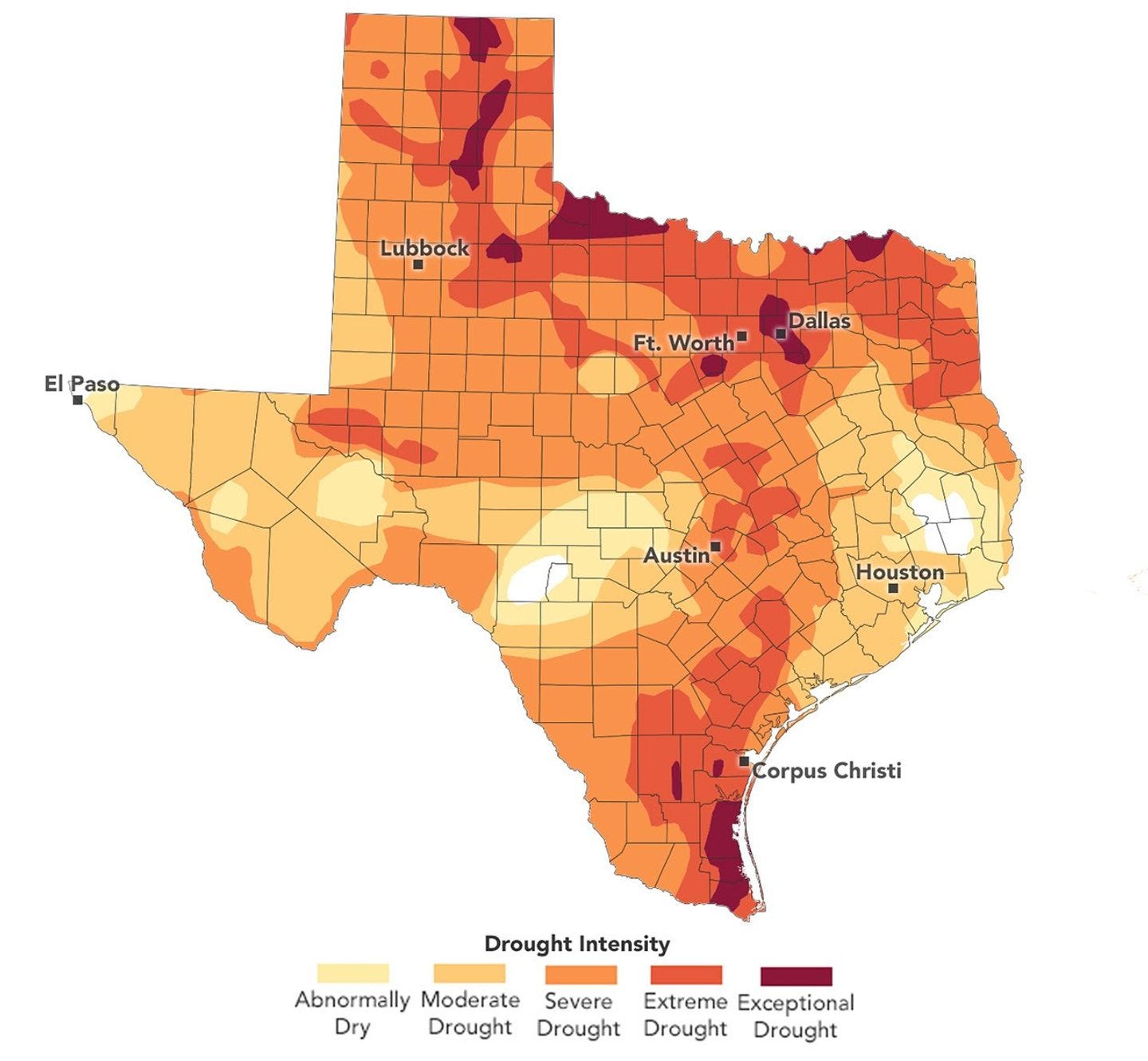
Fighting Drought in Texas Cotton Country [link]
A Landsat view of the Texas High Plains accompanies NASA’s reporting from cotton farms. Growers describe drought and constraints on groundwater used for irrigation.
DLR demonstrates RESITEK with disaster responders [link]
DLR presented RESITEK at a THW training site in Braunschweig. The final demonstration showed how its modular platform can combine data and visualisations for disaster situation monitoring.
Climate
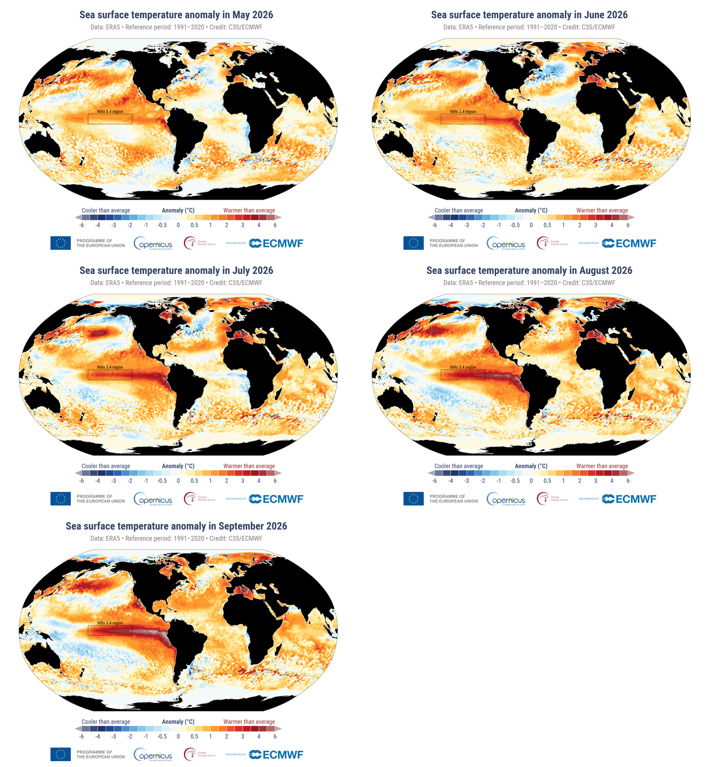
Copernicus: September was the second-warmest on record [link]
Copernicus ranks September 2026 as the second-warmest September in ERA5, at 1.63°C above the estimated pre-industrial September average. Sea-surface temperature across 60°S-60°N averaged 21.05°C, the highest September value on record; the bulletin also reports widespread dryness and low river flows in Europe.
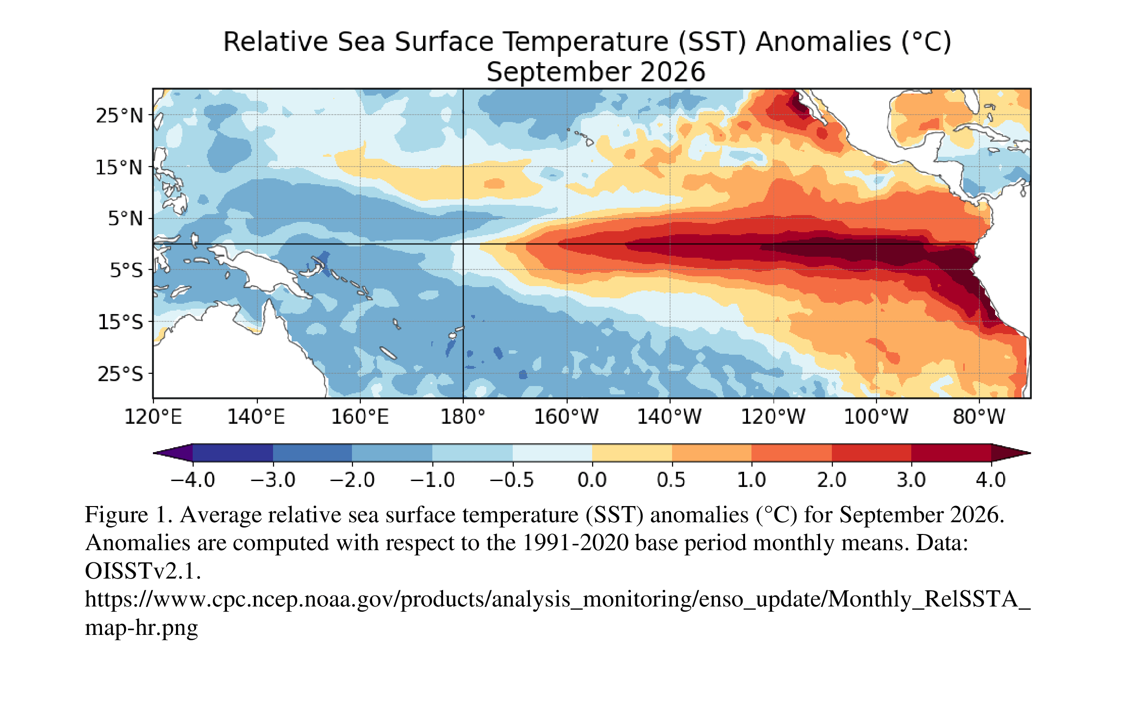
NOAA expects El Niño to keep strengthening [link]
NOAA’s October discussion reports that El Niño is strengthening. It puts the chance of strong to very strong conditions through January-March 2027 above 83%.
Upcoming Events
ESA webinar: Why Karakoram glaciers behave differently [link]
ESA’s Climate Change Initiative has scheduled a 21 October webinar on the Karakoram Anomaly. The talk uses satellite and climate observations to examine unusual glacier dynamics in the region.
CNG Zürich [link]
The Cloud-Native Geospatial Forum meets in Zürich on 29 October, with talks on imagery pipelines, cloud-native formats and EO embeddings, plus a readout from the preceding Geo Embeddings Sprint.
See you in Berlin?
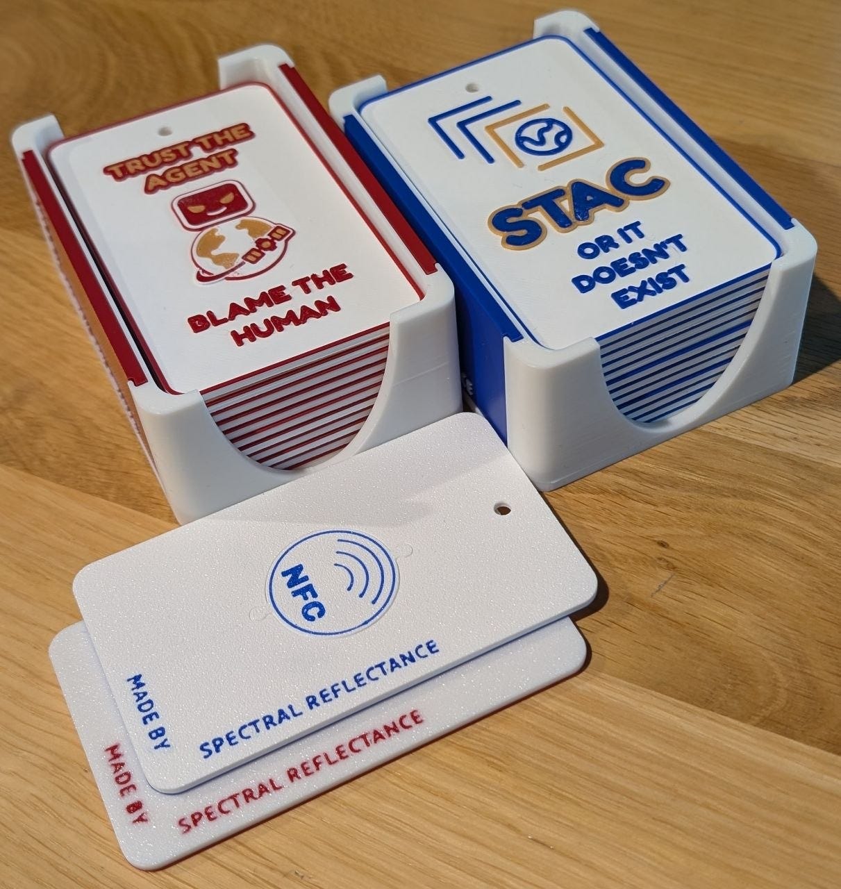
I’ll be at the Agentic AI for Earth Observation Workshop in Berlin from 19 to 21 October. If you’re there, come say hi! I’ve put my 3D printer to good use and made a few tags to give away at the workshop.
I’d also love to hear what you’re working on. I’m hoping to record a few short conversations for Spectral Reflectance with anyone who’s interested.
From Spectral Reflectance
The Morning Backscatter
The Spectral Reflectance Newsletter is not always a quick read, so I started The Morning Backscatter as a shorter and lighter companion for the morning: one news item, one useful link, one visual, and one funny-ish item from the EO world.
There is no mailing list; new issues are published via GitHub Releases, and instructions on how to follow along are available in the repository README.
The Morning Backscatter: https://morningbackscatter.space/
GitHub repo: https://github.com/xen0f0n/morning-backscatter