
Level-2 News
RTX’s Raytheon completes design review of Landsat Next space instruments [link]
Raytheon has completed the preliminary design review for NASA’s Landsat Next Instrument Suite, including a multispectral imager expected to more than double current spatial resolution and capture twice the number of spectral bands.
Tomorrow.io Expands Investment from Pitango and Harel Insurance, Increasing Series F to $210M [link]
Tomorrow.io has expanded its Series F to $210 million with an additional $35 million from Pitango and Harel Insurance, backing further development of its AI-driven resilience platform and DeepSky weather satellite constellation.
Muon Space Scales Workforce Following Transition to Constellation-Scale Manufacturing [link]
Muon Space is scaling its workforce following its transition to constellation-scale manufacturing, building on recent defence contracts, continued commercial growth, and an operational push toward repeatable, high-volume satellite production.
Background: Muon Space’s recent work includes FireSat, MuSat-2 support for DoD weather data collection, and a $44.6M Space Force environmental-monitoring contract, with the company also signalling interest in orbital data infrastructure. The workforce expansion follows this activity as Muon shifts toward constellation-scale production.
LiveEO Secures €28 Million to Accelerate Push into Defence Applications [link]
LiveEO has secured €28 million to expand its Earth Observation offering and accelerate development of new dual-use defence and security products, as it pushes further into a market shaped by rising European space-defence spending.
Planet Selected for 7-Figure Deal with Czech Government for AI-Powered Agriculture Monitoring [link]
Planet has been selected for a two-year, seven-figure deal with the Czech government to provide satellite imagery and AI-powered analytics for agricultural payments monitoring, supporting claim validation across roughly 25,000 agricultural holdings.
Planet Signs 7-Figure Enterprise Contract to Power Greece’s National Satellite Space Project [link]
Planet has signed a two-year, seven-figure agreement with the Greek government, through ESA, to support Greece’s National Satellite Space Project with near-daily medium-resolution imagery, high-resolution tasking, and access to over a decade of PlanetScope data for national monitoring workflows. The deal supports use cases including land management, agriculture, disaster planning, and forest and water monitoring.
Ubotica and NOVI Space Form Strategic Partnership for Real-Time Onboard Space AI [link]
Ubotica and NOVI Space have formed a strategic partnership to bring real-time, decision-grade Earth Observation intelligence into orbit by combining Ubotica’s SPACE:AI platform with NOVI’s GENIE smart-satellite infrastructure for onboard processing, targeting time-critical applications including maritime monitoring and dark-vessel detection.
European imaging companies step in to fill warzone gap [link]
As U.S. satellite imagery providers pulled back from sharing visuals of Iran and the wider Gulf conflict, European imaging companies moved to fill the gap, serving customers such as energy traders, insurers, shipping firms, and news organisations monitoring the Strait of Hormuz.
Cowboy Space Corporation Raises $275M Series B For Vertically-Integrated Orbital Data Centers and Rockets [link]
Cowboy Space, formerly Aetherflux, has raised a $275 million Series B at a $2 billion valuation to advance vertically integrated orbital infrastructure for AI compute, including launch vehicles, in-orbit data centres, and a collaboration with NVIDIA to deploy NVIDIA Space-1 Vera Rubin Modules in low Earth orbit. A first satellite demonstration is planned for later this year.
Satellite Ground Station Market to Reach $230.9 billion, Globally, by 2035 at 11.6% CAGR: Allied Market Research [link]
Allied Market Research projects the satellite ground station market to grow from $70.28 billion in 2024 to $230.9 billion by 2035, driven by the expansion of LEO and multi-orbit constellations and rising demand for high-throughput connectivity.
Developer's Orbit
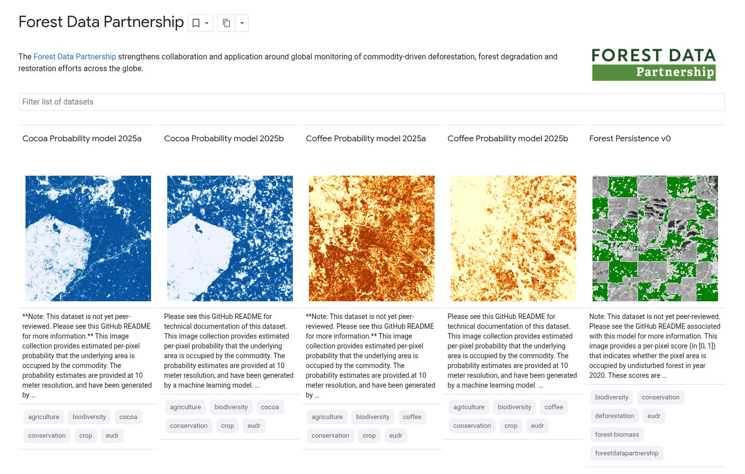
Scaling Transparency: Annual, Pan-Tropical Commodity Maps Powered by AlphaEarth Foundations [link]
Google Earth has published open annual pan-tropical commodity maps at 10 m resolution, using AlphaEarth Foundations embeddings to produce cleaner, more temporally stable crop layers and make them available through Earth Engine.
Trained models are available on GitHub.
Gaussian Splat-based Satellite Image Super Resolution [link]
This Geospatial ML article shows how repeated Sentinel-2 observations with small sub-pixel offsets can be fused through a Gaussian-splat forward model to produce cleaner, sharper reconstructions, recovering detail up to what the data physically supports.
The DuckDB Community Raster Extension v1.0.0 is out! [link]
The DuckDB Community Raster Extension v1.0.0 is out, bringing support for reading raster data as DuckDB tables, running band algebra and spatial operations in SQL, and writing outputs to GDAL-supported formats.
Annual NLCD viewer built with deck.gl-raster [link]
Development Seed’s Anthony Boyd shows an Annual NLCD viewer built with deck.gl-raster that adds hover tooltips and opacity controls to make a large categorical map easier to interpret, while using the COG format so users can explore only a small fraction of a 1.3 GB dataset instead of downloading the whole file.
Related:
deck.gl-raster: Client-side, WebGL2 GeoTIFF & Zarr visualization in deck.gl [link]
geomermaids · GeoParquet Writing cookbook [link]
Guillaume Sueur has published a GeoParquet cookbook that brings together tools, and practical recipes across GDAL, DuckDB, and gpio for people getting started or trying to level up their parquet workflows.

Snapshots
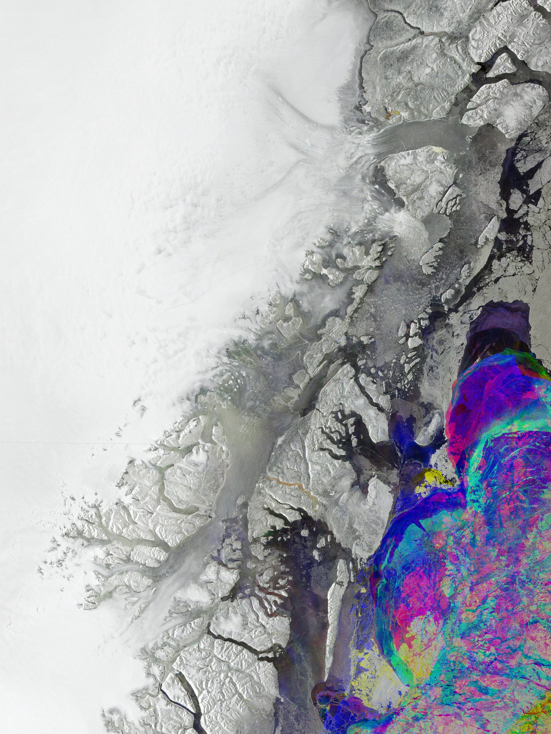
Earth from Space: Greenland’s changing ice [link]
This Earth from Space image features part of the rugged, deeply indented coast of northeastern Greenland in a three-colour Sentinel-1 radar composite built from acquisitions in January, February and March 2026. By assigning each scan a different colour, the image highlights variations on the surface between the three passes, with stable ice appearing white and the shifting sea ice along the coast showing the most visible change.
Interesting read
Beyond Open Data: Usefulness is a better measure of quality than openness [link]
The Beyond Open Data white paper argues that openness alone is no longer a sufficient measure of geospatial data quality, and that datasets should instead be judged by how useful they are in practice. It proposes a broader framework built around factors such as licence, cost, burden, access, and provenance, while making the case for investing in governance, interoperability, and shared data ecosystems, not treating openness as the endpoint.
You can read the full white paper here.
Rescue mission for NASA’s $500 million space telescope passes key testing milestone [link]
NASA’s Swift Boost mission aims to keep the aging Neil Gehrels Swift Observatory — a space telescope launched in 2004 to study gamma-ray bursts and other energetic cosmic events — from re-entering after drag and elevated solar activity accelerated its orbital decay. Katalyst’s LINK spacecraft is set to attempt a rendezvous, capture, and reboost, offering a potentially important glimpse of practical robotic servicing in low Earth orbit.
Why it matters for EO: If successful, the mission could mark an early turning point toward routine life-extension servicing for LEO satellites, including some future EO missions.
Tropical Rainforest Loss Slowed in 2025, but Fire is a Growing Threat to Forests Worldwide [link]
New 2025 tree cover loss data show that tropical primary rainforest loss fell by 36% from 2024, easing after a record fire-driven year but remaining 46% higher than a decade ago. The latest Global Forest Review analysis also warns that fire is becoming an increasingly important driver of forest loss worldwide, even as agricultural expansion remains the leading cause across the tropics.
From satellite data to development finance: how Earth observation is scaling impact across World Bank operations [link]
Through ESA’s Global Development Assistance (GDA) programme, the World Bank is turning satellite data into decision-ready products that are increasingly embedded across its operations, helping move EO from pilot use into routine support for investment design, risk screening, and development finance. Real-world cases include pasture monitoring in Paraguay, EO-based crop reporting in Pakistan and the Philippines, flood-risk in South Sudan, and infrastructure risk analysis in Bangladesh and Uganda.
NOAA issues El Niño Watch as El Niño becomes likely in 2026 [link]
NOAA has issued an El Niño Watch, with El Niño now considered likely to emerge soon and continue through Northern Hemisphere winter 2026–27. In its latest synopsis, NOAA puts the chance of El Niño at 82% for May–July 2026 and 96% for December 2026–February 2027.
NASA Acres develops county-level yield forecasting models [link]
NASA Acres is developing county-level crop yield forecasting models for corn and soybeans across 12 Midwestern states using EO and weather data, including GCVI from MODIS, SERVIR’s Evaporative Stress Index, and AgERA5 precipitation. The project is aimed not just at forecasting accuracy, but at turning those estimates into usable tools for agricultural organisations and other real-world users.
Call For Papers
TerraBytes — Towards global datasets and models for Earth observation [link]
The TerraBytes II workshop at ECCV 2026 has opened its call for papers, inviting submissions on global EO datasets, representation learning, and downstream applications ranging from disaster monitoring to land-use mapping and biophysical estimation. The deadline is 18 June 2026 AoE, and the workshop will take place in Malmö, Sweden, on 8 or 9 September 2026.
From Spectral Reflectance
The Morning Backscatter
The Spectral Reflectance Newsletter is not always a quick read, so I started The Morning Backscatter as a shorter and lighter companion for the morning: one news item, one useful link, one visual, and one funny-ish item from the EO world.
There is no mailing list; new issues are published via GitHub Releases, and instructions on how to follow along are available in the repository README.
The Morning Backscatter: https://morningbackscatter.space/
GitHub repo: https://github.com/xen0f0n/morning-backscatter