
Level-2 News
Sentinel-1D goes live: a milestone for Europe’s radar mission [link]
"The Copernicus Sentinel-1D satellite, launched last November, is now fully operational after successfully completing its critical in-orbit commissioning phase.
With all four Sentinel-1 satellites having now been deployed, this achievement marks a major milestone for this flagship radar mission – a journey that began more than a decade ago and that has helped pave the way for the future of Earth observation."
Italy’s Earth monitoring programme reaches new milestone [link]
"Italy’s IRIDE Earth observation programme has added seven more satellites to its Hawk for Earth Observation (HEO) constellation, enhancing the strategic data it provides for Italy’s environmental, emergency and security services."
ECMWF Launches DestinE ML Earth System Components Page [link]
ECMWF has launched a new page on machine-learning Earth system components developed within the European Commission’s Destination Earth initiative, covering prototype AI-based models for land surface, hydrology, waves, sea ice, and ocean conditions.
ML Earth System Components [link]
SpaceX launches South Korean Earth observation satellite, plus 44 more payloads on midnight Falcon 9 rideshare mission [link]
SpaceX launched South Korea’s CAS500-2 precision Earth-observation satellite and 44 additional rideshare payloads on a Falcon 9 from Vandenberg, with the mission also carrying several other EO satellites from Argotec, Loft Orbital/EarthDaily Analytics, Planet Labs, and GalaxEye.
GMV to Lead Mission Planning for ESA’s Next-Generation Copernicus Expansion [link]
GMV has been selected by ESA to lead the development and long-term maintenance of mission-planning functions for the Copernicus expansion missions, including CRISTAL and ROSE-L, helping coordinate what future Sentinel missions observe, when they acquire data, and how that data is downloaded.
NGA Awards Vantor $70M Option Year Contract to Operate and Enhance Government’s Primary Commercial GEOINT Platform [link]
NGA has awarded Vantor a $70 million Option Year 1 contract under the G-EGD program to operate and enhance GEGD Pro, the U.S. government’s primary commercial GEOINT platform for secure access, streaming, and analysis of large-scale commercial, radar, electro-optical, and NGA-procured geospatial data.
NRO Makes New Commercial Awards to EarthDaily, Iceye, and Pixxel [link]
NRO has awarded new Strategic Commercial Enhancements contracts to EarthDaily, Iceye, and Pixxel for commercial Earth-sensing data, covering daily global electro-optical and infrared collection, RF data, and hyperspectral imagery as part of its expanding use of commercial satellite capabilities.
Developer's Orbit
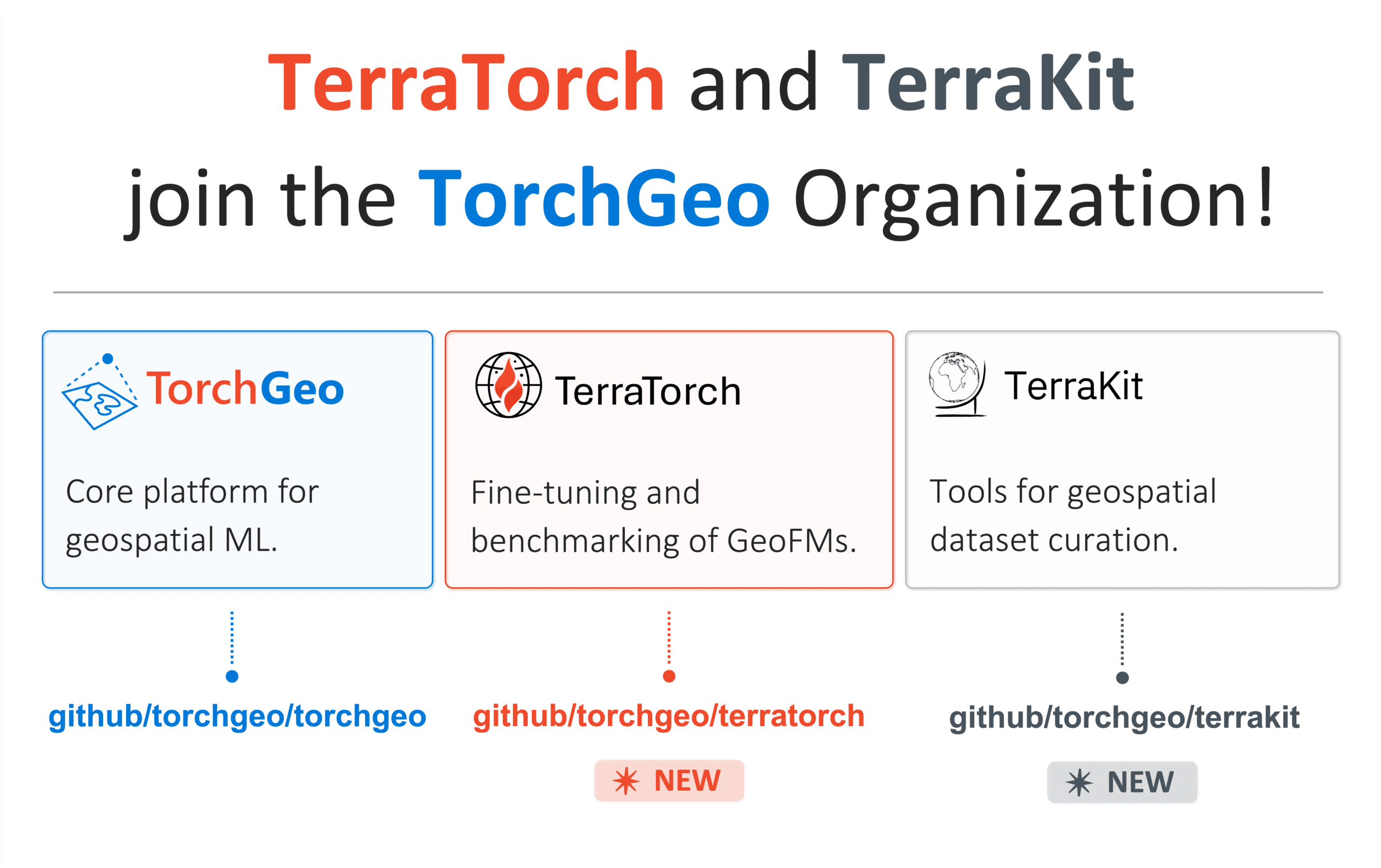
The TorchGeo Organization and IBM Research are joining forces! [link]
OSGeo announced that IBM Research’s TerraTorch and TerraKit libraries have joined the TorchGeo Organization, bringing TorchGeo, TerraTorch, and TerraKit together under one GeoAI ecosystem for geospatial deep learning, foundation-model fine-tuning, and AI-ready dataset creation.
Tailoring the View: TiTiler-CMR Customizes HLS Imagery in Worldview and FIRMS [link]
This NASA Earthdata article explains how TiTiler-CMR is bringing dynamic, on-demand HLS visualisation into Worldview and FIRMS, allowing users customise spectral bands, RGB composites, and indices without relying only on pre-generated static imagery.
datanomy: Dissecting data structures [link]
Raul Cumplido’s datanomy is a terminal-based tool for inspecting the anatomy of columnar data files, giving users an interactive view of a Parquet file’s structure, schema, data, metadata, and statistics.
LazyCOGs: Lazy Access to STAC-Indexed COG Archives [link]
Development Seed’s LazyCOGs lazily opens thousands of STAC-indexed Cloud Optimized GeoTIFFs as a spatially aligned xarray DataArray, using a Rust-native stack instead of GDAL/rasterio to query only the assets needed for a given chunk, CRS, and resolution.
Rethinking Change Detection and Attribution: How You Compare Satellite Embeddings Matters [link]
In this post Mina Burns explores how different ways of comparing AlphaEarth satellite embeddings can produce similar accuracy scores but very different change-attribution maps, arguing that baseline context, training-data balance, and spatial validation matter as much as classifier choice when using geospatial foundation-model outputs.
Introducing OlmoEarth embeddings: Custom embedding exports from OlmoEarth Studio for downstream analysis [link]
Ai2’s OlmoEarth Studio now lets users compute and export custom Earth-observation embedding COGs for chosen areas, time ranges, resolutions, encoder variants, and Sentinel-1 or Sentinel-2 inputs, supporting downstream tasks such as similarity search, few-shot segmentation, change detection, and unsupervised exploration.
Introducing BetaEarth - your own Earth embedding emulator [link]
Mikolaj Czerkawski introduces BetaEarth as a lightweight, open emulator of the AlphaEarth annual embedding product, using the project to explore how far EO embeddings can be reconstructed from other observations while prompting a broader discussion on whether Earth foundation models are beginning to converge toward shared representations of the planet.

Data
Copernicus Adds ERA5-Derived Thermal Comfort Indices to CDS [link]
Copernicus Climate Change Service has added ERA5-derived thermal comfort index time series to the Climate Data Store, giving users hourly UTCI and mean radiant temperature data from 1940 to near real time for point locations or small areas without downloading full global grids.
Thermal comfort indices time-series derived from ERA5 reanalysis [link]
April Releases: Copernicus Marine Launches Three New Products [link]
"Copernicus Marine continues to expand its portfolio of operational ocean intelligence with the release of three new and updated products. Together, they provide new insights into Arctic change, large-scale ocean circulation, and the consistency of global sea surface temperature observations, supporting a wide range of scientific, operational, and policy applications. "
EOForestSTAC: STAC Browser instance of the EO Forest STAC Catalog [link]
Simon Besnard has released EOForestSTAC, an open-source toolbox and STAC catalogue designed to make large-scale forest Earth Observation datasets easier to discover and use across themes such as biomass, forest disturbance, canopy height, forest age, and land-use change.
Explore the catalogue: https://simonbesnard1.github.io/eoforeststac
GitHub: https://github.com/simonbesnard1/eoforeststac
Docs: https://eoforeststac.readthedocs.io/en/latest/
Digital Earth Africa launches continental Water Quality Monitoring Service to strengthen evidence-based water management [link]
Digital Earth Africa has launched a continental Water Quality Monitoring Service that turns harmonised satellite observations into decision-ready information on African lakes, dams, and reservoirs, including indicators such as surface temperature, turbidity, floating algae, trophic state, and optical water type.
Snapshots
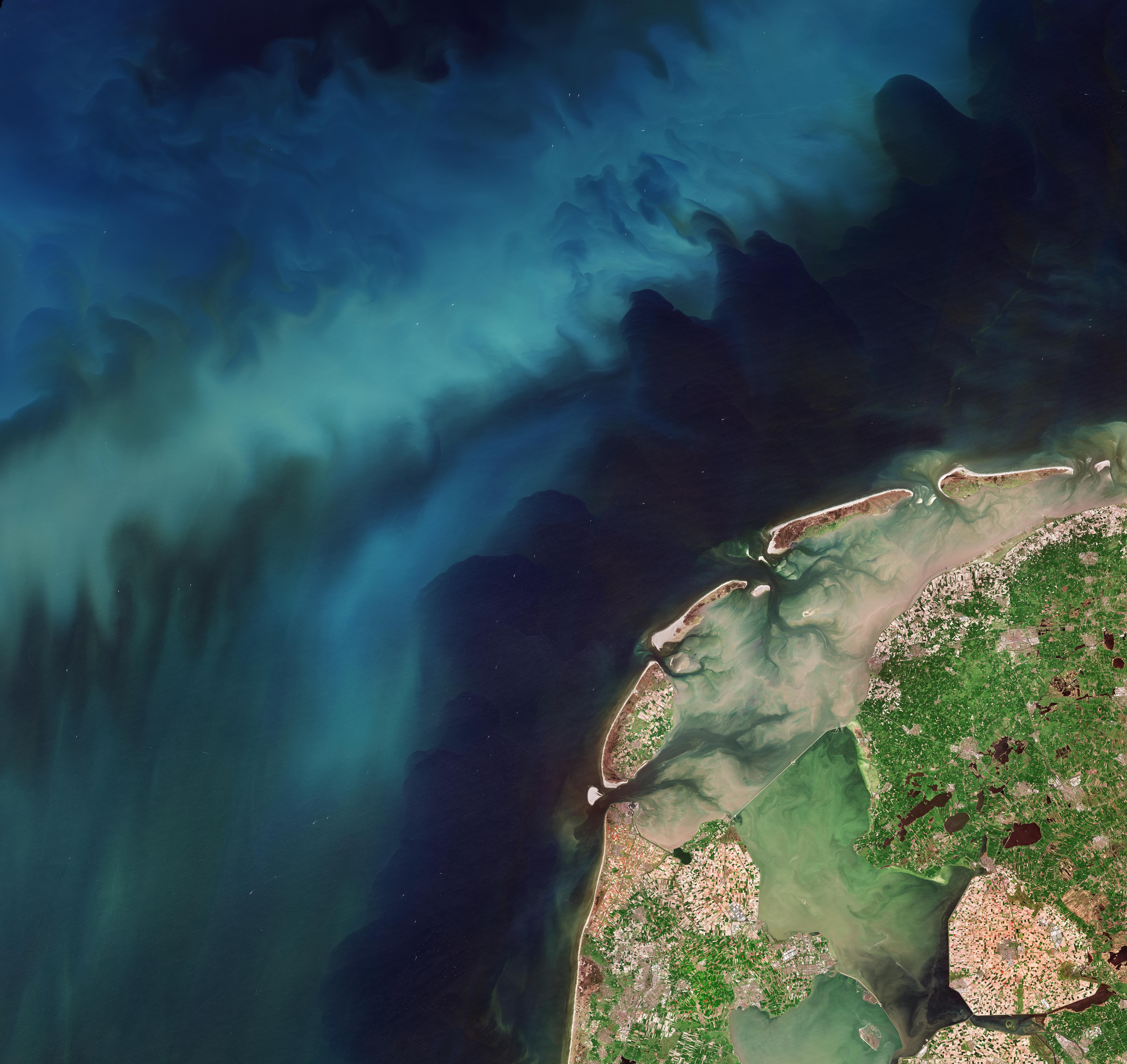
Earth from Space: Netherlands in bloom [link]
ESA’s Earth from Space image, captured by Copernicus Sentinel-2 on 21 April 2026, shows a “double bloom” in the Netherlands, with colourful tulip fields on land and blue-green phytoplankton swirls across the North Sea.
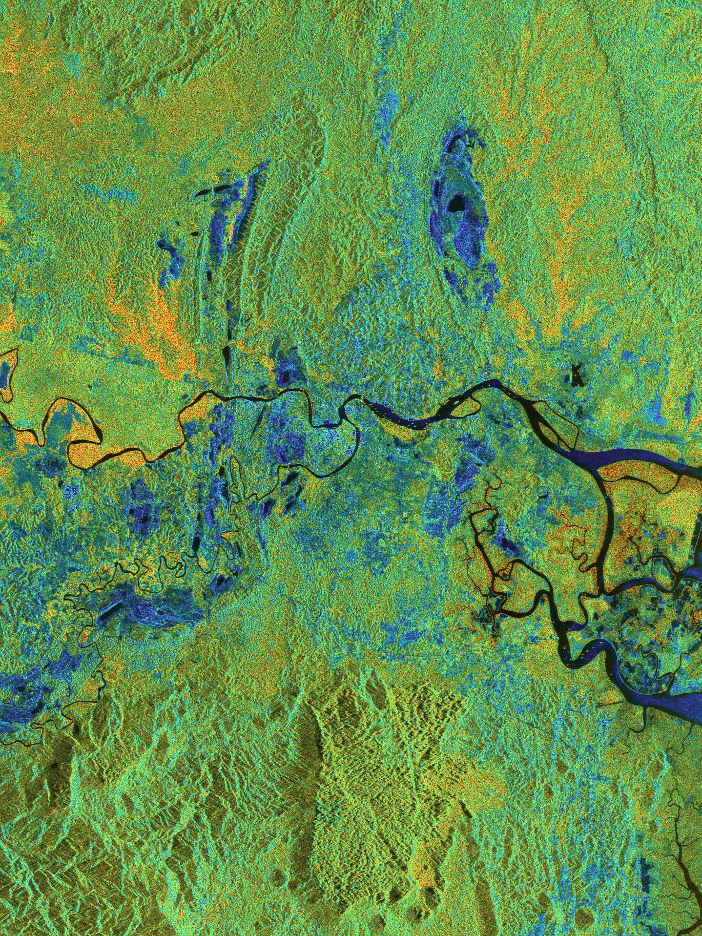
Stunning images from Biomass mark its one year in orbit [link]
ESA marks one year of its Biomass satellite in orbit with a gallery of polarimetric P-band radar images showing forests, rivers, tundra, ice, and other landscapes in structural detail rather than natural colour. The mission is already demonstrating how its canopy-penetrating radar can support better estimates of forest carbon stocks while also opening up wider applications, from environmental-change monitoring to ice-sheet dynamics and possible subsurface geology in arid regions.
Interesting read
Publishing Planetary-Scale Data is Easy [link]
The release of Fields of the World, covering 3.17 billion field boundaries across 241 countries and territorie,s shows that publishing planetary-scale data through cloud object storage is now relatively easy. The harder work lies in creating, sustaining, improving, and opening high-quality data products for broad contribution.
Four ways Google Research scientists have been using Empirical Research Assistance [link]
Google Research highlights how its Empirical Research Assistance (ERA) system can support scientific discovery, including an EO example where weather-satellite data from GOES-East is combined with meteorological information and OCO-2/OCO-3 measurements to estimate atmospheric CO₂ every 10 minutes. The work suggests that AI can extract new climate-monitoring value from existing observational instruments, especially where dedicated greenhouse-gas satellites offer high precision but limited spatial and temporal coverage. The same work also shows relevance beyond climate, with AI-generated approaches performing strongly on high-resolution satellite-image segmentation tasks.
Related:
Accelerating scientific discovery with AI-powered Empirical Research Assistance [link]
African Journalists Spent Earth Day Mapping Mines. Here’s Why That’s Important to Pulitzer Center [link]
Pulitzer Center describes how African journalists joined geospatial experts on Earth Day to help build Africa Mining Watch, an open-source tool using satellite imagery, AI, and locally verified labels to detect and track mining activity across the continent.

After 1,200 years, cherry blossom record to live on despite Japanese scientist’s death [link]
This is not directly related to the usual topics covered in this newsletter, but it fits loosely with the broader themes of climate records, long-term datasets, and data product continuity.
The Guardian reports on the death of Prof Yasuyuki Aono, who maintained a 1,200-year Kyoto mountain cherry blossom record used as a marker of climate change, and on the call to find a new researcher who can continue observing the same species in the same location. Even historically important environmental datasets can depend on individual maintainers; their continuity is as much an institutional problem as a technical one.
Competitions
Dataviz Challenge: From Ocean Data to Visual Storytelling [link]
Copernicus Marine has opened its DataViz Challenge, inviting designers, cartographers, and data-visualisation specialists to create original visual stories from Copernicus Marine ocean data, with selected work to be featured on the cover of the Ocean State Report 10th Anniversary Edition.
The challenge will run until 19 June.