
Applications are now open for ECMWF Code for Earth 2026! [link]
A brand-new set of data-driven challenges is open for the 2026 edition of Code for Earth, ECMWF’s annual innovation programme, inviting innovators to build open-source solutions that improve how Earth science data are used, visualised and interpreted, and help tackle pressing environmental and climate challenges. This year’s topics include rapid decision making during wildfires, analysing global flood forecast data from 10,000 monitoring stations, and detecting implausible behaviour in machine-learning systems, with applications closing 9 April 2026.
Level-2 News
Vantor integrates Google Earth AI imagery models into Tensorglobe to support government and commercial missions [link]
Vantor signed an agreement with Google to integrate Google Earth AI imagery models into its Tensorglobe platform, aiming to bring the models into classified, air-gapped government environments and enable fine-tuning on sovereign and commercial multi-sensor data for tasks like change detection, site monitoring, and damage assessment.
constellr Secures €37 Million Series A Funding to Deliver Defence Grade Thermal Intelligence [link]
constellr announced a €37 million Series A round to expand its operational thermal intelligence capabilities and advance them to defence-grade status for governments, military entities, and security agencies.
Earthmover Selected to Power ARIA’s “Forecasting Tipping Points” Simulation Catalogue [link]
Earthmover announced it was selected by ARIA to power the Simulation Catalogue for the Forecasting Tipping Points programme, supporting 26 modelling and observing teams working toward early warning signals for climate tipping points.
Aspia Space Partners With Stelia to Advance AI Architecture for Global-Scale Land Intelligence [link]
Aspia Space announced a strategic partnership with Stelia to upgrade its AI architecture and speed up the conversion of raw satellite data into scalable, decision-ready land intelligence across sectors like finance, agriculture, supply chain, and the public sector.
Leonardo funding development of Earth observation constellation [link]
Leonardo is investing nearly €500 million to develop a roughly 20-satellite Earth observation constellation combining high-resolution optical and SAR, with launches targeted for 2027–2028. The project is intended both to provide proprietary data for e-GEOS and to demonstrate Leonardo’s end-to-end space-to-ground capability, while serving as a potential model for larger European initiatives.
SatVu Raises £30M in Funding Backed by NATO Innovation Fund to Build Thermal Satellite Constellation [link]
SatVu raised £30M in a round backed by the NATO Innovation Fund (plus the British Business Bank and others) to scale its high-resolution thermal imaging capability from a demo satellite toward a multi-satellite constellation, with HotSat-2 and HotSat-3 slated for launch in 2026.
Telespazio Awarded €20 Million Contract for Canary Islands Constellation [link]
Telespazio Ibérica won a €20M contract to deliver the Canary Islands’ Earth-observation constellation, including the ground segment and operations for three 20-30 kg satellites plus a 2027 technology demonstrator, to support climate impacts monitoring, resource management, and emergency response.
ICEYE Launches New Deforestation Monitoring Tool [link]
ICEYE launched a SAR-based deforestation monitoring tool to provide near-real-time detections of illegal forest clearing.
NRO Awards Contracts to Three Remote Sensing Companies [link]
The U.S. National Reconnaissance Office awarded the first three "Strategic Commercial Enhancements" contracts under its Commercial Solutions Opening to HEO (non-Earth imagery), SatVu (medium-wave infrared thermal imagery), and Sierra Nevada Corporation (radio-frequency sensing), expanding access to multi-phenomenology commercial remote sensing data.
Methane Monitoring Science Act [link]
U.S. Reps. Don Beyer (D-VA) and Pat Harrigan (R-NC) introduced the Methane Monitoring Science Act, directing NASA to assess methane-monitoring technology and improve data sharing across government and industry to help detect and stop leaks from sources including oil and gas operations and agriculture.
BlackSky’s Growth Contracts in 2025 for Second Year [link]
BlackSky reported $106.6M in 2025 revenue (+4.4% YoY) with a 32% backlog increase to $345M driven by $240M in contract bookings, even as net loss widened to $70.3M, with management pointing to near-record Q4 performance tied to Gen-3 satellite deployment and demonstrations.
Related:
NGA Awards BlackSky Seven-Figure Order on Luno A Contract [link]
BlackSky secured a seven-figure renewal order from NGA under the Luno A Facility Monitoring Delivery Order, continuing its high-cadence, AI-enabled change detection to track activity and anomalies at military and economic sites worldwide.BlackSky International Customer Orders Gen-3 Satellite for Sovereign Access [link]
BlackSky signed a deal with an unnamed international customer for a dedicated Gen-3 satellite plus BlackSky’s imagery and AI-enabled analytics, offering a sovereign space-based intelligence capability (including 35 cm imaging) for dynamic monitoring of the customer’s national and regional areas of interest.
Axelspace and Synspective Lock In Imagery Contracts for Japanese Constellation [link]
Axelspace and Synspective finalised contracts (via the Tri-Sat Constellation consortium led by SKY Perfect JSAT, Mitsubishi Electric and Mitsui) to supply optical and SAR imagery to Japan’s Ministry of Defense for its planned privately operated constellation, with services running through March 2031.
Planet and AXA Partner for AI-Powered Risk Management Platform [link]
Planet Labs’ German subsidiary is partnering with AXA’s new Digital Commercial Platform (AXA DCP) to feed Planet’s high- and medium-resolution imagery and near-daily basemaps into an AI-powered risk management system to monitor and anticipate disasters like floods, wildfires, and hurricanes.
Sidus Space Forms New EO Partnership with Simera Sense [link]
Sidus Space partnered with Simera Sense to develop next-generation hyperspectral imaging with in-orbit processing and analytics by combining Simera’s sensors with Sidus’ FeatherEdge hardware and Cielo AI software, aiming to cut ground-processing dependency and deliver faster, more actionable EO insights for government and commercial missions.
Developer's Orbit
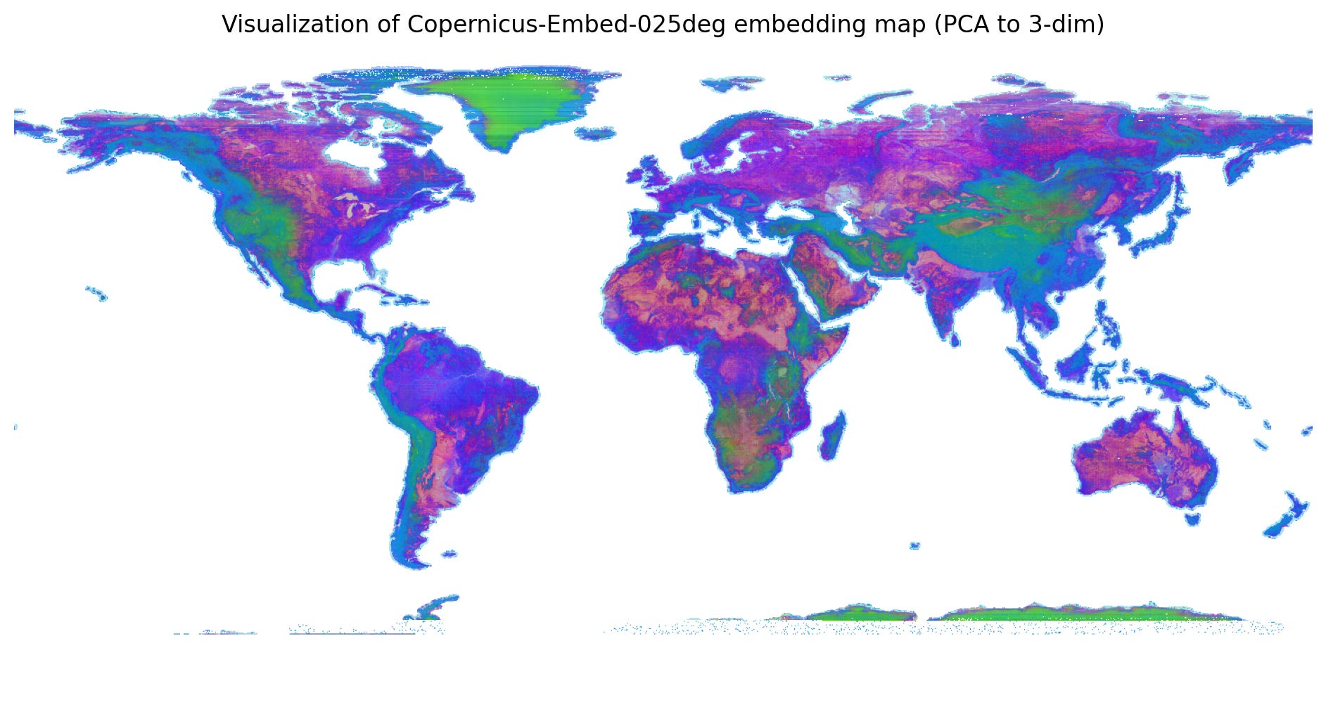
GeoTessera - Python library for the Tessera embeddings [link]
"GeoTessera provides access to geospatial embeddings from the Tessera foundation model, which processes Sentinel-1 and Sentinel-2 satellite imagery to generate 128-channel representation maps at 10m resolution. These embeddings compress a full year of temporal-spectral features into dense representations optimised for downstream geospatial analysis tasks. Read more details about the model."
Open source Innovation Clusters code [link]
DSIT’s Data Science team has open sourced the Innovation Clusters map front end, an award recognised tool showcasing 3,000 innovation clusters across 85 sectors, so others can learn from and build their own accessible, data driven mapping tools.
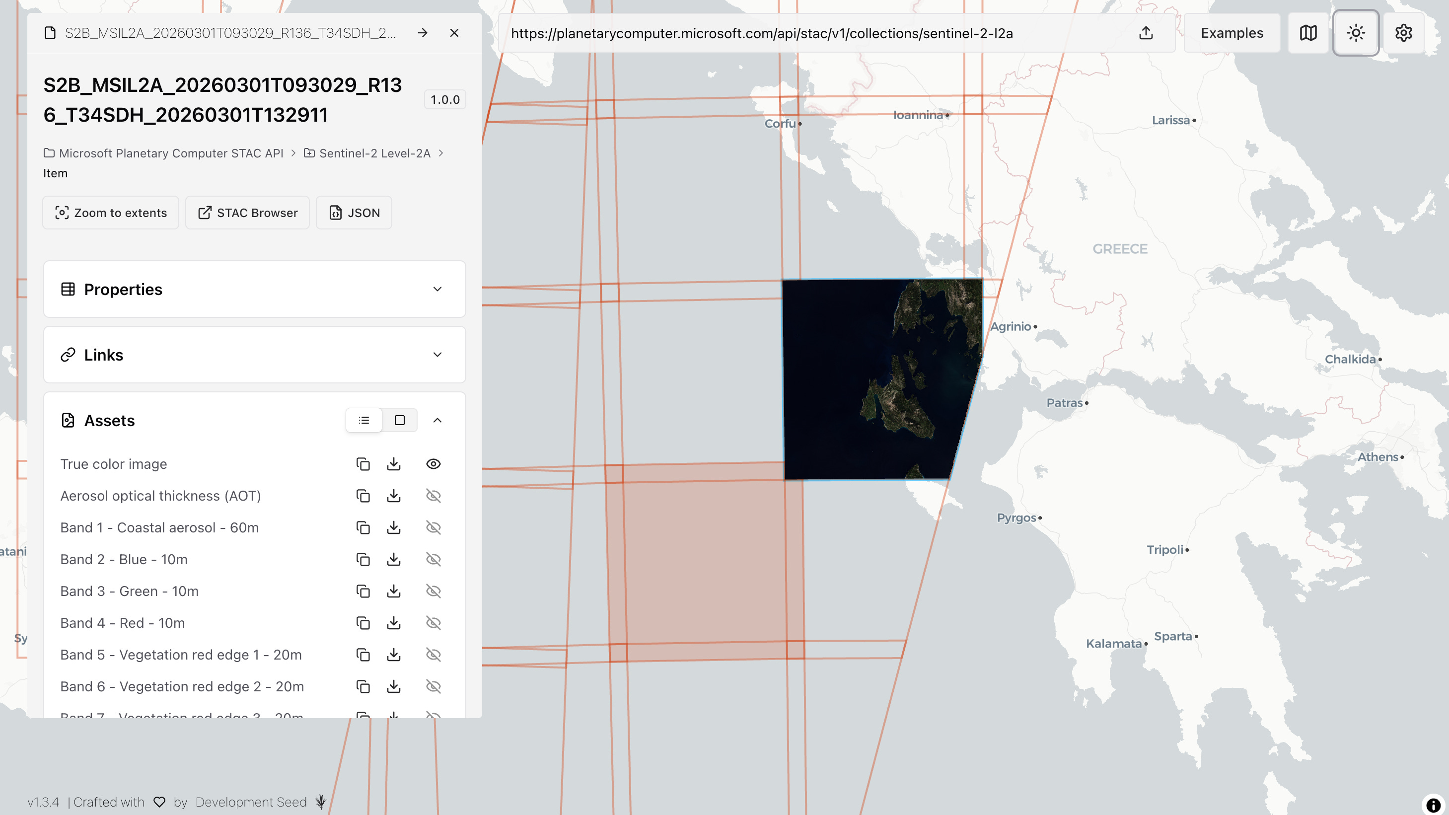
stac-map [link]
A map-first STAC search and visualization tool, with stac-geoparquet support.
TorchGeo 0.9.0 [link]
TorchGeo v0.9.0 adds 13 new datasets, introduces precomputed "Earth embeddings" datasets, and improves time-series and change-detection support, with some breaking changes on the road to 1.0.
HyperCoast QGIS plugin [link]
Qiusheng Wu shared a tutorial introducing the HyperCoast QGIS plugin, which helps users open, inspect, and visualize hyperspectral datasets in QGIS from missions like AVIRIS, NEON, PACE, EMIT, DESIS, PRISMA, and EnMAP, with support for related datasets such as ECOSTRESS.
Screencast video credit: Qiusheng Wu

Data
Over 100,000 New Data Files Available from NISAR [link]
"The NISAR (NASA-ISRO Synthetic Aperture Radar) mission team has released new Level-1 to Level-3 L-band data products via the Alaska Satellite Facility DAAC.
This is the second publication of NISAR data since the satellite’s launch in July 2025. The new data collections capture a sampling of locations around the world that will help users develop workflows in accessing files, get more familiar with the data files themselves, and have the ability to create a time-series with the data."
NISAR Data User Guide [link]
CarbonPlan launches Open Climate Risk for building-level U.S. wildfire risk [link]
CarbonPlan launched Open Climate Risk, a fully open and free-to-access option for building-level climate risk data in the United States (starting with wildfire), built to address the high cost and limited transparency of proprietary risk models.
Open Climate Risk Explorer [link]
NASA PACE cloud height data quality page gets a major update [link]
Andrew Sayer shared a major update to a public page that checks the quality of NASA PACE cloud-height measurements by comparing them with ground-based observations from monitoring sites. The update adds results from about the first 1.5 years of the mission and gives users an early, practical view of data quality (including downloadable site-level comparisons) ahead of a future journal paper.
NASA PACE Cloud Top Height [link]
Earth Blox dataset review: MODIS Net Primary Productivity (NPP) [link]
EarthBlox highlights MODIS NPP (gap-filled MOD17A3HGF v6.1) as the most consistent long-term global record of terrestrial carbon fixation since 2001, and positions it as a practical backbone for nature-related disclosure and compliance, including TNFD (Taskforce on Nature-related Financial Disclosures) and the EU’s CSRD (Corporate Sustainability Reporting Directive), for baseline-setting and chronic nature-risk assessment.
Pioneering Satellite Data Enhances Ocean and Sea-Level Monitoring [link]
Copernicus Marine introduced a new global altimetry dataset that significantly improves how scientists observe the ocean by merging traditional nadir altimetry with SWOT KaRIn measurements to deliver higher-resolution sea-surface-height fields, improving monitoring of ocean circulation, mesoscale variability, and coastal sea-level change.
Snapshots
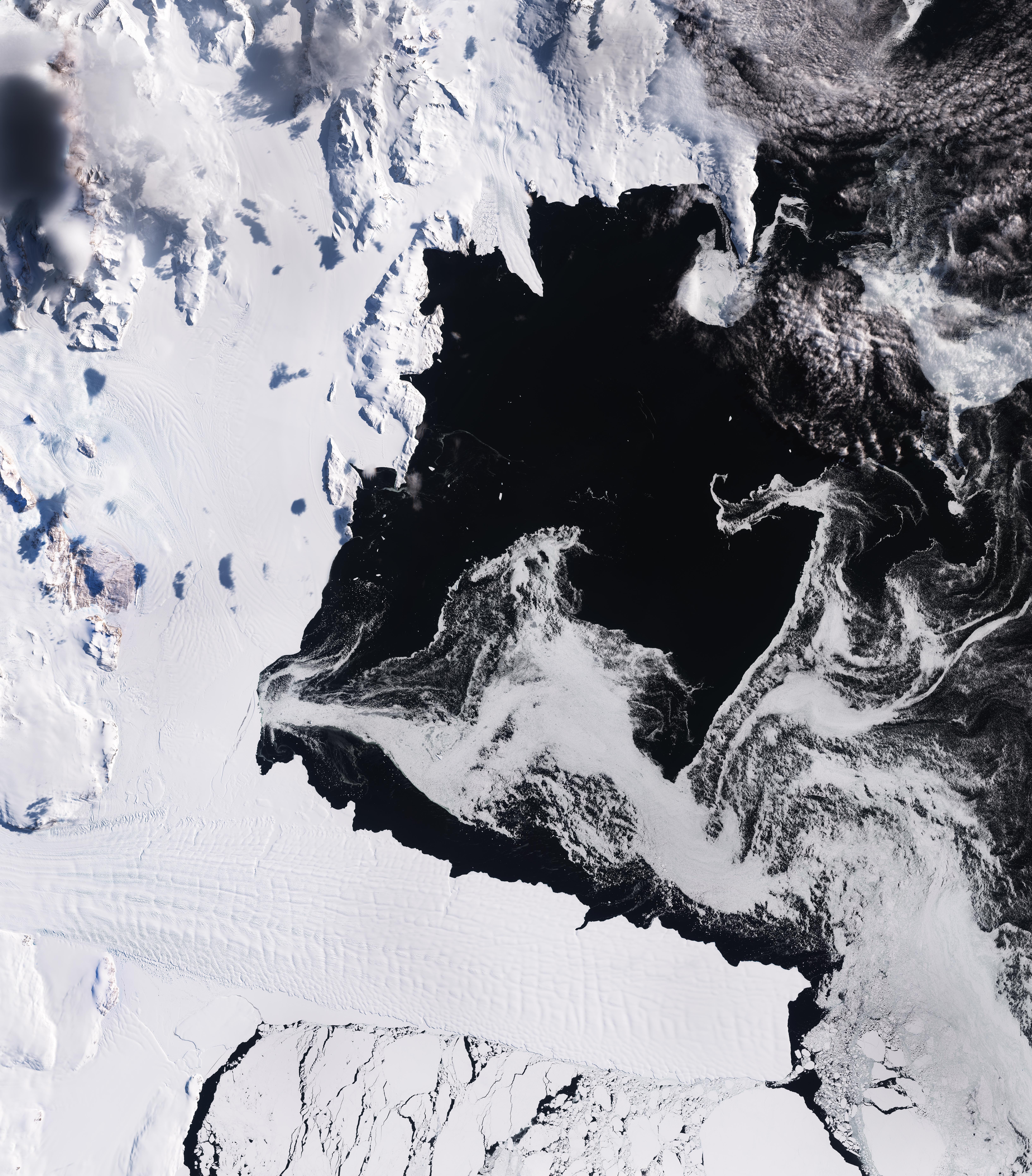
Earth from Space: Terra Nova Bay, Antarctica [link]
A Copernicus Sentinel-2 image of Terra Nova Bay in East Antarctica (14 February) captures late-summer minimum sea-ice conditions, with drifting white floes and icebergs tracing swirling ocean currents between Cape Washington and the Drygalski Ice Tongue.
Interesting read
NASA Lifelines - 2025 Year In Review [link]
NASA Lifelines has published the full 2025 Year in Review, showing how they are turning Earth observation into real world humanitarian impact through programmes like Ready for Impact, Speed Dating, fellowships, and Supper Clubs. Highlights include engaging over 1,000 experts, supporting teams working with satellite imagery and GeoAI across multiple regions, and scaling partnerships that bring funding and technical support into the community.
When Kepler Meets Turing [link]
In his essay, Muon Space CEO Jonny Dyer argues that orbital data centers are "inevitable", but the real story is a broader space technology revolution: as launch gets cheaper and AI drives a surge in demand for compute and power, space systems and Earth-based infrastructure are likely to merge into a single, tightly connected global stack, creating major opportunities and new risks over the next 20 years.
Reducing Government Costs and Increasing Access to Greenspaces in the United Kingdom with DINO [link]
Forest Research in the UK is applying the open-source DINOv2 model — trained on 18 million satellite images to generate a high-resolution canopy-height map capable of detecting individual trees globally — to improve the detection of small woodlands and urban canopy, reduce reliance on costly LiDAR surveys, and strengthen the evidence base for government greenspace and environmental monitoring decisions.
Cows going global – reflections on a year mapping manure around the world [link]
Earth Genome’s post reflects on a year of mapping cattle facilities and manure-related signatures around the world for Climate TRACE, using Earth Index and foundation-model embeddings on satellite imagery to help improve greenhouse-gas emissions tracking. It also shares technical scaling lessons (global transferability limits, larger regional models) and highlights ongoing work on a proposed Bovine Slurry Index (BSI) to improve remote sensing detection of cattle pens and liquid manure waste.
Build your own probability of fire model [link]
ECMWF introduced the Probability of Fire (PoF)-Toolbox, a lightweight set of reproducible Jupyter notebooks (plus a starter dataset) that lets users build, train, and deploy local machine-learning fire-danger models using their own data.
Using satellite images to support erosion control in Madagascar [link]
Through ESA’s Global Development Assistance (GDA) Fast Earth Observation Co-Financing Facility, the German Development Bank KfW supported Madagascar’s anti-erosion and reforestation programme by adding satellite monitoring for fires, reforestation progress, and forest biomass, giving funders and national institutions clearer, evidence-based tracking at scale.
Using Φ-lab’s machine learning algorithms to fight mosquito-borne outbreaks in Brazil and Peru [link]
ESA Φ-lab highlights DIRE (Disease Incidence and Resource Estimator), a predictive mapping and decision-support platform that uses a climate-based ensemble machine-learning approach developed by Φ-lab for UNICEF to forecast dengue and malaria risk in Brazil and Peru, and estimate the resources and costs needed for response.
Drifting away from MODIS in the CAMS Global Fire Assimilation System [link]
The Copernicus Atmosphere Monitoring Service (CAMS) is going through a major transition in its global fire monitoring as NASA’s long-running MODIS instruments on Terra and Aqua approach retirement, expanding GFAS to incorporate VIIRS and Copernicus Sentinel-3 inputs to maintain a continuous global fire-emissions record.
LinkedIn Highlights
Earth observation VS geospatial VS remote sensing [link]
Classic debate: Aravind is separating EO, remote sensing, and geospatial into practice, science, and discipline, and the comments section is on fire.
Climate
Visualising Climate 2026 [link]
"The first global conference dedicated to how data visualisation can transform public understanding of our changing planet and support informed decision-making in the face of climate challenges."
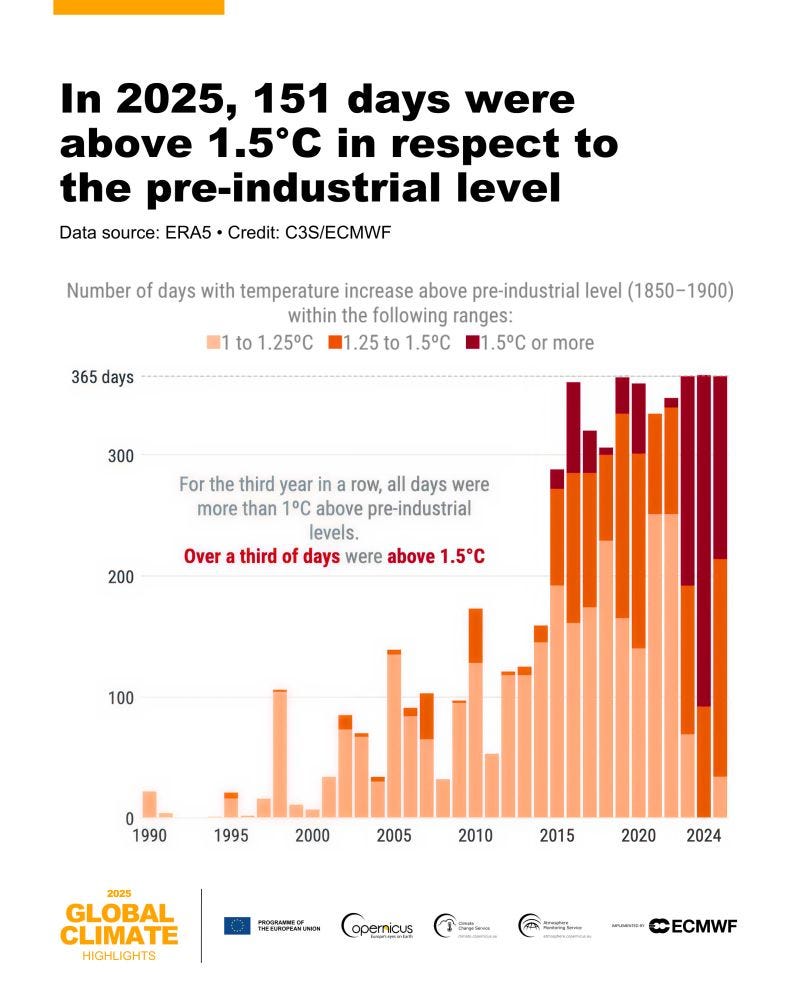
Global Climate Highlights 2025 [link]
The Copernicus Climate Change Service’s Global Climate Highlights 2025 report provides a brief synopsis of the state of global climate in 2025, based mainly on ECMWF’s ERA5 reanalysis, covering air temperature, sea-surface temperature and polar sea ice, and putting results in the context of the Paris Agreement targets.
Key highlights:
2025 was the third-warmest year on record (ERA5): global average 14.97°C, +0.59°C vs 1991–2020, about +1.47°C vs 1850-1900.
Near-1.5°C context: 2025 itself did not reach 1.5°C above pre-industrial, but the 2023–2025 three-year average did (first time in the instrumental record, per ERA5).
Persistent high ocean warmth: extra-polar sea-surface temperature ranked third-highest in 2025, remaining historically high despite mostly neutral to weak La Niña conditions.
Sea ice lows: February 2025 saw the lowest global sea-ice extent for any month in the satellite era, driven by very low Arctic ice and below-average Antarctic ice.
Extremes continued: 2025 featured major impacts from floods, heatwaves, drought and wildfires, and half the globe saw more days than average with at least strong heat stress.
Full report [link]
Interactive graphics gallery [link]
Upcoming Events
PACE Applications Workshop: Putting PACE Data to Work Across the Earth System [link]
NASA’s PACE Applications Team is hosting a free, virtual PACE Applications Workshop on 11-12 March 2026 to help current and prospective users put PACE data to work across aquatic (e.g., harmful algal blooms, fisheries, public health), atmospheric (air quality, modeling), and terrestrial (agriculture, forestry) applications, with talks plus capacity-building demos and tutorials.
Live Browsing Sentinel Zarr – EOPF Explorer Launch Webinar [link]
"Join ESA, Development Seed, EOX, and thriveGEO for the official launch of the EOPF Sentinel Zarr Explorer – a new platform bringing cloud-native visualisation to Sentinel data."
Mon 9 Mar 2026 15:00 - 16:00 CET
Online, Zoom
Artificial intelligence and earth observation: From innovation to services [link]
The European Commission (DG DEFIS, with HaDEA support) is hosting a hybrid workshop in Brussels on 9-10 March 2026 on how AI and other new digital technologies can turn Copernicus Earth observation data into reliable services, and how Copernicus can link with DestinE. The event includes keynotes, technical briefings, panels and hands-on demos, with online streaming available (on-site registration is closed).
LST_cci Workshop 12-14 May 2026 [link]
The ESA Climate Change Initiative Land Surface Temperature (LST_cci) project is running a user workshop on 1-–14 May 2026 at the Met Office in Exeter, focused on satellite land surface temperature products, user requirements and applications, with an ESMValTool training session on the final day.
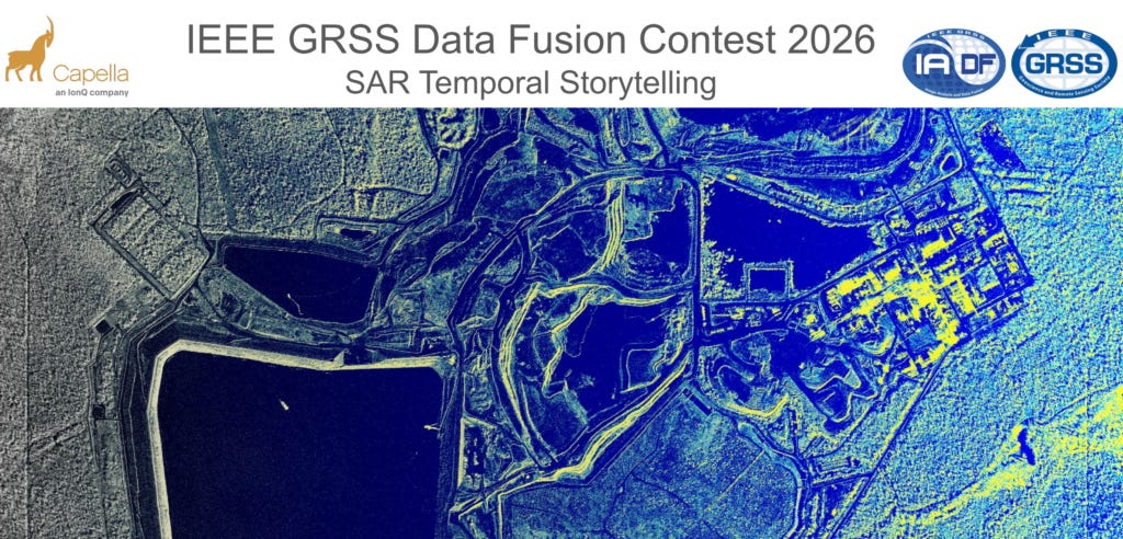
2026 Data Fusion Contest [link]
The 2026 IEEE GRSS Data Fusion Contest invites participants to tackle "SAR Temporal Storytelling" by developing methods on open, densely sampled InSAR-compatible stacks of very-high-resolution X-band SAR imagery from a commercial constellation, with winners showcased at IGARSS 2026.
Learning
"Watch the replay of this Copernicus Marine webinar showcasing how Python can be used to analyse marine data, with a focus on sea surface temperature trends under climate change in the Black Sea. The session presents practical examples using Copernicus Marine products for data access, analysis, and visualisation."