

A satellite for the people
Common Space is working toward a new kind of satellite mission - one driven by impact, not profit. Their goal is to deliver open, high-resolution imagery where it’s needed most: to support communities, journalists, educators, and human rights advocates tackling crises on the ground.
They're designing this mission around societal impact, and they want your input on what that should look like.
Share your thoughts here: Fill out the survey
Read more about the initiative here: https://www.commonspace.world/
Level-2 News
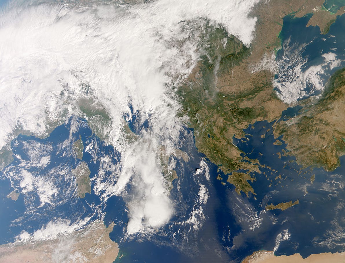
METimage delivers spectacular first images [link]
"EUMETSAT has released the first Earth images from its METimage instrument on board the recently launched Metop Second Generation A1 (Metop-SGA1) satellite, with these early teasers showcasing the exquisite detail, true-to-life colour, and data products that will ultimately support national weather services in improving forecasts that save lives, protect communities and benefit economies."
Planet Awarded Luno B Contract by National Geospatial-Intelligence Agency (NGA) for AI-Enabled Solutions [link]
"Planet announced its subsidiary Planet Labs Federal has been awarded a contract by the National Geospatial-Intelligence Agency (NGA) under the Luno B indefinite delivery, indefinite quantity (IDIQ) contract.
Planet Labs Federal today announced it has been awarded a $12.8M contract by the National Geospatial-Intelligence Agency (NGA) under the Luno B indefinite delivery, indefinite quantity (IDIQ) contract.
The $12.8 million initial award is for Advanced Analytics for Maritime Operations and Reconnaissance (AAMOR). Under this award, Planet will provide the NGA with AI-enabled Maritime Domain Awareness solutions, which include vessel detections and monitoring over key areas of interest in Asia-Pacific. The contract, which was won with Planet partner SynMax, integrates Planet’s daily, global PlanetScope data and SynMax’s Theia product analytics – providing AI-enabled detections of maritime events at strategic and tactical levels."
The Netherlands Commits to “Maintain” ESA Contribution Levels Through 2028 [link]
"The Dutch government has decided to contribute €344.3 million to the European Space Agency (ESA) over the next three years. The government also announced that, with the addition of its national space programmes, the country would spend a total of €550 million from 2026 to 2028.
The most significant contributions to ESA programmes, apart from its mandatory Science Programme contribution, will be €40 to 50 million for ESA Earth Observation programmes, €40 to 45 million for ESA’s launcher programmes, and €25 to 30 million for ESA Technology programmes."
Rocket Lab launches Synspective’s “Owl New World” mission with improved SAR capabilities [link]
"The “Owl New World” mission launched on Electron from Rocket Lab Launch Complex 1 in New Zealand at 16:33 UTC on October 14 to deploy the seventh StriX satellite to a 583km low Earth orbit.
The mission was the first of a series of 21 dedicated Electron launches to take place between now and the end of the decade for Synspective, a Synthetic Aperture Radar (SAR) satellite data and analytics company from Japan."
Planet Unveils Next-Gen Owl Satellites With 1 Meter Resolution, Nvidia GPUs [link]
"Planet unveiled its next-generation “Owl” satellites, which are designed to provide near-daily monitoring in 1-meter resolution, with more advanced onboard processing capabilities. The Owl fleet will provide continuity with the existing SuperDove fleet that underpins the company’s core, PlanetScope Monitoring product."
Related:
Introducing Owl: Planet’s Most Advanced Satellite Mission Yet [link]
IHI Orders Satellites from Iceye in Deal to Assemble Satellites in Japan [link]
"Japanese aerospace and defense company IHI Corporation has signed a procurement contract with Iceye to build four satellites and up to 20 additional satellites in a synthetic aperture radar (SAR) constellation."
Space42 Completes First UAE-Integrated SAR Satellites in Iceye Partnership [link]
"Space42 has shipped three synthetic aperture radar (SAR) satellites — its first satellites to go through assembly, integration, and testing (AIT) within the United Arab Emirates under a partnership with Iceye."
Defense Continues to Propel Earth Observation Market, With Opportunties in AI and Golden Dome [link]
Defense continues to propel the Earth Observation market, representing nearly 50% of overall EO activity and driving a 42% growth in the defense data and value-added services sector, now worth $2.5 billion.
Industry leaders at World Space Business Week highlighted a growing demand for sovereign geospatial autonomy as nations seek independent capabilities for security and intelligence.
At the same time, opportunities are emerging in the U.S. Golden Dome project and through the convergence of AI and EO, enabling faster, more automated insights from space.
Developer's Orbit
Zarr Everywhere [link]
Zarr is a cloud-native open standard for chunked array data, widely used in Earth science and beyond to make massive datasets easier to store, share, and analyze in distributed environments.
Development Seed continues to push the boundaries of cloud-native geospatial data with the Zarr community. Read about their latest work on Virtual Zarr and Zarr v3 adoption.
tifviewer - A simple GeoTIFF viewer for the command line [link]
Keiko Nomura developed this lightweight GeoTIFF viewer that runs directly from the command line, called viewtif.
Users can visualise single-band GeoTIFFs, RGB composites, and shapefile overlays in a simple Qt-based window.
GitHub: https://github.com/nkeikon/tifviewer
Related:
Interactively explore raster and vector datasets using CLI tools powered by Leafmap, MapLibre, and LocalTileserver [link]

TerraTorch v1.1 is released [link]
"TerraTorch is a toolkit for Geospatial Foundation Models (GFMs) — built for fine-tuning and inference at scale. The new release brings improvements in usability, new models support, and better inference options."
Work in progress: ECMWF data stores turn ARCO [link]
ECMWF has introduced a new Analysis-Ready Cloud-Optimised (ARCO) Data Lake, extending its Data Store services for CAMS and C3S. Built on Zarr and the ECMWF Common Cloud Infrastructure, ARCO enables faster, more efficient access to multi-dimensional datasets like ERA5 and ERA5-Land.
Related:
ARCO Data Lake coming soon for the Data Stores Services [link]
S2-RUT-L1C - Stand alone tool computing Sentinel2-MSI L1C uncertainties [link]
"ESA announced the public release of an upgraded version of the Sentinel-2 L1C Radiometric Uncertainty Tool (S2-L1C-RUT).
This tool enables users to generate pixel-level maps of expected radiometric uncertainty for any Sentinel-2 spectral band.
The uncertainty estimates are built on established metrology standards and have been validated using flight data from the 2024 Sentinel-2A / Sentinel-2C tandem acquisitions campaign.
The tool is open source, Python-based, and freely available for download, together with full documentation, at: https://gitlab.acri-cwa.fr/opt-mpc/s2_tools/s2rut"
phidown [v0.1.20] Sentinel-1 Burst Search [link]
"You can now search and retrieve individual Sentinel-1 SLC bursts directly. Perfect for InSAR time series, burst-level analysis, or regional monitoring."
Check out the new notebook example.

Data
Digital Earth Australia (DEA) Tidal Composites [link]
"Digital Earth Australia (DEA) Tidal Composites are cloud-free imagery mosaics of Australia’s coasts, estuaries and reefs at low and high tide. Calculated using a geometric median of Sentinel-2 imagery from the highest and lowest 15% of observed tides, DEA Tidal Composites deliver an annually updated snapshot of high and low tide Australian coastal environments."
Release of Version 2.0.0 of the Global land surface meteorological observations dataset (1755–present) from comprehensive in situ observations [link]
"ECMWF announced the release of Version 2.0.0 of the Global land surface meteorological observations dataset (1755–present) from comprehensive in situ observations, now available in the C3S Climate Data Store (CDS).
What’s new in this version?
Up-to-date coverage: Now includes data through 2024
Sub-daily data: +50% more stations (now serving over 29,000 stations)
Daily data: +15% more stations (now serving over 86,000 stations)
Monthly data: +14% more stations (now serving over 83,000 stations)
The consolidated dataset brings together land surface meteorological observations from hundreds of sources worldwide – including National Meteorological Services and others – in collaboration with international partners."
More information available here.
Snapshots
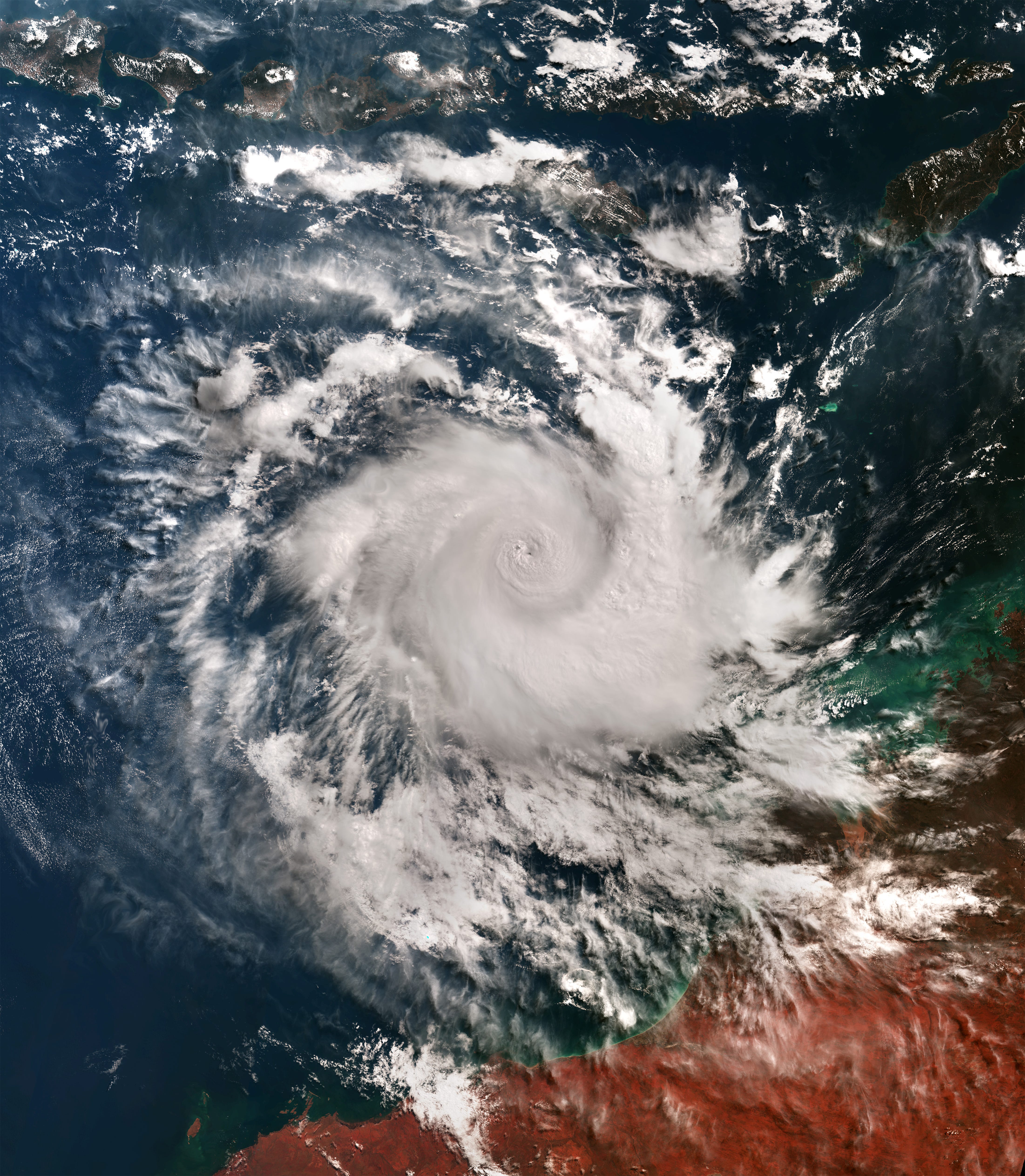
Earth from Space: Cyclone Errol [link]
"Errol was a powerful tropical cyclone, which formed as a tropical storm at the beginning of April 2025 and rapidly intensified while moving towards northern Australia, passing from category 1 to 5 in 30 hours."
Interesting reads
Air Quality Challenges in 2025: Europe’s Summer of Smoke, Dust and Ozone [link]
"The summer of 2025 significantly affected Europe’s atmosphere. From record-breaking wildfires in southern and western Europe, to intense Saharan dust intrusions and repeated peaks in surface ozone during prolonged heatwaves, air quality was negatively impacted by multiple events. Data from the Copernicus Atmosphere Monitoring Service (CAMS) show how these overlapping events combined to create serious risks for human health and the environment across the continent. This Observer takes a closer look at what the data show. "
LinkedIn Highlights
"Uncalibrated imagery is nearly worthless" [link]
This quote from Christopher Robson captures a truth that often gets overlooked in the hype around satellite launches and new missions. Building an Earth Observation company isn’t just about getting to orbit - it’s about delivering usable, well-calibrated data products. Otherwise, it’s just another shoebox-sized satellite thrown into space.
Call for Papers
REO: Advances in Representation Learning for Earth Observation [link]
"The Representation Learning for Earth Observation (REO) workshop brings together researchers and practitioners from machine learning, computer vision, and Earth sciences to advance the development of robust, interpretable, and scalable models for monitoring our planet. With the growing availability of large-scale, multimodal Earth observation (EO) data and the rise of general-purpose foundation models, new opportunities and challenges emerge for integrating data-driven approaches across sensing modalities and application domains. REO will provide a forum for presenting novel technical methods, scientific applications, and system-level innovations, fostering cross-disciplinary exchange and collaborations between academia, industry, and policy stakeholders."
Submission deadline is extended to October 20
Related:
Advancing AI for Earth observation at the REO workshop [link]
Competitions

Contest ‘Seize the beauty of our Planet’ for the best satellite image of Earth [link]
"The annual international contest ‘Seize the beauty of our Planet’ recognizes the most beautiful satellite images of the Earth. This year’s theme is Cities and nature.
It is the 6th time that CloudFerro, a Copernicus Ambassador, is inviting Earth observation specialists, climate researchers and enthusiasts to join the contest and turn satellite data into powerful messages.
This year we are looking for best images on the theme of ‘Cities and nature’ as captured by Earth observation satellites.
Compelling images capture public and policy attention. We invite you to seize your best satellite-derived view of cities in balance with nature, and to help tell a story that matters for the planet. The imagery you enter can galvanize communities and policymakers to plan cities that thrive with nature and serve the people who live in them."
Deadline to submit and image: 26 October
Learning
PACE Data Hackweek 2025 Resources Now Available [link]
Recordings of the lectures, coding tutorials, and demo sessions from the 2025 PACE Data Hackweek are now live on the Hackweek website: https://pacehackweek.github.io/pace-2025/presentations/notebooks.html
Love this perspective! It’s wonderfull to see you consistently highlight initiatives like Common Space that prioritize impact over pure profit, and I really wonder how they plan to ensure true comunity access and data literacy in all target regions. The sheer potential of these AI-enabled maritime solutions for global awareness is also fascinating, and makes me think about the intricate algorithms and inference infrastructure needed for such scale.