Level-2 News
AWS successfully runs AWS compute and machine learning services on an orbiting satellite in a first-of-its kind space experiment [link]
“Amazon Web Services (AWS) announced that it successfully ran a suite of AWS compute and machine learning (ML) software on an orbiting satellite, in a first-of-its-kind space experiment. The experiment, conducted over the past 10 months in low Earth orbit (LEO), was designed to test a faster, more efficient method for customers to collect and analyze valuable space data directly on their orbiting satellites using the cloud.”
Space-based thermal-infrared data intelligence startup OroraTech adds €15 million to the flightplan [link]
“Leveraging space-based thermal-infrared observing capabilities, OroraTech’s first offer to the market is a Wildfire Intelligence solution that uses existing third-party data for wildfire detection and monitoring and is used by clients including the US Forest Service, the Tasmania Parks & Wildlife Service, and TTG Brasil, detecting over 100,000 fires daily and protecting more than 160 million hectares of forest on six continents.”
The effects of air conditioning in Qatar’s stadiums [link]
“The Qatar World Cup has been highly contested for its environmental impact, especially regarding the air conditioning of the stadiums.
Thanks to satellite data, we can observe the differences in land surface temperature caused by air conditioning.
On these images the surface temperature is 35° outside the Al-Bayt stadium (equivalent to an ambient temperature of 27°) and 28° inside (equivalent to an ambient temperature of 20°).”
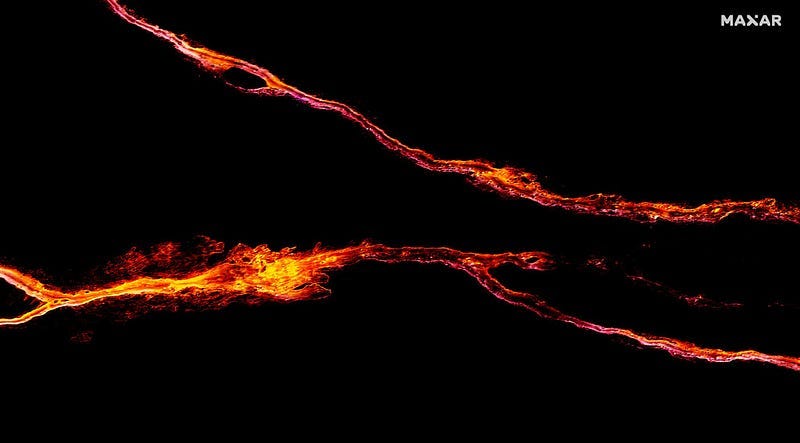
WorldView-2 captures rivers of lava from the Mauna Loa volcano eruption during nighttime [link]
Related: Earth from Orbit: Mauna Loa Erupts for First Time Since 1984 [YouTube]
Larger Wheat Harvest in Ukraine Than Expected [link]
“The risks on the ground during the war have made the NASA Harvest monitoring system one of the only safe and reliable ways for researchers to track what is happening to crops in Ukraine.
The NASA Harvest team calculated that farmers harvested 26.6 million tons of wheat in 2022, several million tons higher than expected in leading forecasts. The team used satellites to observe the areas that were left unharvested and found they were mainly concentrated along the front line. The analysis showed that 5.8 million tons of wheat was harvested from areas that were not under Ukrainian control. That represents a loss of at least $1 billion.”

Rare subtropical December storm may form in Atlantic for first time in nearly a decade [link]
Although the Atlantic hurricane season ended Nov. 30, there is medium chance (50%) for a subtropical or tropical storm to form within the next day or two.
If the system develops, it’ll be the first December named storm in nine years and just the 11th December named storm on record since 1950.
Developer’s Orbit
Python LeafMap package now support JupyterLite to be run entirely on the browser with some interactive basemaps [link]
Deploy TiTiler (on AWS) in 3 clicks! [link]
“Titiler is a set of python modules that focus on creating FastAPI application for dynamic tiling.”
Follow this for how to deploy TiTiler on AWS.
Earth Observation at NeurIPS 2022
NeurIPS 2022 Workshop Tackling Climate Change with Machine Learning [link]
The Neural Information Processing Systems (NeurIPS) is one of the top conferences on machine learning. This workshop is part of NeurIPS for the 4th consecutive year, focusing on climate-relevant applications of machine learning. Follow the link to view the accepted papers.
Related: As covered previously, NOAA has selected Lockheed Martin and NVIDIA to build a prototype digital twin of Earth for climate research. Therefore, it makes no surprise that NVIDIA has a strong presence in this workshop.
Weather4cast NeurIPS Competition — Super-Resolution Rain Movie Prediction under Spatio-temporal Shifts [link]
Co-organizsed by ESA’s Philab and the Institute of Advanced Research in Artificial Intelligence (IARAI), the competition called for teams to submit ML models predicting future weather using a combination of data from ground weather stations and multi-band satellite sensor images.
1st place: WeatherFusionNet: Predicting Precipitation from Satellite Data [link]
“WeatherFusionNet is a U-Net architecture that fuses three different ways to process the satellite data; predicting future satellite frames, extracting rain information from the current frames, and using the input sequence
directly.”
The code and trained parameters are available at https://github.com/Datalab-FIT-CTU/weather4cast-2022
Dataset
SATLAS: A Large-Scale, Multi-Task Dataset for Remote Sensing Image Understanding [link]
“Label everything that is visible in satellite imagery”
“SATLAS is a large scale dataset for remote sensing. Labels in this dataset are relevant to many important earth monitoring applications, including water resource monitoring, tracking deforestation, detecting wind turbines for mapping renewable energy infrastructure, extracting ice extents for tracking glacier loss, flood detection, tracking urban expansion, and vessel detection for tackling illegal fishing.
SATLAS consists of 290M labels under 137 categories and seven label modalities.”
The dataset will be released in January 2023.
Interesting reads

How Satellite Data is Contributing to Global Food Security [link]
Follow this article to learn how the World Food Program (WFP) uses remote sensing data to improve food security.

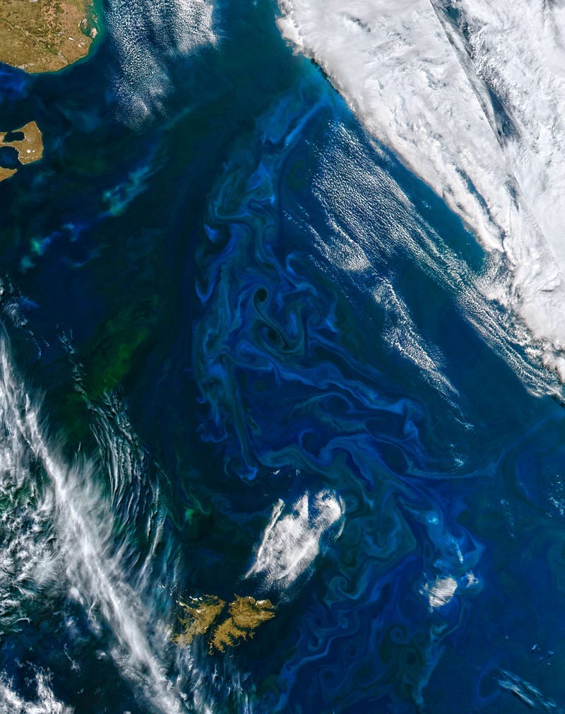
Breathing Life into the Ocean [link]
The article describes how scientists use satellites to measure concentrations of chlorophyll and track phytoplankton in the ocean.
Learning
CCAI Webinar Series [link]
Climate Change AI (CCAI), co-hosts of the NeurIPS workshop, mentioned above, has been hosting a series of webinar. Follow the link for more!


