Level-2 News
Open Cosmos announces OpenConstellation.
OpenConstellation is a global shared satellite infrastructure. The project aims for a total of 25 satellites, “with a mix of spatial and spectral resolution”. The first 6 satellites are scheduled to launch this November.
EnMAP records the largest erosion cirque in the world.
“On the 8th of July 2022, the spaceborne hyperspectral sensor EnMAP took an image over the Makhtesh Ramon basin complemented by field measurements of scientists from the Remote Sensing Laboratory of the Tel-Aviv University. Makhtesh Ramon is one of the test sites of the EnMAP validation campaign used for validating EnMAP reflectance data products (Level 2A) due to its mineral and rock formation richness contained in a very small area of only 40 km x 7 km.”
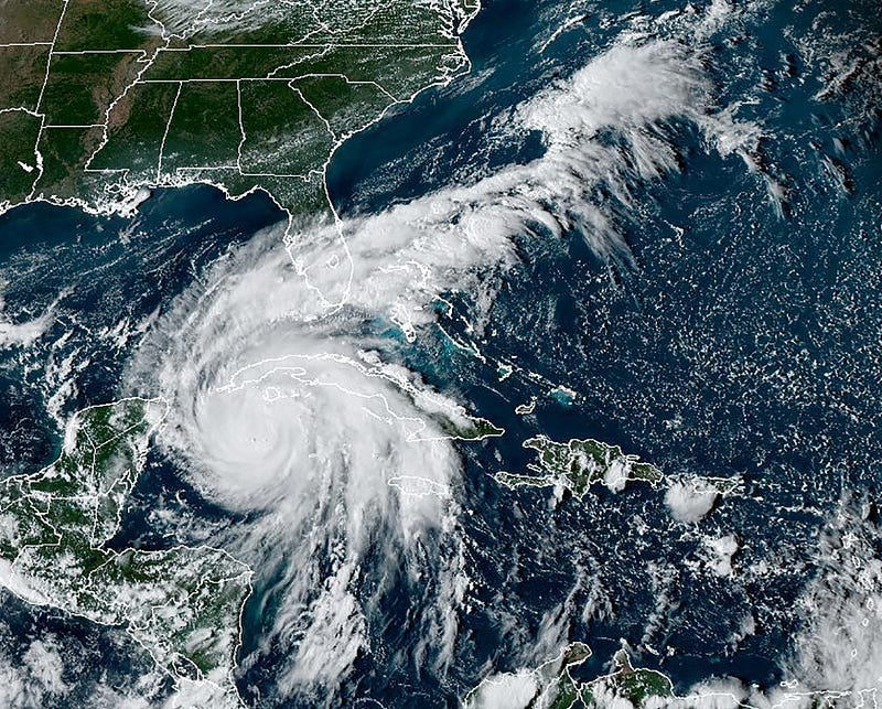
Tracking Hurricanes
As hurricane Fiona was making landfall in Canada, hurricane Ian was forming in Caribbean.

Canada Braces for Fiona
Hurricane Fiona Leaves Wake of Destruction
Hurricane Ian strengthening to Category 3
NOAA Hurricane Tracker
Potent Storms Hit Puerto Rico, Japan
The Developer’s Orbit
ΕΟDAG (Earth Observation Data Access Gateway)
EODAG gives you an easy way to access products from more than 10 providers, with more than 50 different product types (Sentinel 1, Sentinel 2, Sentinel 3, Landsat, etc.) that can be searched and downloaded.
In this code snippet we search and download S2_L1C products from CREODIAS (you have to register on CREODIAS first).
TIP: To add Copernicus Scihub as your provider you will need to install an additional plugin, eodag-sentinelsat. This is useful in case you want to download older S2_L2A products because Scihub stores them in LTA (Lond Term Archive) and you can still order them (you have to wait a few minutes for them to come back online), whereas CREODIAS stores only the last 6 months. Check this issue for more details.
from eodag import EODataAccessGateway, setup_logging
import os
from sentinelsat import read_geojson, geojson_to_wkt
os.environ["EODAG__CREODIAS__AUTH__CREDENTIALS__USERNAME"] = "PLEASE_CHANGE_ME"
os.environ["EODAG__CREODIAS__AUTH__CREDENTIALS__PASSWORD"] = "PLEASE_CHANGE_ME"dag = EODataAccessGateway()
footprint = geojson_to_wkt(read_geojson('my_aoi.geojson'))search_criteria = {
"productType": "S2_MSI_L1C",
"start": "2022-03-03",
"end": "2022-04-15",
"geom": footprint
}dag.set_preferred_provider("creodias")
search_results, _ = dag.search(**search_criteria)dest_folder = f'eodag_workspace_download'os.makedirs(dest_folder, exist_ok=True)dag.download_all(
search_results,
outputs_prefix=dest_folder,
timeout=100
)How To Normalize Satellite Images for Deep Learning.
A deep dive by folks at Sinergise, investigating how different normalization methods affect the performance of a Deep Learning model.
Learning
Artificial Intelligence (AI) for Earth Monitoring [MOOC]
Explore how artificial intelligence (AI) and machine learning (ML) technologies are helping to advance Earth monitoring. During the course you will use the WEkEO platform and Jupyter Notebooks to process and analyse EO data.
Earth Observation: Data, Processing and Applications [Textbook]
A series of textbooks by the Australian Earth Observation (EO) community describing EO data, processing and applications. They include a wide range of local case studies to demonstrate Australia’s increasing usage of EO data.


